 Old Cumbria Gazetteer
 |
 |
|
| Ainstable Methodist Church, Ainstable | ||
| Ainstable Methodist Church | ||
| locality:- | Rowfoot | |
| civil parish:- | Ainstable (formerly Cumberland) | |
| county:- | Cumbria | |
| locality type:- | methodist chapel | |
| locality type:- | chapel | |
| coordinates:- | NY52594638 | |
| 1Km square:- | NY5246 | |
| 10Km square:- | NY54 | |
|
|
||
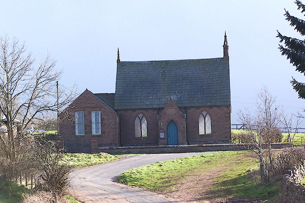 BNI61.jpg (taken 9.3.2007) 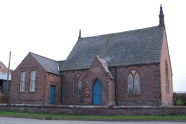 BNI62.jpg (taken 9.3.2007) |
||
|
|
||
| evidence:- | old map:- OS County Series (Cmd 32 9) |
|
| source data:- | Maps, County Series maps of Great Britain, scales 6 and 25
inches to 1 mile, published by the Ordnance Survey, Southampton,
Hampshire, from about 1863 to 1948. "Methodist Chapel (Wesleyan)" |
|
|
|
||
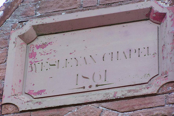 BNI63.jpg Plaque:- "WESLEYAN CHAPEL / 1861" (taken 9.3.2007) |
||
|
|
||
 Lakes Guides menu.