 Old Cumbria Gazetteer
 |
 |
|
| Marsh Grange, Askam and Ireleth | ||
| Marsh Grange | ||
| Street:- | Tippins Lane | |
| civil parish:- | Askam and Ireleth (formerly Lancashire) | |
| county:- | Cumbria | |
| locality type:- | buildings | |
| coordinates:- | SD22097971 | |
| 1Km square:- | SD2279 | |
| 10Km square:- | SD27 | |
|
|
||
| evidence:- | old map:- OS County Series (Lan 10 16) placename:- Marsh Grange |
|
| source data:- | Maps, County Series maps of Great Britain, scales 6 and 25
inches to 1 mile, published by the Ordnance Survey, Southampton,
Hampshire, from about 1863 to 1948. |
|
|
|
||
| evidence:- | old map:- Otley 1818 placename:- Marsh Grange |
|
| source data:- | Map, uncoloured engraving, The District of the Lakes,
Cumberland, Westmorland, and Lancashire, scale about 4 miles to
1 inch, by Jonathan Otley, 1818, engraved by J and G Menzies,
Edinburgh, Scotland, published by Jonathan Otley, Keswick,
Cumberland, et al, 1833.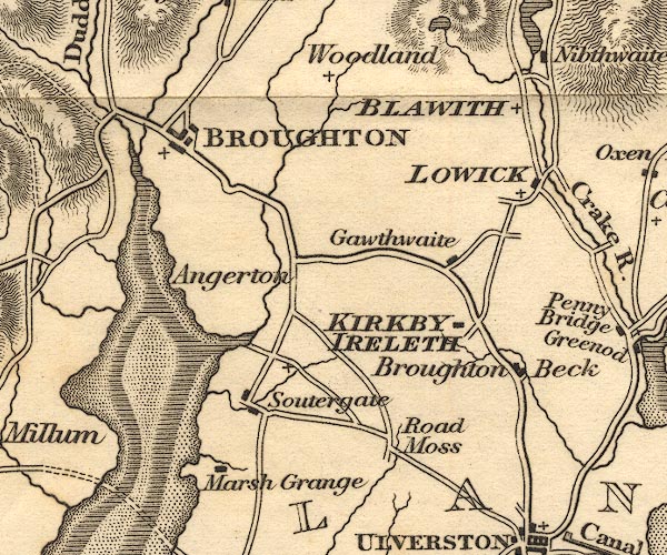 OT02SD28.jpg item:- JandMN : 48.1 Image © see bottom of page |
|
|
|
||
| evidence:- | database:- Listed Buildings 2010 placename:- Marsh Grange |
|
| source data:- | courtesy of English Heritage "MARSH GRANGE / / TIPPINS LANE / DALTON TOWN WITH NEWTON / BARROW IN FURNESS / CUMBRIA / II[star] / 388619 / SD2209079715" |
|
|
|
||
| evidence:- | database:- Listed Buildings 2010 |
|
| source data:- | courtesy of English Heritage "GATE PIERS AND WALL ENCLOSING FORECOURT AT MARSH GRANGE / / TIPPINS LANE / DALTON TOWN WITH NEWTON / BARROW IN FURNESS / CUMBRIA / II[star] / 388620 / SD2212379707" |
|
|
|
||
 Lakes Guides menu.