 Old Cumbria Gazetteer
 |
 |
|
| Raise Bridge, Dunmail Raise | ||
| Raise Bridge | ||
| site name:- | Raise Beck | |
| locality:- | Dunmail Raise | |
| civil parish:- | Lakes (formerly Westmorland) | |
| county:- | Cumbria | |
| locality type:- | bridge | |
| coordinates:- | NY32771159 | |
| 1Km square:- | NY3211 | |
| 10Km square:- | NY31 | |
| SummaryText:- | two bridges; for a short dual carriageway in the middle of nowhere | |
|
|
||
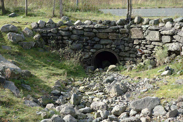 CDZ84.jpg (taken 28.9.2015) |
||
| This is the route of the stream, the old county boundary, before diverted by Manchester
Corporation. |
||
|
|
||
| evidence:- | old map:- OS County Series (Wmd 18 8) placename:- Raise Bridge |
|
| source data:- | Maps, County Series maps of Great Britain, scales 6 and 25
inches to 1 mile, published by the Ordnance Survey, Southampton,
Hampshire, from about 1863 to 1948. |
|
|
|
||
| evidence:- | old map:- Ogilby 1675 (plate 96) |
|
| source data:- | Road strip map, hand coloured engraving, the Road from Kendal to
Cockermouth, and the Road from Egremond to Carlisle, scale about
1 inch to 1 mile, by John Ogilby, London, 1675.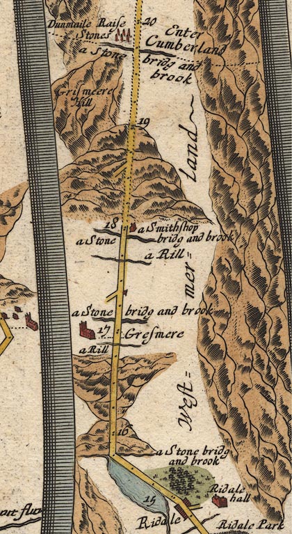 OG96m015.jpg In mile 19, Westmerland, Cumberland. Road crosses:- "a Stone bridg and brook" no bridge drawn. item:- JandMN : 22 Image © see bottom of page |
|
|
|
||
| evidence:- | probably old map:- Bowen and Kitchin 1760 |
|
| source data:- | Map, hand coloured engraving, A New Map of the Counties of
Cumberland and Westmoreland Divided into their Respective Wards,
scale about 4 miles to 1 inch, by Emanuel Bowen and Thomas
Kitchin et al, published by T Bowles, Robert Sayer, and John
Bowles, London, 1760.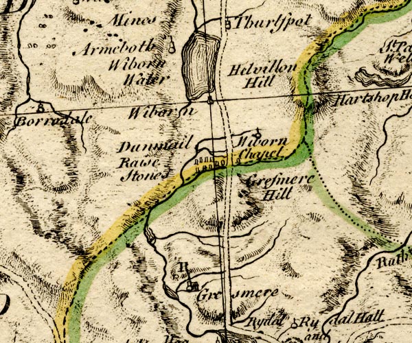 BO18NY20.jpg road across Raise Beck item:- Armitt Library : 2008.14.10 Image © see bottom of page |
|
|
|
||
| evidence:- | old map:- Donald 1774 (Cmd) |
|
| source data:- | Map, hand coloured engraving, 3x2 sheets, The County of Cumberland, scale about 1
inch to 1 mile, by Thomas Donald, engraved and published by Joseph Hodskinson, 29
Arundel Street, Strand, London, 1774.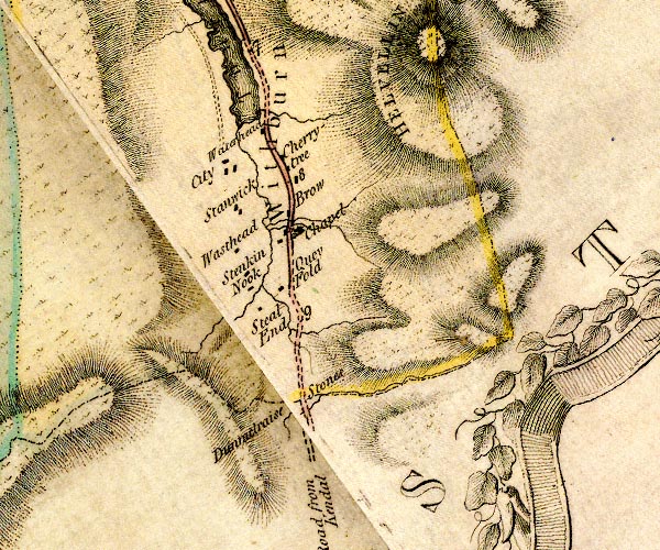 D4NY31SW.jpg double line across a river; a bridge item:- Carlisle Library : Map 2 Image © Carlisle Library |
|
|
|
||
 Lakes Guides menu.