 Old Cumbria Gazetteer
 |
 |
|
| North Row Bridge, Bassenthwaite | ||
| North Row Bridge | ||
| site name:- | Halls Beck | |
| civil parish:- | Bassenthwaite (formerly Cumberland) | |
| county:- | Cumbria | |
| locality type:- | bridge | |
| coordinates:- | NY22283196 | |
| 1Km square:- | NY2231 | |
| 10Km square:- | NY23 | |
|
|
||
| evidence:- | old map:- Ogilby 1675 (plate 96) |
|
| source data:- | Road strip map, hand coloured engraving, the Road from Kendal to
Cockermouth, and the Road from Egremond to Carlisle, scale about
1 inch to 1 mile, by John Ogilby, London, 1675.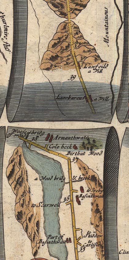 OG96m035.jpg In mile 36, Cumberland. Road crosses:- "a Wood bridg &brook" no bridge drawn. item:- JandMN : 22 Image © see bottom of page |
|
|
|
||
| evidence:- | old map:- Bell 1892 |
|
| source data:- | Map, colour lithograph, Road Map of Cumberland, by George Joseph
Bell, scale about 2.5 miles to 1 inch, printed by Charles
Thurnam and Sons, Carlisle, Cumberland, 1892.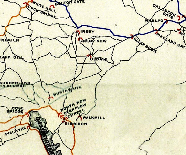 BEL9NY23.jpg "[OVERFLOW]" bridge symbol Road map of Cumberland showing County Bridges item:- Carlisle Library : Map 38 Image © Carlisle Library |
|
|
|
||
| evidence:- | old map:- Bell 1892 placename:- North Row Bridge |
|
| source data:- | Map, colour lithograph, Road Map of Cumberland, by George Joseph
Bell, scale about 2.5 miles to 1 inch, printed by Charles
Thurnam and Sons, Carlisle, Cumberland, 1892. BEL9NY23.jpg "NORTH ROW" bridge symbol Road map of Cumberland showing County Bridges item:- Carlisle Library : Map 38 Image © Carlisle Library |
|
|
|
||
 Lakes Guides menu.