 Old Cumbria Gazetteer
 |
 |
|
| Herding Neb, Seascale | ||
| Herding Neb | ||
| Street:- | Drigg Road | |
| locality:- | Seascale | |
| civil parish:- | Seascale (formerly Cumberland) | |
| county:- | Cumbria | |
| locality type:- | buildings | |
| coordinates:- | NY03740083 | |
| 1Km square:- | NY0300 | |
| 10Km square:- | NY00 | |
|
|
||
 BMV63.jpg (taken 13.10.2006) 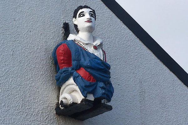 BMV64.jpg (taken 13.10.2006) |
||
|
|
||
| evidence:- | old map:- OS County Series (Cmd 78 13) placename:- Herding Nab |
|
| source data:- | Maps, County Series maps of Great Britain, scales 6 and 25
inches to 1 mile, published by the Ordnance Survey, Southampton,
Hampshire, from about 1863 to 1948. |
|
|
|
||
| evidence:- | old photograph:- Bell 1880s-1940s item:- figurehead |
|
| source data:- | Photograph, sepia, Herding Neb and The Crescent, Seascale, Cumberland, by Herbert
Bell, photographer, Ambleside, Westmorland, 1890s.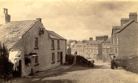 click to enlarge click to enlargeHB0711.jpg item:- Armitt Library : ALPS375 Image © see bottom of page |
|
|
|
||
 Lakes Guides menu.