 Old Cumbria Gazetteer
 |
 |
|
| Crofton Hall, Thursby | ||
| gone | ||
| Crofton Hall | ||
| Crofton Place | ||
| locality:- | Crofton | |
| civil parish:- | Thursby (formerly Cumberland) | |
| county:- | Cumbria | |
| locality type:- | buildings | |
| coordinates:- | NY30325004 | |
| 1Km square:- | NY3050 | |
| 10Km square:- | NY35 | |
|
|
||
| evidence:- | old map:- OS County Series (Cmd 29 3) placename:- Crofton Hall item:- gas works; dovecote; summer house; riding school |
|
| source data:- | Maps, County Series maps of Great Britain, scales 6 and 25
inches to 1 mile, published by the Ordnance Survey, Southampton,
Hampshire, from about 1863 to 1948. "Crofton Hall / Gas Ho. / Riding School / Dovecot / Summer Ho." |
|
|
|
||
| evidence:- | perhaps descriptive text:- Simpson 1746 placename:- Crofton |
|
| source data:- | Atlas, three volumes of maps and descriptive text published as
'The Agreeable Historian, or the Compleat English Traveller
...', by Samuel Simpson, 1746. goto source goto source"... Crofton, the Seat of John Briscoe, Esq; ..." |
|
|
|
||
| evidence:- | old map:- Donald 1774 (Cmd) placename:- Crofton Hall |
|
| source data:- | Map, hand coloured engraving, 3x2 sheets, The County of Cumberland, scale about 1
inch to 1 mile, by Thomas Donald, engraved and published by Joseph Hodskinson, 29
Arundel Street, Strand, London, 1774.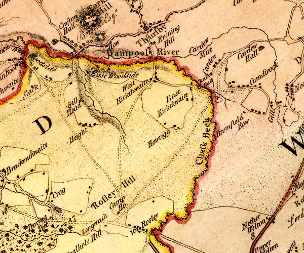 D4NY34NW.jpg "Crofton Hall / Briscoe Esqr." house and avenue of trees item:- Carlisle Library : Map 2 Image © Carlisle Library |
|
|
|
||
| evidence:- | road book:- Cary 1798 (2nd edn 1802) placename:- Crofton Hall |
|
| source data:- | Road book, itineraries, Cary's New Itinerary, by John Cary, 181
Strand, London, 2nd edn 1802. goto source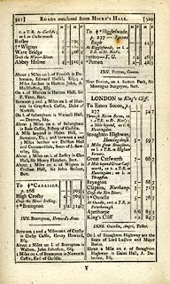 click to enlarge click to enlargeC38321.jpg page 321-322 "About 3 Miles on r. of Wigton is Crofton Hall, Sir John Briscoe, Bart." item:- JandMN : 228.1 Image © see bottom of page |
|
|
|
||
| evidence:- | road book:- Cary 1798 (2nd edn 1802) placename:- Crofton Hall |
|
| source data:- | Road book, itineraries, Cary's New Itinerary, by John Cary, 181
Strand, London, 2nd edn 1802. goto source click to enlarge click to enlargeC38555.jpg page 555-556 "Beyond Woodhouses, on l. is Crofton Hall, Sir John Briscoe, Bart." item:- JandMN : 228.2 Image © see bottom of page |
|
|
|
||
| evidence:- | old map:- Ford 1839 map placename:- Crofton Hall |
|
| source data:- | Map, uncoloured engraving, Map of the Lake District of
Cumberland, Westmoreland and Lancashire, scale about 3.5 miles
to 1 inch, published by Charles Thurnam, Carlisle, and by R
Groombridge, 5 Paternoster Row, London, 3rd edn 1843.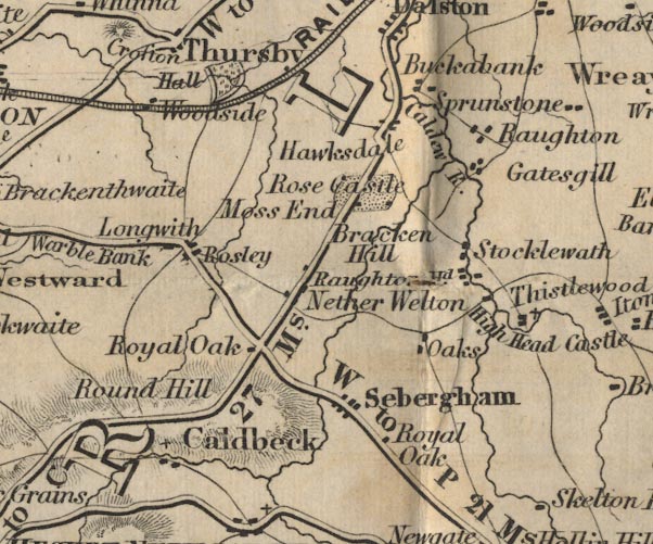 FD02NY34.jpg "Crofton Hall" Building and park. item:- JandMN : 100.1 Image © see bottom of page |
|
|
|
||
| evidence:- | old map:- Garnett 1850s-60s H placename:- Crofton Hall |
|
| source data:- | Map of the English Lakes, in Cumberland, Westmorland and
Lancashire, scale about 3.5 miles to 1 inch, published by John
Garnett, Windermere, Westmorland, 1850s-60s. GAR2NY25.jpg "Crofton Hall" block, building item:- JandMN : 82.1 Image © see bottom of page |
|
|
|
||
| evidence:- | old map:- Burrow 1920s |
|
| source data:- | Road book, On the Road, Dunlop Pictorial Road Plans, volume V,
strip maps with parts in Westmorland, Cumberland etc, irregular
scale about 1.5 miles to 1 inch, by E J Burrow and Co,
Cheltenham, Gloucestershire, 1920s.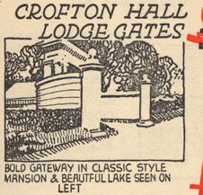 EJB3Vg55.jpg item:- private collection : 17 Image © see bottom of page |
|
|
|
||
| evidence:- | database:- Listed Buildings 2010 |
|
| source data:- | courtesy of English Heritage "GATE ARCH AND FLANKING WALLS, TO SOUTH-EAST OF CROFTON HALL / / / THURSBY / ALLERDALE / CUMBRIA / II / 71932 / NY3090749603" |
|
|
|
||
| evidence:- | database:- Listed Buildings 2010 item:- date stone (1826) |
|
| source data:- | courtesy of English Heritage "STABLE BLOCK FOR THE DEMOLISHED CROFTON HALL / / / THURSBY / ALLERDALE / CUMBRIA / II / 71935 / NY3033249982" |
|
|
|
||
| evidence:- | perhaps old painting:- placename:- Crofton Place |
|
| source data:- | Painting, watercolour, Crofton Place, perhaps Crofton Hall, Thursby, Cumberland, by
Robert Carlyle snr, 1791.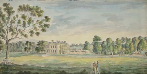 click to enlarge click to enlargePR1248.jpg Included in an album The Antiquities of the City of Carlisle. View of Crofton Place from surrounding parkland. two men stand conversing in the foreground. inscribed at bottom centre:- "CROFTON PLACE" item:- Tullie House Museum : 1978.108.77.23 Image © Tullie House Museum |
|
|
|
||
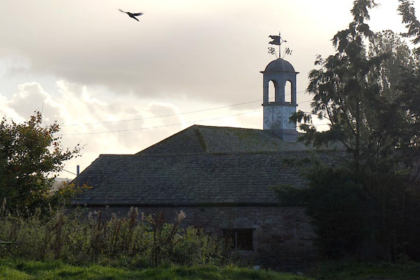 BZP54.jpg Stables. (taken 1.11.2013) |
||
|
|
||
| notes:- |
Home of the Brisco Family; created a baronet 1782. |
|
| The house was a grecian style building built 1838, the interior designed by the Adam
brothers and italian craftsmen. It was said to be haunted by a Lady in Grey. |
||
| It was demolished, being in unsafe condition, 1957. The ghost disppeared as well. |
||
| The estate was sold to the Land Settlement Association in 1935. It became a community
of unemployed miners from west Cumberland. The miners helped build their own homes,
and farmed pigs, poultry, and worked greenhouses. The project was supported by the
association until 1970. |
||
|
|
||
Lakes Guides menu.