 Old Cumbria Gazetteer
 |
 |
|
| Shop Bridge, Broughton West | ||
| Shop Bridge | ||
| site name:- | Lickle, River | |
| locality:- | Broughton Mills | |
| civil parish:- | Broughton West (formerly Lancashire) | |
| civil parish:- | Dunnerdale-with-Seathwaite (formerly Lancashire) | |
| county:- | Cumbria | |
| locality type:- | bridge | |
| coordinates:- | SD22239071 | |
| 1Km square:- | SD2290 | |
| 10Km square:- | SD29 | |
|
|
||
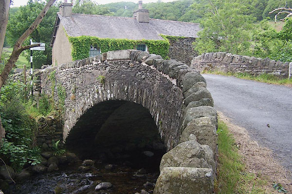 BMG21.jpg (taken 12.6.2006) 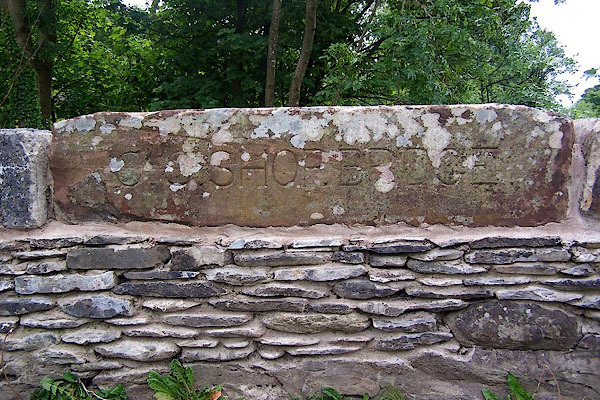 BMG22.jpg Inscribed stone:- "C.C. SHOP BRIDGE" (taken 12.6.2006) |
||
|
|
||
| evidence:- | old map:- OS County Series (Lan 6 4) placename:- Shop Bridge |
|
| source data:- | Maps, County Series maps of Great Britain, scales 6 and 25
inches to 1 mile, published by the Ordnance Survey, Southampton,
Hampshire, from about 1863 to 1948. |
|
|
|
||
| evidence:- | database:- Listed Buildings 2010 |
|
| source data:- | courtesy of English Heritage "SHOP BRIDGE AND BOUNDARY STONE / / / BROUGHTON WEST / SOUTH LAKELAND / CUMBRIA / II / 75813 / SD2223690716" |
|
| source data:- | courtesy of English Heritage "Bridge over River Lickle. Possibly C18 with later widening. Stone rubble. Segmental arch has thin voussoirs approx. 3.5m wide. Widening to north-east and south-west angles. Low parapets. Boundary marked by upright stone with vertical inscription: "BROUGHTON/DUNNERDALE". Part of this item is in Dunnerdale-with-Seathwaite C.P." |
|
|
|
||
 Lakes Guides menu.