 Old Cumbria Gazetteer
 |
 |
|
| Wood House, Whicham | ||
| Wood House | ||
| civil parish:- | Whicham (formerly Cumberland) | |
| county:- | Cumbria | |
| locality type:- | buildings | |
| coordinates:- | SD12438298 | |
| 1Km square:- | SD1282 | |
| 10Km square:- | SD18 | |
|
|
||
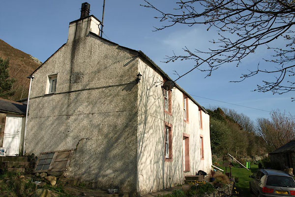 BSN59.jpg (taken 16.4.2010) courtesy of the owner 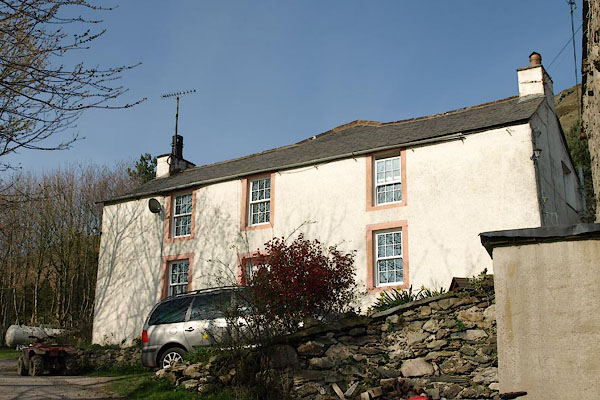 BSN60.jpg (taken 16.4.2010) courtesy of the owner |
||
|
|
||
| evidence:- | old map:- OS County Series (Cmd 87 12) placename:- Wood House |
|
| source data:- | Maps, County Series maps of Great Britain, scales 6 and 25
inches to 1 mile, published by the Ordnance Survey, Southampton,
Hampshire, from about 1863 to 1948. |
|
|
|
||
| evidence:- | old map:- Donald 1774 (Cmd) placename:- Wood House |
|
| source data:- | Map, hand coloured engraving, 3x2 sheets, The County of Cumberland, scale about 1
inch to 1 mile, by Thomas Donald, engraved and published by Joseph Hodskinson, 29
Arundel Street, Strand, London, 1774.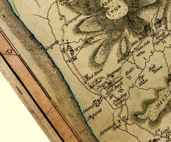 D4SD18SW.jpg "Wood House" block or blocks, labelled in lowercase; a hamlet or just a house item:- Carlisle Library : Map 2 Image © Carlisle Library |
|
|
|
||
| evidence:- | old map:- Hall 1820 (Cmd) placename:- Wood House |
|
| source data:- | Map, hand coloured engraving, Cumberland, scale about 21 miles
to 1 inch, engraved by Sidney Hall, published by S Leigh, 18
Strand, London, 1820-31. click to enlarge click to enlargeHA14.jpg "Wood Ho." circle; house item:- JandMN : 91 Image © see bottom of page |
|
|
|
||
 Lakes Guides menu.