 Old Cumbria Gazetteer
 |
 |
|
| Winter House, Morland | ||
| Winter House | ||
| civil parish:- | Morland (formerly Westmorland) | |
| county:- | Cumbria | |
| locality type:- | buildings | |
| coordinates:- | NY60332392 | |
| 1Km square:- | NY6023 | |
| 10Km square:- | NY62 | |
|
|
||
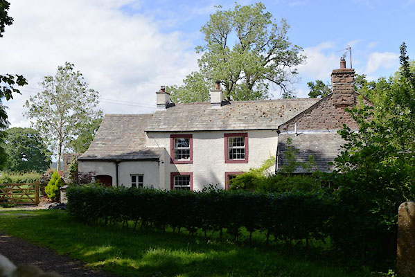 CGE39.jpg (taken 15.6.2017) |
||
|
|
||
| evidence:- | old map:- OS County Series (Wmd 8 7) placename:- Winter House |
|
| source data:- | Maps, County Series maps of Great Britain, scales 6 and 25
inches to 1 mile, published by the Ordnance Survey, Southampton,
Hampshire, from about 1863 to 1948. |
|
|
|
||
| evidence:- | possibly old map:- Jefferys 1770 (Wmd) placename:- Sower Taith |
|
| source data:- | Map, 4 sheets, The County of Westmoreland, scale 1 inch to 1
mile, surveyed 1768, and engraved and published by Thomas
Jefferys, London, 1770.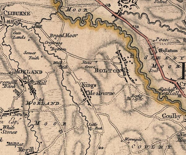 J5NY62SW.jpg "Sower Taith" circle, labelled in italic lowercase text; settlement, farm, house, or hamlet? item:- National Library of Scotland : EME.s.47 Image © National Library of Scotland |
|
|
|
||
| evidence:- | possibly old map:- Cary 1789 (edn 1805) placename:- Sower Taith |
|
| source data:- | Map, uncoloured engraving, Westmoreland, scale about 2.5 miles
to 1 inch, by John Cary, London, 1789; edition 1805.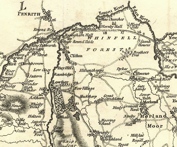 CY24NY52.jpg "Sower Taith" block/s, labelled in italic lowercase; house, or hamlet item:- JandMN : 129 Image © see bottom of page |
|
|
|
||
| evidence:- | database:- Listed Buildings 2010 placename:- Winter House item:- date stone (1726) |
|
| source data:- | courtesy of English Heritage "WINTER HOUSE / 1 / CROSSRIGG ESTATE / MORLAND / EDEN / CUMBRIA / II / 461795 / NY6033723922" |
|
|
|
||
 Lakes Guides menu.