 Old Cumbria Gazetteer
 |
 |
|
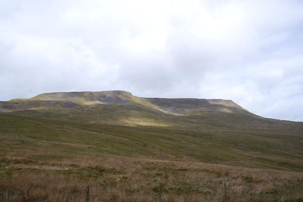
| Wild Boar Fell, Mallerstang | ||
| Wild Boar Fell | ||
| civil parish:- | Mallerstang (formerly Westmorland) | |
| civil parish:- | Ravenstonedale (formerly Westmorland) | |
| county:- | Cumbria | |
| locality type:- | hill | |
| locality type:- | fell | |
| coordinates:- | SD75799882 (etc) | |
| 1Km square:- | SD7598 | |
| 10Km square:- | SD79 | |
| altitude:- | 2323 feet | |
| altitude:- | 708m | |
|
|
||
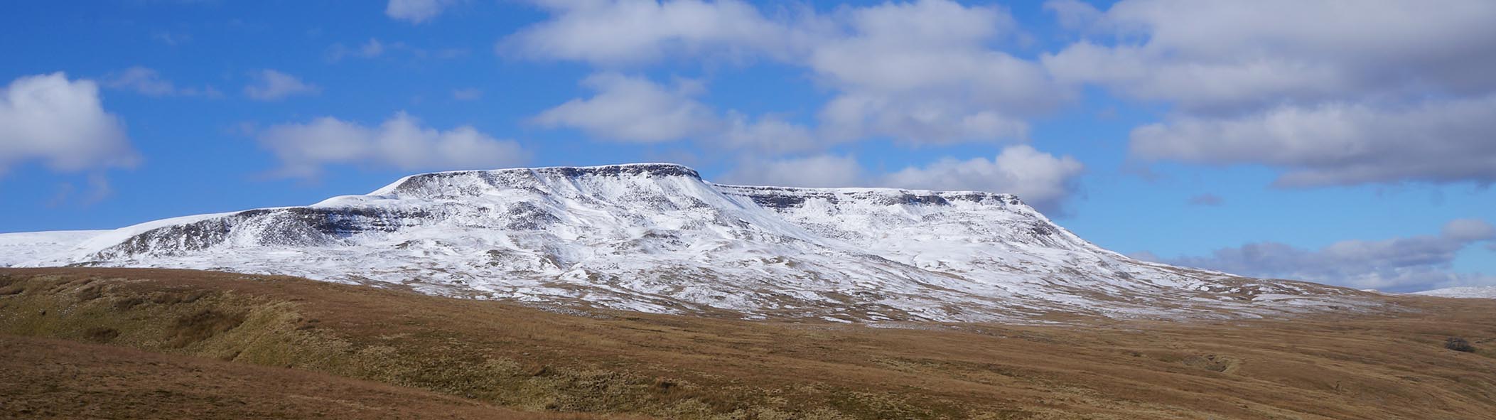
 CDC28.jpg (taken 26.5.2015) 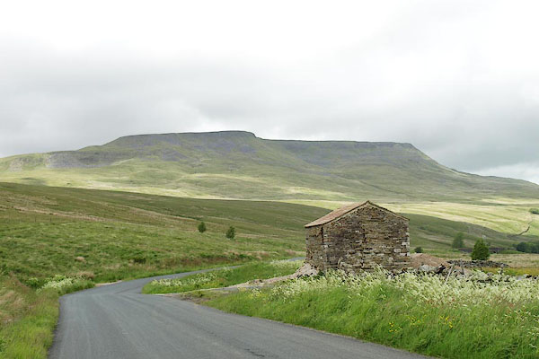 BQV44.jpg (taken 18.6.2009) |
||
|
|
||
| evidence:- | old map:- OS County Series (Wmd 36 6) placename:- Wild Boar Fell |
|
| source data:- | Maps, County Series maps of Great Britain, scales 6 and 25
inches to 1 mile, published by the Ordnance Survey, Southampton,
Hampshire, from about 1863 to 1948. |
|
|
|
||
| evidence:- | old map:- Morden 1695 (Wmd) placename:- Wildborefell |
|
| source data:- | Map, hand coloured engraving, Westmorland, scale about 2.5 miles to 1 inch, by Robert
Morden, published by Abel Swale, the Unicorn, St Paul's Churchyard, Awnsham, and John
Churchill, the Black Swan, Paternoster Row, London, 1695.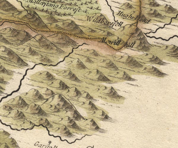 MD10SD79.jpg "Wildborefell" Hillock. item:- JandMN : 24 Image © see bottom of page |
|
|
|
||
| evidence:- | descriptive text:- Defoe 1724-26 placename:- Mowill Hill placename:- Wildbore Fell |
|
| source data:- | Tour through England and Wales, by Daniel Defoe, published in
parts, London, 1724-26. "... The River Eden, ... rises in this part out of the side of a monstrous high mountain, called Mowill Hill, or Wildbore Fell, which you please; ..." |
|
|
|
||
| evidence:- | old map:- Simpson 1746 map (Wmd) placename:- Wildbore Fell |
|
| source data:- | Map, uncoloured engraving, Westmorland, scale about 8 miles to 1
inch, printed by R Walker, Fleet Lane, London, 1746.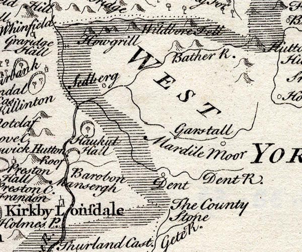 SMP2SDU.jpg "Wildbore Fell" Hillock. item:- Dove Cottage : 2007.38.59 Image © see bottom of page |
|
|
|
||
| evidence:- | old map:- Bowen and Kitchin 1760 placename:- Wildbore Fell |
|
| source data:- | Map, hand coloured engraving, A New Map of the Counties of
Cumberland and Westmoreland Divided into their Respective Wards,
scale about 4 miles to 1 inch, by Emanuel Bowen and Thomas
Kitchin et al, published by T Bowles, Robert Sayer, and John
Bowles, London, 1760.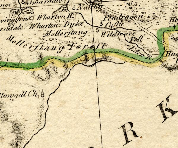 BO18NY70.jpg "Wildbore Fell" hill hachuring item:- Armitt Library : 2008.14.10 Image © see bottom of page |
|
|
|
||
| evidence:- | old map:- Jefferys 1770 (Wmd) placename:- Wild Boar Fell |
|
| source data:- | Map, 4 sheets, The County of Westmoreland, scale 1 inch to 1
mile, surveyed 1768, and engraved and published by Thomas
Jefferys, London, 1770.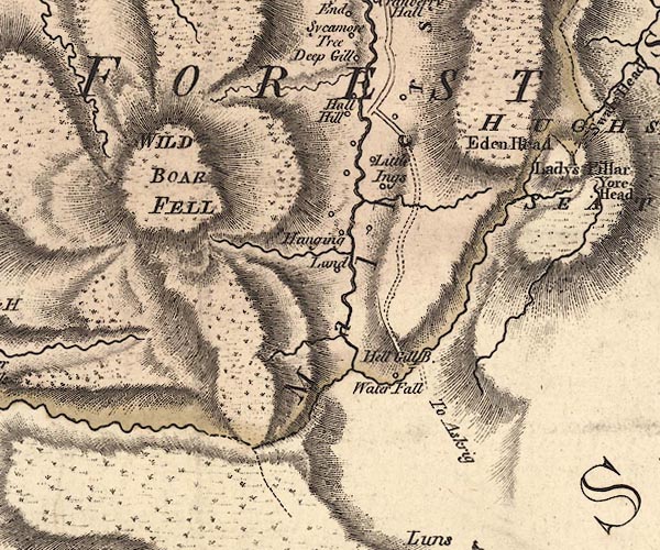 J5SD79NE.jpg "WILD BOAR FELL" hill hachuring; hill or mountain item:- National Library of Scotland : EME.s.47 Image © National Library of Scotland |
|
|
|
||
| evidence:- | probably old print:- Clarke 1787 placename:- Wilber Fell |
|
| source data:- | circle click to enlarge click to enlargeCL18.jpg "Wilber Fell" item:- Armitt Library : A6615.12 Image © see bottom of page |
|
|
|
||
| evidence:- | old map:- Cary 1789 (edn 1805) placename:- Wild Boar Fell |
|
| source data:- | Map, uncoloured engraving, Westmoreland, scale about 2.5 miles
to 1 inch, by John Cary, London, 1789; edition 1805.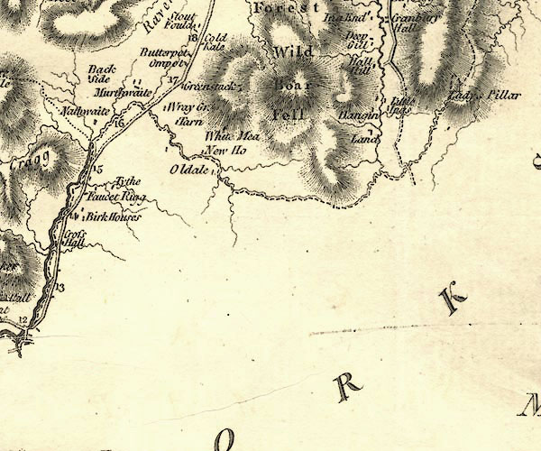 CY24SD79.jpg "Wild Boar Fell" hill hachuring item:- JandMN : 129 Image © see bottom of page |
|
|
|
||
| evidence:- | old text:- Capper 1808 placename:- Wild Boar Fell item:- Helm Wind |
|
| source data:- | Gazetteer, A Topographical Dictionary of the United Kingdom,
compiled by Benjamin Pitts Capper, published by Richard
Phillips, Bridge Street, Blackfriars, London, 1808; published
1808-29. goto source goto source"... On the top of Wild Boar Fell, a remarkable high mountain, there is often a curious phenomenon called a Helm Wind, being a rolling cloud floating sometimes for several days, when every other part of the sky is perfectly serene, from whence issues a violent hurricane down the sides of the hill, threatening destruction to all before it. ..." |
|
|
|
||
| evidence:- | old map:- Cooper 1808 placename:- Wild Boar Fell |
|
| source data:- | Map, hand coloured engraving, Westmoreland ie Westmorland, scale
about 9 miles to 1 inch, by H Cooper, 1808, published by R
Phillips, Bridge Street, Blackfriars, London, 1808. click to enlarge click to enlargeCOP4.jpg "Wild Boar Fell" hill hachuring; mountain or hill item:- Dove Cottage : 2007.38.53 Image © see bottom of page |
|
|
|
||
 Click to enlarge CER17.jpg (taken 7.3.2016) 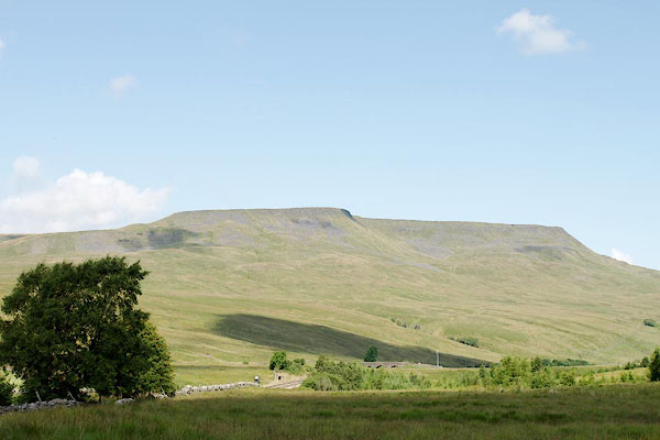 BRF83.jpg (taken 3.8.2009) 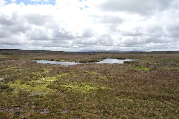 CDD19.jpg Small tarn, (taken 26.5.2015) 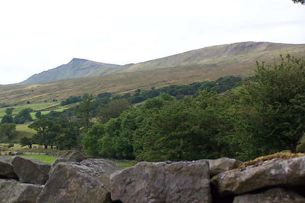 BJR63.jpg From Mallerstang. (taken 9.8.2005) |
||
|
|
||
| hearsaystory:- |
The last wild boar in England is said to have been killed by Richard Musgrave of Kirkby
Stephen on the fell, late 17th century. When his grave was opened in 1847 a boar's
tusk was found lying on his body, which proves it, doesn't it? |
|
| Or in the 16th century, according to some. |
||
|
|
||
Lakes Guides menu.