 Old Cumbria Gazetteer
 |
 |
|
| Whitehall, Allhallows | ||
| out of sight | ||
| Whitehall | ||
| locality:- | Mealsgate | |
| civil parish:- | Allhallows (formerly Cumberland) | |
| county:- | Cumbria | |
| locality type:- | buildings | |
| locality type:- | moat | |
| coordinates:- | NY20184159 | |
| 1Km square:- | NY2041 | |
| 10Km square:- | NY24 | |
|
|
||
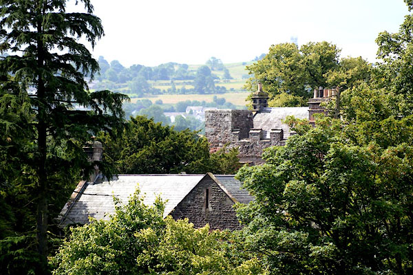 CGH63.jpg (taken 4.8.2017) |
||
|
|
||
| evidence:- | old map:- OS County Series (Cmd 36 7) placename:- Whitehall |
|
| source data:- | Maps, County Series maps of Great Britain, scales 6 and 25
inches to 1 mile, published by the Ordnance Survey, Southampton,
Hampshire, from about 1863 to 1948. |
|
|
|
||
| evidence:- | old map:- Ogilby 1675 (plate 96) placename:- Whitehall |
|
| source data:- | Road strip map, hand coloured engraving, the Road from Kendal to
Cockermouth, and the Road from Egremond to Carlisle, scale about
1 inch to 1 mile, by John Ogilby, London, 1675.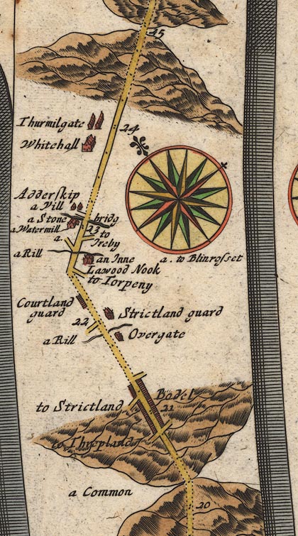 OG96Bm20.jpg In mile 23, Cumberland. "Whitehall" large house off the left of the road. item:- JandMN : 22 Image © see bottom of page |
|
|
|
||
| evidence:- | old map:- Bowen 1720 (plate 261) placename:- Whitehall |
|
| source data:- | Road strip map, uncoloured engraving, pl.261, the end of the
road from Kendal to Cockermouth and the road from Egremont to
Carlisle, scale about 2 miles to 1 inch, published by Emanuel
Bowen, St Katherines, London, 1720.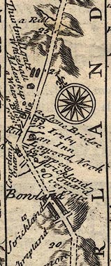 B261m20.jpg At mile 23-24 from Egremont. item:- Dove Cottage : Lowther.36 Image © see bottom of page |
|
|
|
||
| evidence:- | possibly descriptive text:- Simpson 1746 placename:- Whitehall |
|
| source data:- | Atlas, three volumes of maps and descriptive text published as
'The Agreeable Historian, or the Compleat English Traveller
...', by Samuel Simpson, 1746. goto source goto source"... Whitehall, Mr. Salkeld's ..." |
|
|
|
||
| evidence:- | probably old map:- Bowen and Kitchin 1760 placename:- Whitehall |
|
| source data:- | Map, hand coloured engraving, A New Map of the Counties of
Cumberland and Westmoreland Divided into their Respective Wards,
scale about 4 miles to 1 inch, by Emanuel Bowen and Thomas
Kitchin et al, published by T Bowles, Robert Sayer, and John
Bowles, London, 1760.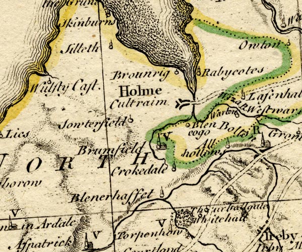 BO18NY14.jpg "Whitehall" circle and line item:- Armitt Library : 2008.14.10 Image © see bottom of page |
|
|
|
||
| evidence:- | old map:- Donald 1774 (Cmd) placename:- White Hall |
|
| source data:- | Map, hand coloured engraving, 3x2 sheets, The County of Cumberland, scale about 1
inch to 1 mile, by Thomas Donald, engraved and published by Joseph Hodskinson, 29
Arundel Street, Strand, London, 1774.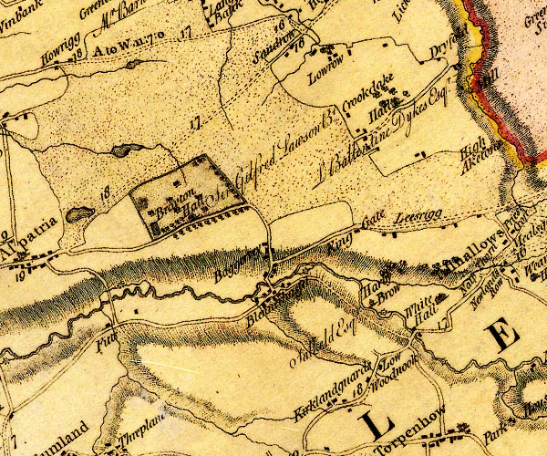 D4NY14SE.jpg "White Hall" house and hamlet item:- Carlisle Library : Map 2 Image © Carlisle Library |
|
|
|
||
| evidence:- | database:- Listed Buildings 2010 placename:- Whitehall item:- coat of arms; date stone (1589) |
|
| source data:- | courtesy of English Heritage "WHITEHALL / / / ALLHALLOWS / ALLERDALE / CUMBRIA / I / 72309 / NY2019141632" |
|
|
|
||
| notes:- |
Hall and tower; there is a moat very close by |
|
| Perriam, D R &Robinson, J: 1998: Medieval Fortified Buildings of Cumbria: CWAAS::
ISBN 1 873124 23 6; plan and illustration |
||
|
|
||
Lakes Guides menu.