


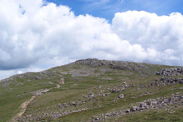
BWU67.jpg (taken 18.6.2012)
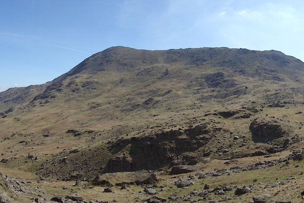
CCX84.jpg (taken 22.4.2015)
placename:- Wetherlam
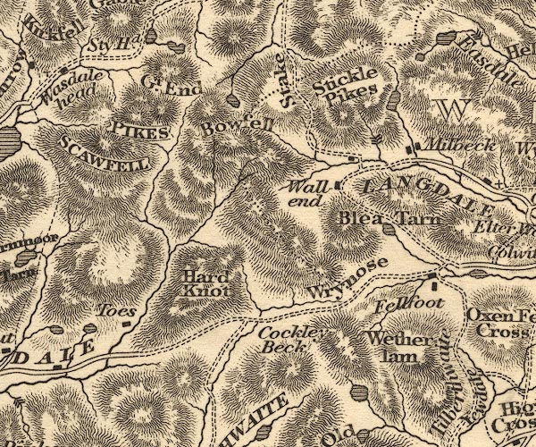
OT02NY20.jpg
item:- JandMN : 48.1
Image © see bottom of page
placename:- Wetherlam
 click to enlarge
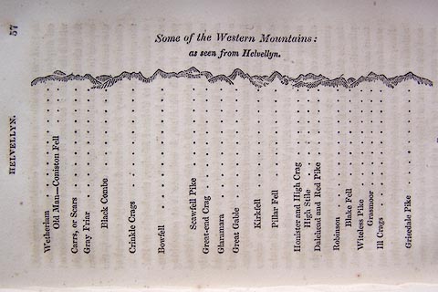
O75E02.jpg
p.57 in A Concise Description of the English Lakes, by Jonathan Otley, 4th edition, 1830. "Some of the Western Mountains: / as seen from Helvellyn."
"Wetherlam / Old Man - Coniston Fell / Carrs, or Scars / Gray Friar / Black Combe / Crinkle Crags / Bowfell / Scawfell Pike / Great-end Crag / Glaramara / Great Gable / Kirkfell / Pillar Fell / Honister and High Crag / High Stile / Dalehead and Red Pike / Robinson / Blake Fell / Witeless Pike / Grasmoor / Ill Crags / Grisedale Pike"
item:- Armitt Library : A1175.3
Image © see bottom of page
placename:- Wetherlam
 click to enlarge
O75E04.jpg
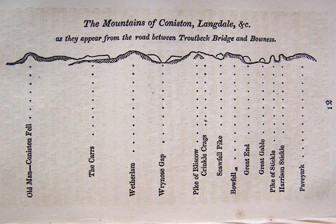
p.97 in A Concise Description of the English Lakes, by Jonathan Otley, 4th edition, 1830. "The Mountains of Coniston, Langdale, &c. / as they appear from the road between Troutbeck Bridge and Bowness."
"Old Man - Coniston Fell / The Carrs / Wetherlam / Wrynose Gap / Pike of Bliscow / Crinkle Crags / Scawfell Pike / Bowfell / Great End / Great Gable / Pike of Stickle / Harrison Stickle / Paveyark"
item:- Armitt Library : A1175.4
Image © see bottom of page
placename:- Wetherlam
 click to enlarge
O80E03.jpg
item:- Armitt Library : A1180.4
Image © see bottom of page
placename:- Wetherlam
 click to enlarge
O80E05.jpg
item:- Armitt Library : A1180.6
Image © see bottom of page
placename:- Wetherlam
 click to enlarge
O80E17.jpg
item:- Armitt Library : A1180.18
Image © see bottom of page
 click to enlarge
OT2E01.jpg
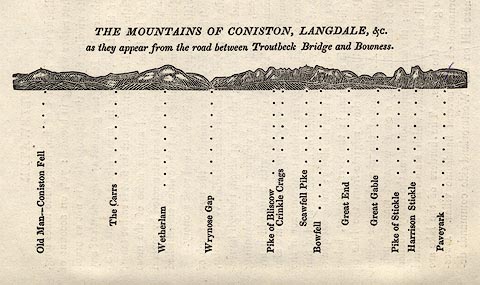
Printed on p.7 of A Concise Description of the English Lakes, by Jonathan Otley, 5th edition, 1834. "THE MOUNTAINS OF CONISTON, LANGDALE, &c. as they appear from the road between Troutbeck Bridge and Bowness."
Mountains in the view are listed:- "Old Man - Coniston Fell / The Carrs / Wetherlam / Wrynose Gap / Pike of Bliscow / Crinkle Crags / Scawfell Pike / Bowfell / Great End / Great Gable / Pike of Stickle / Harrison Stickle / Paveyark"
item:- JandMN : 48.2
Image © see bottom of page
 click to enlarge
OT2E09.jpg
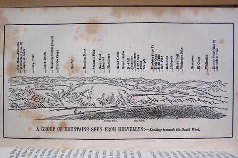
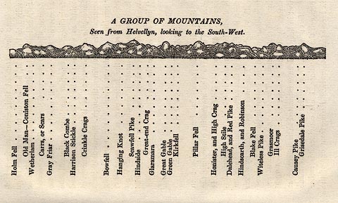
Printed on p.63 of A Concise Description of the English Lakes, by Jonathan Otley, 5th edition, 1834. "A GROUP OF MOUNTAINS, Seen from Helvellyn, looking to the South-West."
"Holm Fell / Old Man - Coniston Fell / Wetherlam / Carrs, or Scars / Gray Friar / Black Combe / Harrison Stickle / Crinkle Crags / Bowfell / Hanging Knot / Scawfell Pike / Hindside / Great-end Crag / Glaramara / Great Gable / Green Gable / Kirkfell / Pillar Fell / Honister, and High Crag / High Stile / Dalehead, and Red Pike / Hindscarth, and Robinson / Blake Fell / Witeless Pike / Grasmoor / Ill Crags / Causey Pike / Grisedale Pike"
item:- JandMN : 48.10
Image © see bottom of page
placename:- Wetherlam
GAR2NY20.jpg
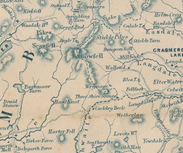
"Wetherlam"
hill hachuring
item:- JandMN : 82.1
Image © see bottom of page
 click to enlarge
MNU102.jpg
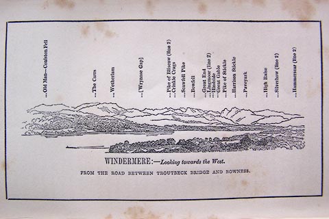
Folded in opposite p.7 in A Complete Guide to the English Lakes, by Harriet Martineau. "MOUNTAINS ON THE WEST SIDE OF WINDERMERE"
"L Aspland Delt. / W Banks Sc Edinburgh."
The view is captioned, numbers referring to mountains in the image:- "1 Coniston Old Man 1a Carrs 2 Wetherlam 3 Wrynose Gap 4 Crinkle Crags 5 Pike of Bliscow 6 Scawfell Pike 7 Bowfell 8 Hanging Knotts 9 Glaramara 10 Great End 11 Pike of Stickle 12 Harrison Stickle 13 Paveyark 14 Lingmoor 15 High Raise 16 Silver How 17 Loughrigg Fell 18 Ullscarth"
item:- Armitt Library : A1159.2
Image © see bottom of page
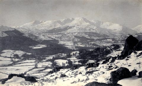
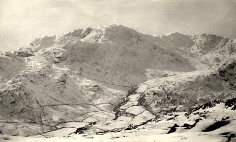
item:- snow; winter
 click to enlarge
HB0788.jpg
item:- Armitt Library : ALPS451
Image © see bottom of page
item:- snow; winter; stone wall
 click to enlarge
HB0789.jpg
item:- Armitt Library : ALPS452
Image © see bottom of page
placename:- Wetherlam
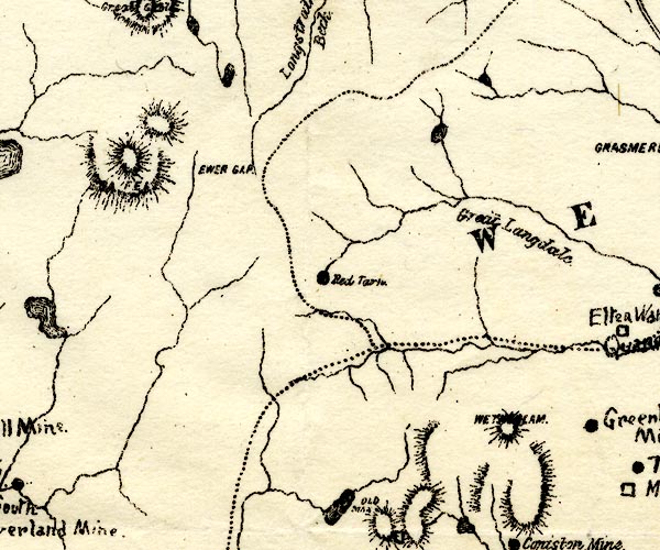
PST2NY20.jpg
"WETHERLAM"
hill hachuring
item:- JandMN : 162.2
Image © see bottom of page
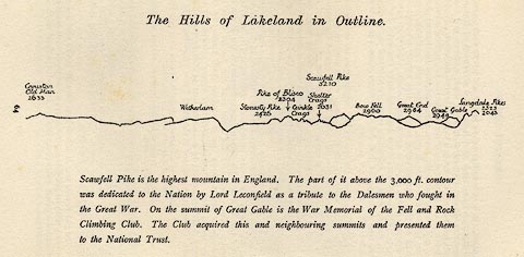 click to enlarge
LS1E32.jpg
item:- JandMN : 95.5
Image © see bottom of page
placename:- Weatherlam
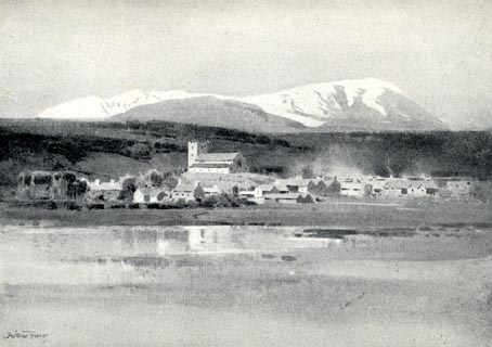 click to enlarge
RSN116.jpg
Tipped in opposite p.64 of Wordsworthshire by Eric Robertson.
printed at bottom:- "HAWKSHEAD / ('Priest's Pot' Pool in foreground; Weatherlam covered with snow)"
signed at painting lower left:- "Arthur Tucker"
item:- JandMN : 197.16
Image © see bottom of page
placename:- Wetherlam
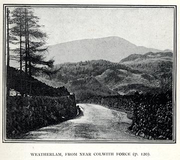 click to enlarge
PS1E44.jpg
On p.121 of Pearson's Gossipy Guide to the English Lakes and Neighbouring Districts.
printed at bottom:- "WETHERLAM, FROM NEAR COLWITH FORCE. (p.120)."
item:- Armitt Library : A1188.51
Image © see bottom of page
placename:- Wetherlam
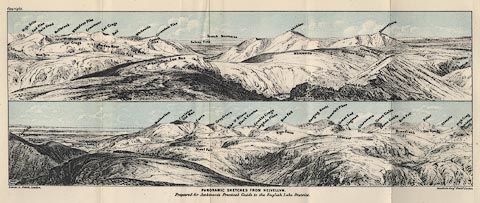 click to enlarge
Jk01E1.jpg
"... Wetherlam ..."
item:- JandMN : 28.5
Image © see bottom of page
placename:- Wetherlam
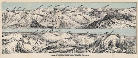 click to enlarge
Jk01E3.jpg
"... Wetherlam ..."
item:- JandMN : 28.9
Image © see bottom of page
placename:- Wetherlam
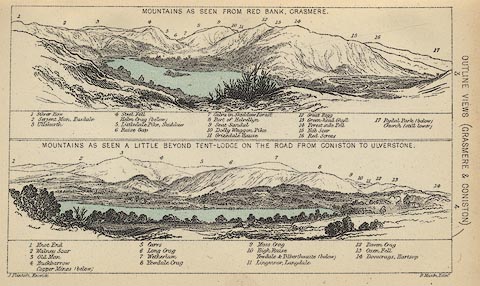 click to enlarge
BC08E3.jpg
"... 7 Wetherlam ..."
item:- JandMN : 37.12
Image © see bottom of page
placename:- Wetherlam
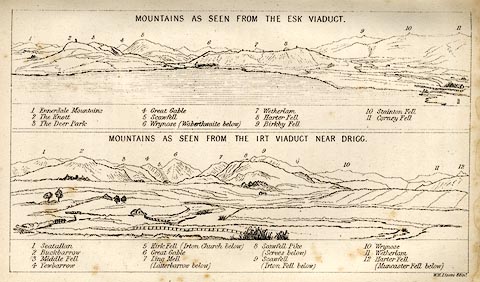 click to enlarge
LN1E13.jpg
Tipped in opposite p.86 of A Handbook of the Whitehaven and Furness Railway, by John Linton.
item:- Armitt Library : A1158.11
Image © see bottom of page
placename:- Wetherlam
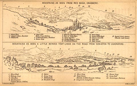 click to enlarge
BC02E3.jpg
"... 7 Wetherlam ..."
item:- JandMN : 32.5
Image © see bottom of page
placename:- Wetherlam
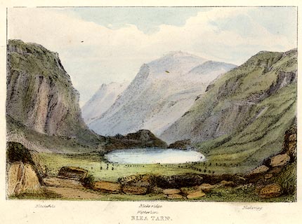 click to enlarge
TAT203.jpg
Included in The Lakes of England, by W F Topham.
printed at bottom:- "BLEA TARN."
printed at bottom:- "Black Pike. / Wetherlam. / Blake ridge. / Blakerigg."
item:- Armitt Library : A1067.3
Image © see bottom of page
placename:- Wetherlam
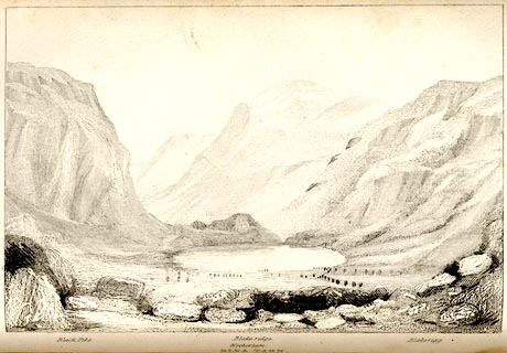 click to enlarge
TAT108.jpg
The print is captioned with mountain names and acts as an outline view.
Tipped in opposite p.41 of The Lakes of England, by George Tattersall.
printed at bottom:- "BLEA TARN."
printed at bottom left to right:- "Black Pike. / Wetherlam. / Blake ridge. / Blakerigg."
item:- Armitt Library : A1204.9
Image © see bottom of page
placename:- Wetherlam
 click to enlarge
PR1577.jpg
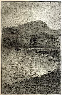
Tipped in opposite p.24 of Through the Wordsworth Country, by William Knight.
printed at lower right:- "When, from behind that craggy steep till then / The horizon's bound, a huge peak, black and huge, / As if with voluntary power instinct / Upreared its head."
printed at lower right:- "HG 1886"
item:- JandMN : 382.7
Image © see bottom of page
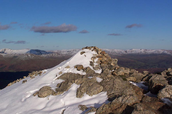
BTU51.jpg Cairn.
(taken 10.11.2010)
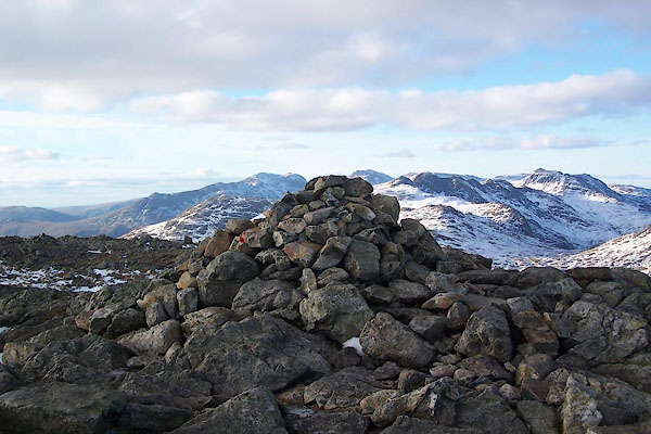
BTU52.jpg Cairn.
(taken 10.11.2010)

 Lakes Guides menu.