Old Cumbria Gazetteer
 |
 |
|
||
| Watendlath, Borrowdale | ||||
| Watendlath | ||||
| civil parish:- | Borrowdale (formerly Cumberland) | |||
| county:- | Cumbria | |||
| locality type:- | locality | |||
| locality type:- | buildings | |||
| coordinates:- | NY27601633 (etc) | |||
| 1Km square:- | NY2716 | |||
| 10Km square:- | NY21 | |||
|
|
||||
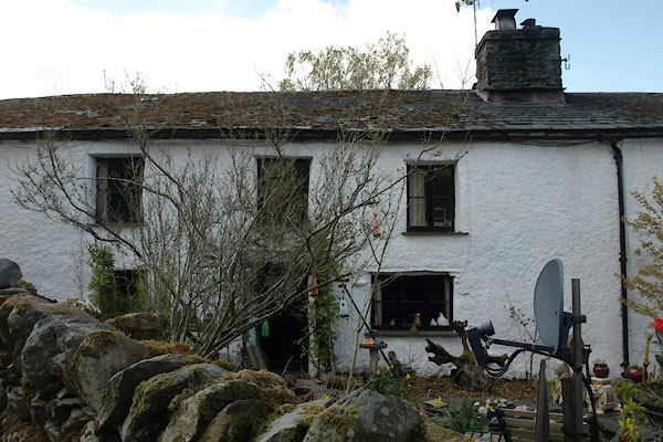
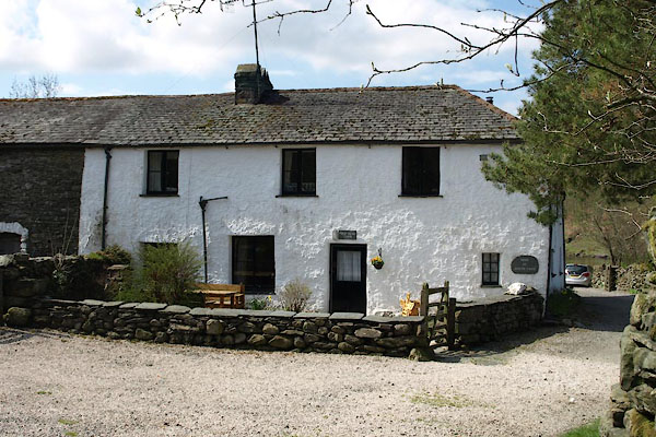
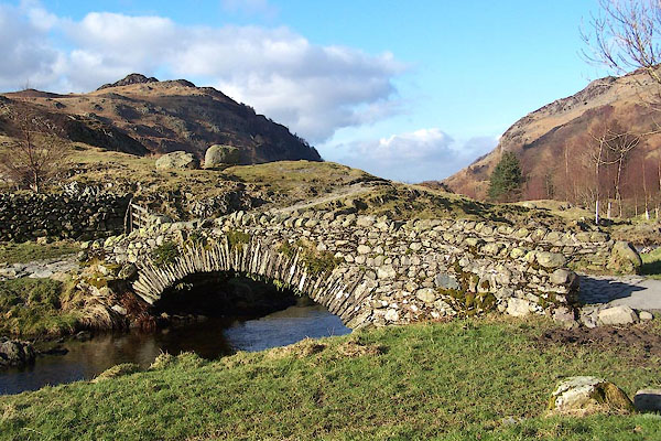
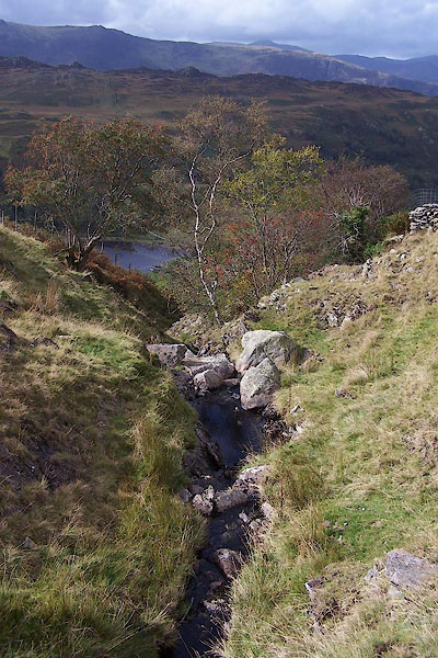
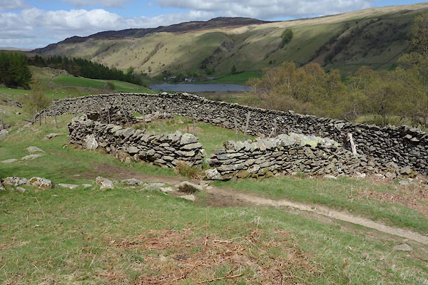
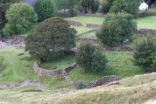
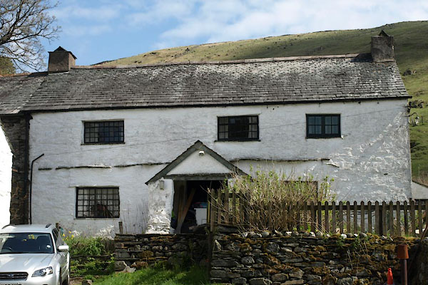
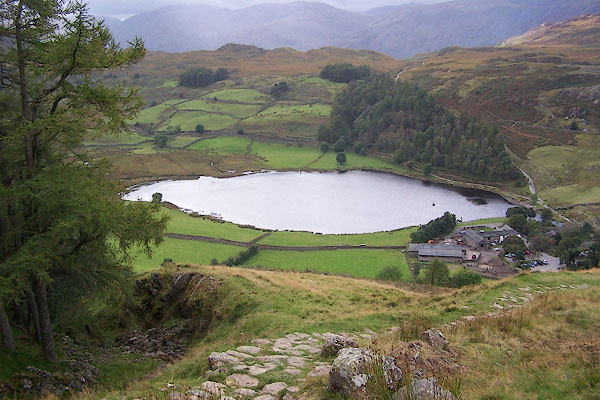
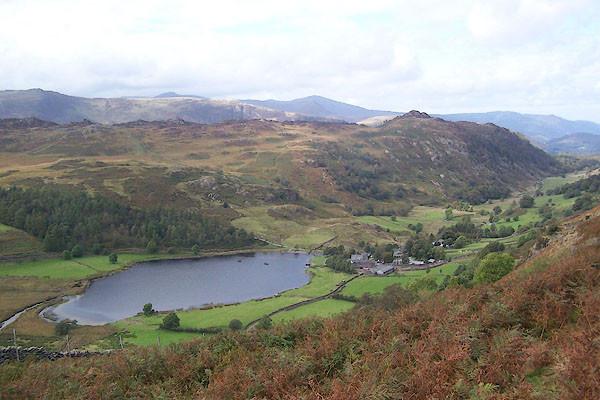 BRP77.jpg (taken 23.9.2009) 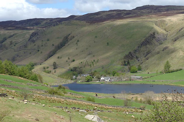 BYJ46.jpg (taken 22.5.2013) |
||||
|
|
||||
| evidence:- | old map:- OS County Series (Cmd 70 6) placename:- Watendlath |
|||
| source data:- | Maps, County Series maps of Great Britain, scales 6 and 25
inches to 1 mile, published by the Ordnance Survey, Southampton,
Hampshire, from about 1863 to 1948. |
|||
|
|
||||
| evidence:- | old map:- Saxton 1579 placename:- Watenlath |
|||
| source data:- | Map, hand coloured engraving, Westmorlandiae et Cumberlandiae Comitatus ie Westmorland
and Cumberland, scale about 5 miles to 1 inch, by Christopher Saxton, London, engraved
by Augustinus Ryther, 1576, published 1579-1645.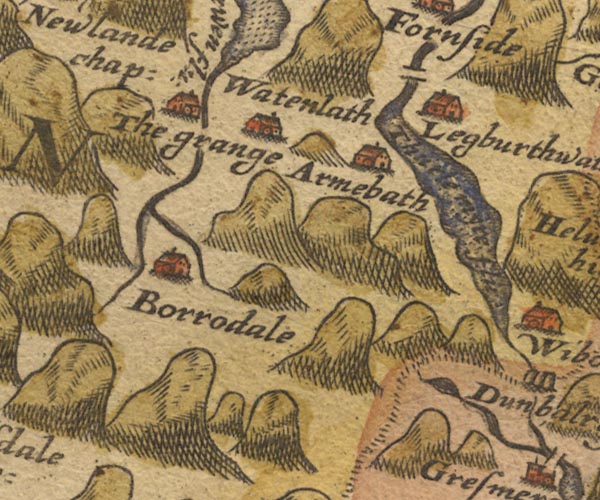 Sax9NY21.jpg Building, symbol for a hamlet, which may or may not have a nucleus. "watenlath" item:- private collection : 2 Image © see bottom of page |
|||
|
|
||||
| evidence:- | old map:- Speed 1611 (Cmd) placename:- Watenlath |
|||
| source data:- | Map, hand coloured engraving, Cumberland and the Ancient Citie
Carlile Described, scale about 4 miles to 1 inch, by John Speed,
1610, published by J Sudbury and George Humble, Popes Head
Alley, London, 1611-12.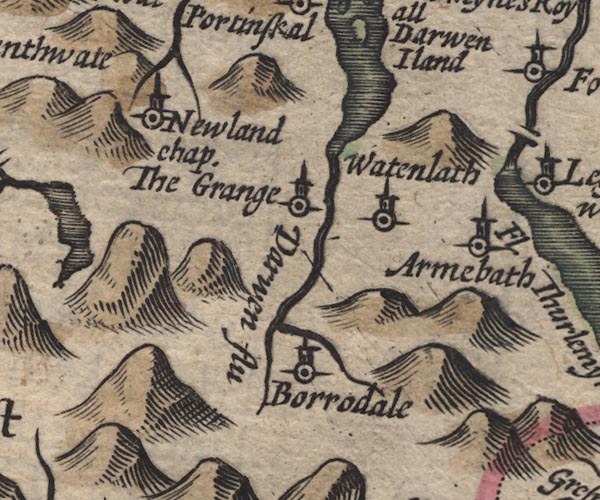 SP11NY21.jpg "Watenlath" circle, tower item:- private collection : 16 Image © see bottom of page |
|||
|
|
||||
| evidence:- | old map:- Jansson 1646 placename:- Watenlath |
|||
| source data:- | Map, hand coloured engraving, Cumbria and Westmoria, ie
Cumberland and Westmorland, scale about 3.5 miles to 1 inch, by
John Jansson, Amsterdam, Netherlands, 1646.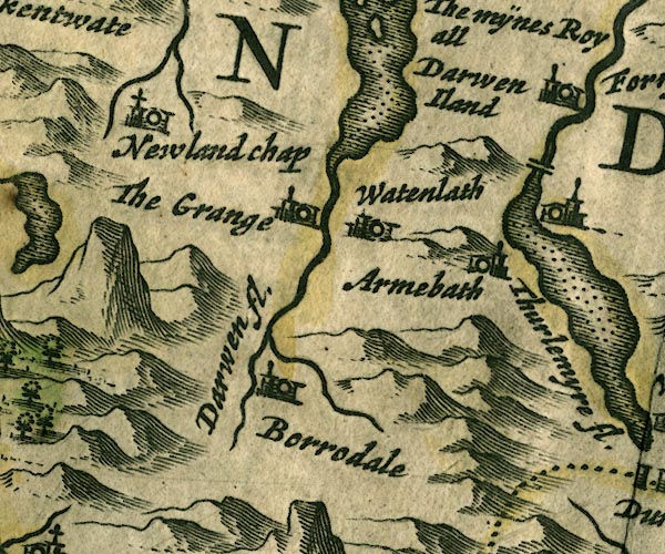 JAN3NY21.jpg "Watenlath" Buildings and tower. item:- JandMN : 88 Image © see bottom of page |
|||
|
|
||||
| evidence:- | old map:- Morden 1695 (Cmd) placename:- Watenlath |
|||
| source data:- | Map, uncoloured engraving, Cumberland, scale about 4 miles to 1
inch, by Robert Morden, 1695, published by Abel Swale, the
Unicorn, St Paul's Churchyard, Awnsham, and John Churchill, the
Black Swan, Paternoster Row, London, 1695-1715.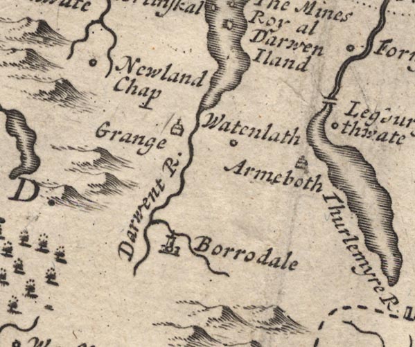 MD12NY21.jpg "Watenlath" Circle. item:- JandMN : 90 Image © see bottom of page |
|||
|
|
||||
| evidence:- | old map:- Bowen and Kitchin 1760 placename:- Watenlath |
|||
| source data:- | Map, hand coloured engraving, A New Map of the Counties of
Cumberland and Westmoreland Divided into their Respective Wards,
scale about 4 miles to 1 inch, by Emanuel Bowen and Thomas
Kitchin et al, published by T Bowles, Robert Sayer, and John
Bowles, London, 1760. BO18NY21.jpg "Watenlath" circle, tower item:- Armitt Library : 2008.14.10 Image © see bottom of page |
|||
|
|
||||
| evidence:- | old map:- Donald 1774 (Cmd) placename:- Watendlath |
|||
| source data:- | Map, hand coloured engraving, 3x2 sheets, The County of Cumberland, scale about 1
inch to 1 mile, by Thomas Donald, engraved and published by Joseph Hodskinson, 29
Arundel Street, Strand, London, 1774. D4NY21NE.jpg "Watendlath" block or blocks, labelled in lowercase; a hamlet or just a house item:- Carlisle Library : Map 2 Image © Carlisle Library |
|||
|
|
||||
| evidence:- | old map:- Otley 1818 placename:- Watendlath |
|||
| source data:- | Map, uncoloured engraving, The District of the Lakes,
Cumberland, Westmorland, and Lancashire, scale about 4 miles to
1 inch, by Jonathan Otley, 1818, engraved by J and G Menzies,
Edinburgh, Scotland, published by Jonathan Otley, Keswick,
Cumberland, et al, 1833.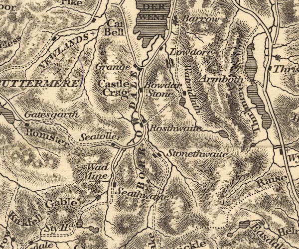 OT02NY21.jpg Labelling the valley. item:- JandMN : 48.1 Image © see bottom of page |
|||
|
|
||||
| evidence:- | descriptive text:- Otley 1823 (8th edn 1849) placename:- Watendlath placename:- Wattendleth placename:- Watanlath placename:- Watenlath placename:- Watendleth placename:- Watinlath |
|||
| source data:- | Guide book, A Concise Description of the English Lakes, the
mountains in their vicinity, and the roads by which they may be
visited, with remarks on the mineralogy and geology of the
district, by Jonathan Otley, published by the author, Keswick,
Cumberland now Cumbria, by J Richardson, London, and by Arthur
Foster, Kirkby Lonsdale, Cumbria, 1823; published 1823-49,
latterly as the Descriptive Guide to the English Lakes. "... Watendlath ..." In a footnote Jonathan Otley comments on spelling:- "A specimen of the diversity of local orthography:-" "Watendlath - Donald, 1774." "Wattendleth - Clarke, 1789." "Watanleth - West, 1796." "Watenlath - Hist. Cumb. 1791. Wordsworth, Green, Parson and White, Gilpin, Housman." "Watendleth - Ware, 1808." "Watinlath - Alison, 1835. Wilkinson." |
|||
|
|
||||
| evidence:- | descriptive text:- Ford 1839 (3rd edn 1843) placename:- Watendlath |
|||
| source data:- | Guide book, A Description of Scenery in the Lake District, by
Rev William Ford, published by Charles Thurnam, Carlisle, by W
Edwards, 12 Ave Maria Lane, Charles Tilt, Fleet Street, William
Smith, 113 Fleet Street, London, by Currie and Bowman,
Newcastle, by Bancks and Co, Manchester, by Oliver and Boyd,
Edinburgh, and by Sinclair, Dumfries, 1839. goto source goto sourcePage 61:- "..." "WATENDLATH." "The road pursues the eastern side of Derwent Water as far as Barrow Common, when it ascends the hill, having Barrow House on the right, Ashness Bridge crossing the stream which forms that cascade. There is a fine retrospective view of Derwent Water, with Skiddaw, Bassenthwaite, and the distant lands. The road then passes through a narrow valley, walled in on the right by steep precipices two or three hundred feet high; while the other side recedes upwards, so that its slopes admit of the plough. Through this defile flows the stream forming Lowdore, which on leaving the valley enters an abyss, rendered gloomy by beetling crags and shadowy trees. The hamlet is in a solitary valley three hundred yards above the surrounding vales: all the houses are richly coloured, and well combined with wood and back grounds. The bridge is worthy of notice, and crosses the stream at its outlet from the lake or tarn, which is large and circular, fringed with trees and guarded by rocky heights. The stream that enters it, flows from Blea Tarn, which is higher up, whence there is presented a most extensive mountain prospect. ..." goto sourcePage 168:- "..." "Watendlath is a narrow upland glen, through which runs a mountain stream issuing out of Blea Tarn, lying high up on the lonely fells. A hamlet, consisting of two or three houses, is sweetly reflected in the small tarn, the surplus water of which escapes under an extremely rude but picturesque bridge at its foot." |
|||
|
|
||||
| evidence:- | old map:- Ford 1839 map placename:- Watendlath |
|||
| source data:- | Map, uncoloured engraving, Map of the Lake District of
Cumberland, Westmoreland and Lancashire, scale about 3.5 miles
to 1 inch, published by Charles Thurnam, Carlisle, and by R
Groombridge, 5 Paternoster Row, London, 3rd edn 1843.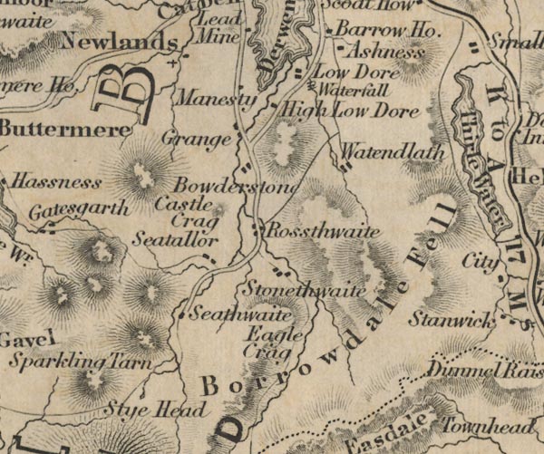 FD02NY21.jpg "Watendlath" item:- JandMN : 100.1 Image © see bottom of page |
|||
|
|
||||
| evidence:- | old map:- Garnett 1850s-60s H placename:- Watendlath |
|||
| source data:- | Map of the English Lakes, in Cumberland, Westmorland and
Lancashire, scale about 3.5 miles to 1 inch, published by John
Garnett, Windermere, Westmorland, 1850s-60s.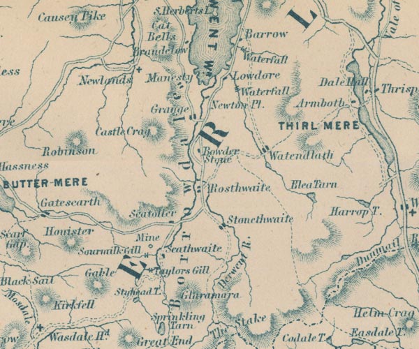 GAR2NY21.jpg "Watendlath" blocks, settlement item:- JandMN : 82.1 Image © see bottom of page |
|||
|
|
||||
| evidence:- | old text:- Martineau 1855 |
|||
| source data:- | Guide book, A Complete Guide to the English Lakes, by Harriet
Martineau, published by John Garnett, Windermere, Westmorland,
and by Whittaker and Co, London, 1855; published 1855-76. goto source Page 76:- "..." "If the tourist desires, (as it is to be hoped that he does) to see one of the primitive valleys of the district,- one of those recesses lapped in the mountains, where the sounds of civilised life have hardly penetrated, let him now go to Watendlath (locally called Wathendal) and descend into Borrowdale by Rosthwaite. The circuit is one of 13 miles; and it must be accomplished on foot or horseback; for there is no carriage-road in the upper part. So few pass that way that the women afford a remarkable specimen of the effects of a life of excessive seclusion. The men go to markets and sales, and have more use of their tongues and wits accordingly. The road along the lake side is followed, till it gives out a branch before reaching Barrow House. Up this by-road the explorer goes, ... The upland valley runs parallel with the lower one; and in it lies the clear circular pool which feeds the fall of Lodore. ..." |
|||
|
|
||||
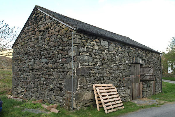
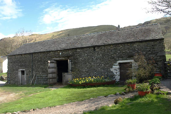
| evidence:- | old photograph:- Bell 1880s-1940s item:- cart; barn |
|||
| source data:- | Photograph, sepia, farmyard at Watendlath, Borrowdale, Cumberland, by Herbert Bell,
Ambleside, Westmorland, 1890s.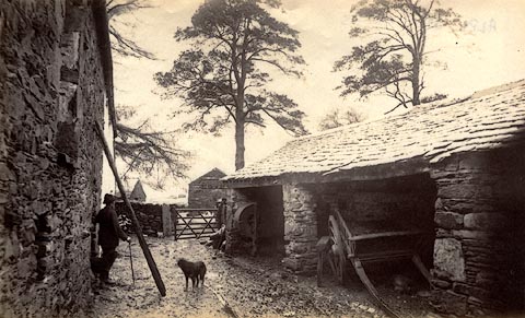 click to enlarge click to enlargeHB0397.jpg item:- Armitt Library : ALPS51 Image © see bottom of page |
|||
|
|
||||
| evidence:- | old photograph:- Bell 1880s-1940s |
|||
| source data:- | Photograph, sepia, Watendlath in winter, Borrowdale, Cumberland, by Herbert Bell,
Ambleside, Westmorland, 1890s.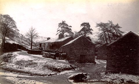 click to enlarge click to enlargeHB0398.jpg item:- Armitt Library : ALPS52 Image © see bottom of page |
|||
|
|
||||
| evidence:- | old postcard:- placename:- Watendlath |
|||
| source data:- | Postcard, colour photograph, Watendlath, Borrowdale, Cumberland, published by J Arthur
Dixon, Newport, Isle of Wight, about 1966.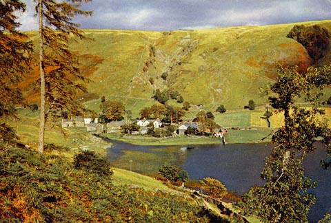 click to enlarge click to enlargePH0107.jpg There are three postmarks, as the GPO try to deliver the card to the addressee. printed at rev:- "Watendlath Hamlet and Tarn, Cumberland / The setting for Sir Hugh Walpole's "Judith Paris." ... / ... / Printed and Published by J. Arthur Dixon, Newport, I. W., England / ..." postmark:- "KESWICK / 11 30 AM / 15 JLY / 1965 / CUMBERLAND" postmark:- "REIGATE &REDHILL / 9 30 AM / 17 JLY / [ ] / SURREY" postmark:- "EPSOM / [ ] AM / 20 JLY / 1965 / SURREY" item:- JandMN : 975 Image © see bottom of page |
|||
|
|
||||
| evidence:- | old print:- Barber and Atkinson 1927 placename:- Watendlath |
|||
| source data:- | Print, halftone photograph, Watendlath, Borrowdale, Cumberland, by E H Atkinson, published
by James Atkinson, Caxton Printing Works, Ulverston, Lancashire, 1928.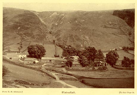 click to enlarge click to enlargeAK0406.jpg Tipped in opposite p.31 of Lakeland Passes, by John B Barber and George Atkinson, 1927, 3rd edn 1928. printed at bottom:- "Photo E. H. Atkinson) Watendlath. (To face plage 31." item:- JandMN : 350.7 Image © see bottom of page |
|||
|
|
||||
| evidence:- | old print:- Rose 1832-35 (vol.2 no.4) placename:- Watendlath |
|||
| source data:- | Print, uncoloured engraving, Watendlath, and the Stream of Lowdore, drawn by Thomas
Allom, engraved by J Sands, published by Fisher, Son and Co, London, 1833.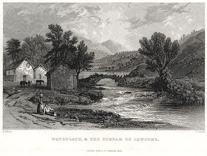 click to enlarge click to enlargePR0401.jpg Vol.2 no.4 in Westmorland, Cumberland, Durham and Northumberland Illustrated, with descriptions by Thomas Rose, published by H Fisher, R Fisher, and P Jackson, Newgate, London, about 1835. printed at bottom left, right, centre:- "T. Allom. / . Sands. / WATENDLATH, & THE STREAM OF LOWDORE. / FISHER, SON &CO. LONDON, 1833." item:- Dove Cottage : 2008.107.394 Image © see bottom of page |
|||
|
|
||||
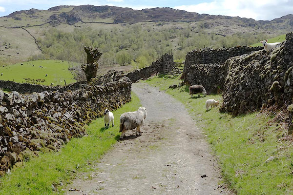 BYJ47.jpg Herdwick sheep. (taken 22.5.2013) |
||||
|
|
||||
| hearsay:- |
Mally Messenger was born here, 1763. She had a dame school in Keswick:- |
|||
| "... an ancient sybil, bending her thin face and brown antique features and unspectacled
eyes on the Sacred Book." |
||||
|
|
||||
| hearsay:- |
Once part of the lands belonging to Fountains Abbey, Yorkshire. |
|||
|
|
||||
| reference:- |
Watendlath |
|||
| Adams, Douglas & Lloyd, John: 1990: Deeper Meaning of Life, The: Pan Books &Faber
and Faber |
||||
|
|
||||
| personal | ||||
| person:- | teacher : Messenger, Mally |
|||
| place:- | birthplace | |||
| date:- | 1763 |
|||
|
|
||||
| places:- |
|
|||
|
||||
|
||||
|
||||
|
||||
|
||||
|
||||
|
||||
|
||||
|
||||
|
||||
|
||||
|
||||
|
||||
|
||||
|
||||
|
||||
|
||||
|
||||
|
||||
Lakes Guides menu.