 Old Cumbria Gazetteer
 |
 |
|
| Troutbeck Park Farm, Troutbeck | ||
| Troutbeck Park | ||
| locality:- | Troutbeck | |
| civil parish:- | Lakes (formerly Westmorland) | |
| county:- | Cumbria | |
| locality type:- | buildings | |
| coordinates:- | NY42020569 | |
| 1Km square:- | NY4205 | |
| 10Km square:- | NY40 | |
|
|
||
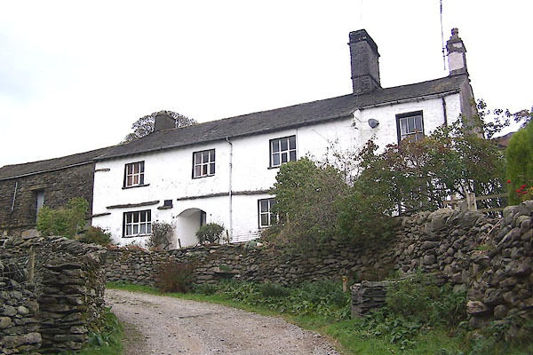 BMY40.jpg (taken 5.11.2006) 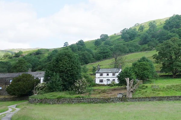 CDO29.jpg (taken 9.7.2015) |
||
|
|
||
| evidence:- | old map:- OS County Series (Wmd 26 4) placename:- Troutbeck Park |
|
| source data:- | Maps, County Series maps of Great Britain, scales 6 and 25
inches to 1 mile, published by the Ordnance Survey, Southampton,
Hampshire, from about 1863 to 1948. |
|
| source data:- | Maps, County Series maps of Great Britain, scales 6 and 25
inches to 1 mile, published by the Ordnance Survey, Southampton,
Hampshire, from about 1863 to 1948. |
|
|
|
||
| evidence:- | old map:- Jefferys 1770 (Wmd) placename:- Park House |
|
| source data:- | Map, 4 sheets, The County of Westmoreland, scale 1 inch to 1
mile, surveyed 1768, and engraved and published by Thomas
Jefferys, London, 1770.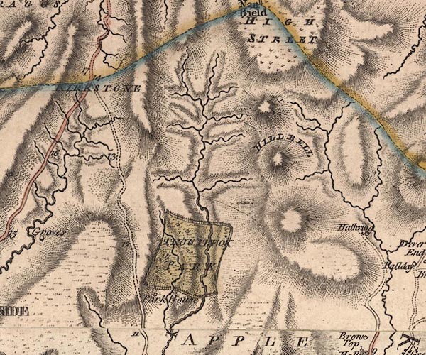 J5NY40NW.jpg "Park House" circle, labelled in italic lowercase text; settlement, farm, house, or hamlet? item:- National Library of Scotland : EME.s.47 Image © National Library of Scotland |
|
|
|
||
| evidence:- | old map:- Cary 1789 (edn 1805) placename:- Park House |
|
| source data:- | Map, uncoloured engraving, Westmoreland, scale about 2.5 miles
to 1 inch, by John Cary, London, 1789; edition 1805.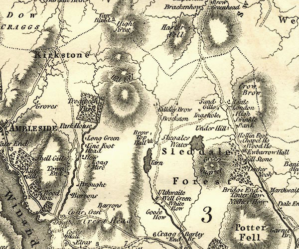 CY24NY40.jpg "Park House" block/s, labelled in italic lowercase; house, or hamlet item:- JandMN : 129 Image © see bottom of page |
|
|
|
||
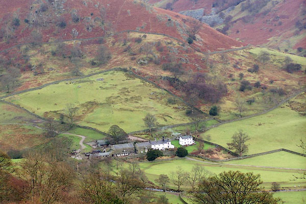 BLK60.jpg House and farm from the Kirkstone road. (taken 5.12.2005) 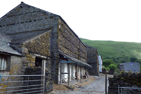 CDO31.jpg Barn. (taken 9.7.2015) 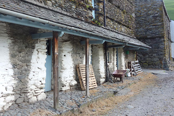 CDO32.jpg Barn, pentice. (taken 9.7.2015) 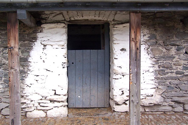 BMY42.jpg Door. (taken 5.11.2006) 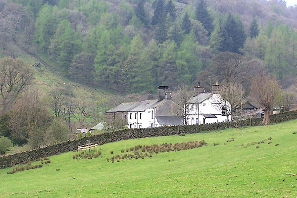 BQL07.jpg (taken 16.4.2009) 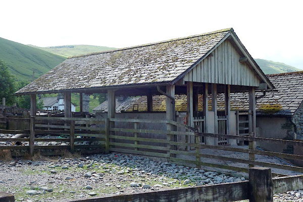 CDO34.jpg (taken 9.7.2015) 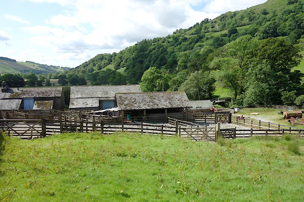 CDO33.jpg Sheep pens. (taken 9.7.2015) |
||
|
|
||
 Lakes Guides menu.