 Old Cumbria Gazetteer
 |
 |
|
| Tongue, Mungrisdale | ||
| civil parish:- | Mungrisdale (formerly Cumberland) | |
| county:- | Cumbria | |
| locality type:- | hill | |
| coordinates:- | NY34753017 | |
| 1Km square:- | NY3430 | |
| 10Km square:- | NY33 | |
| altitude:- | 1808 feet | |
| altitude:- | 551m | |
|
|
||
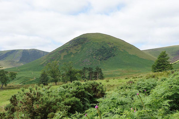 CDR26.jpg (taken 12.8.2015)  Click to enlarge CDR44.jpg From Bannerdale. (taken 12.8.2015) |
||
|
|
||
| evidence:- | old map:- OS County Series (Cmd 57 1) placename:- Tongue, The |
|
| source data:- | Maps, County Series maps of Great Britain, scales 6 and 25
inches to 1 mile, published by the Ordnance Survey, Southampton,
Hampshire, from about 1863 to 1948. |
|
|
|
||
| evidence:- | old map:- Gents Mag 1747 placename:- Tongue, The |
|
| source data:- | Map, uncoloured engraving, perspective view, Caudbeck Fells ie
Caldbeck Fells, scale about 1+ miles to 1 inch, published in the
Gentleman's Magazine, 1747.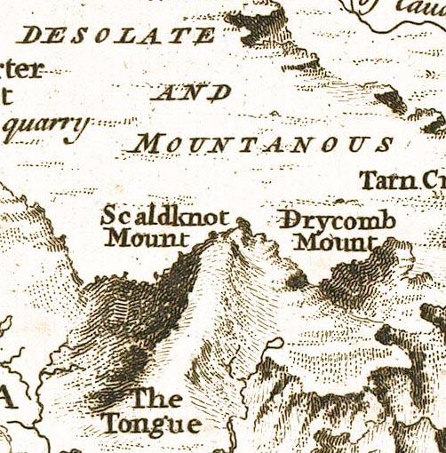 GM1405.jpg "The Tongue" knobbly hillocks; mountains item:- Carlisle Library : Map 43 Image © Carlisle Library |
|
|
|
||
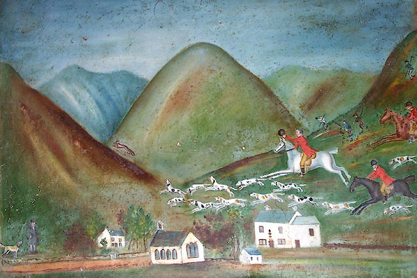 BNT81.jpg Painting on the chimney breast at Chapelside; Mungrisdale, and the Blencathra Hunt. It is possible the hunt scene was added later. (taken 1.6.2007)  BMH26.jpg (taken 29.6.2006) |
||
|
|
||
 Lakes Guides menu.