 Old Cumbria Gazetteer
 |
 |
|
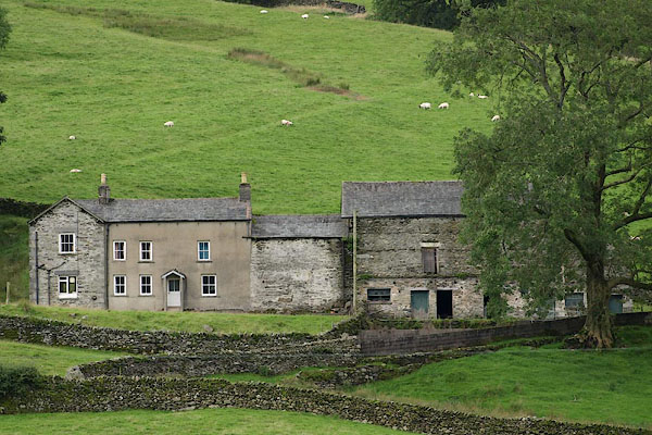
| Toms Howe, Longsleddale | ||
| Toms Howe | ||
| Tom's Howe | ||
| civil parish:- | Longsleddale (formerly Westmorland) | |
| county:- | Cumbria | |
| locality type:- | buildings | |
| coordinates:- | NY48630496 | |
| 1Km square:- | NY4804 | |
| 10Km square:- | NY40 | |
|
|
||
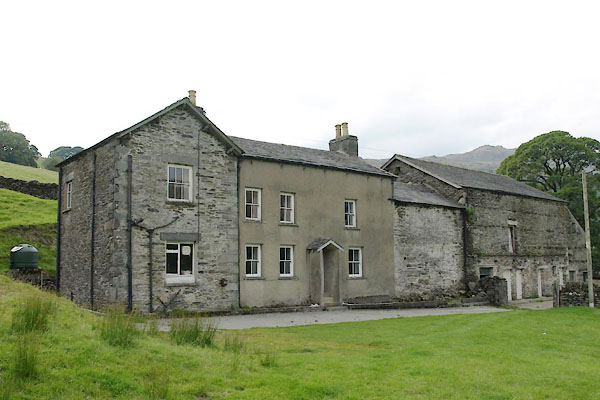 BTN25.jpg (taken 3.9.2010) 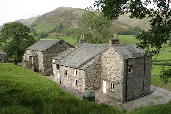 BTN26.jpg (taken 3.9.2010) |
||
|
|
||
| evidence:- | old map:- OS County Series (Wmd 27 7) placename:- Tom's Howe |
|
| source data:- | Maps, County Series maps of Great Britain, scales 6 and 25
inches to 1 mile, published by the Ordnance Survey, Southampton,
Hampshire, from about 1863 to 1948.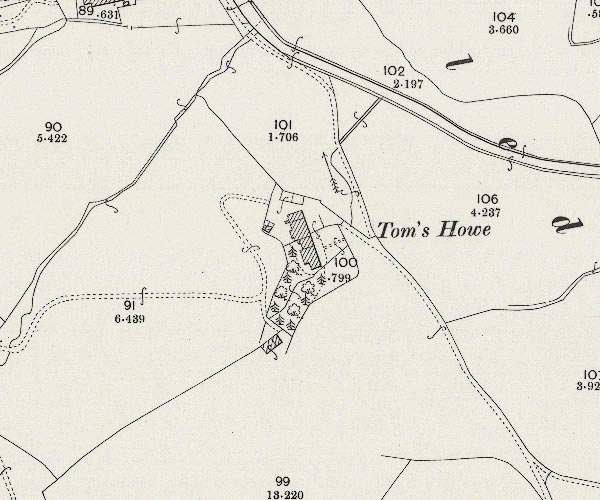 C5E005.jpg "Tom's Howe" |
|
|
|
||
| evidence:- | census returns:- placename:- Tomshow placename:- Toms How |
|
|
|
||
 old parish registers (formerly ) old parish registers (formerly ) |
||
|
|
||
| evidence:- | old map:- Jefferys 1770 (Wmd) placename:- Tomshow |
|
| source data:- | Map, 4 sheets, The County of Westmoreland, scale 1 inch to 1
mile, surveyed 1768, and engraved and published by Thomas
Jefferys, London, 1770.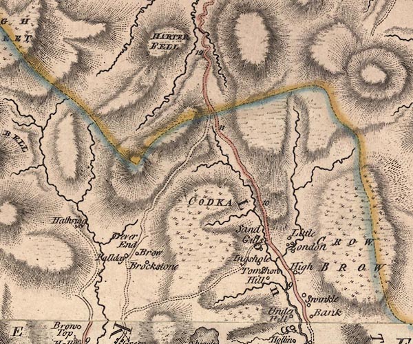 J5NY40NE.jpg "Tomshow" circle, labelled in italic lowercase text; settlement, farm, house, or hamlet? item:- National Library of Scotland : EME.s.47 Image © National Library of Scotland |
|
|
|
||
| evidence:- | old map:- Hodgson 1828 placename:- Toms How |
|
| source data:- | Map, hand coloured engraving, 4 sheets mounted together on linen and rolled, Plan
of the County of Westmorland, scale about 1.25 inches to 1 mile, by Thomas Hodgson,
engraved by W R Gardner, Harpur Street, London, published by Thomas Hodgson, Lancaster,
and perhaps by C Smith, 172 Strand, London,1828.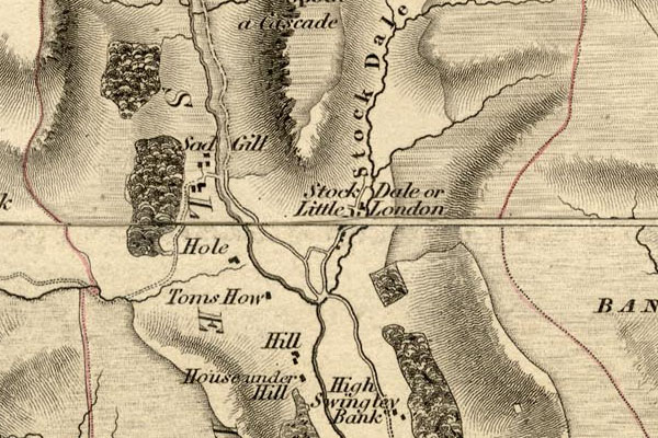 HDG6lsl3.jpg map courtesy of Mark Cropper "Toms How" item:- private collection : 371 Image © see bottom of page |
|
|
|
||
| evidence:- | old map:- Kendal Corn Rent Act 1836 placename:- Thoms How |
|
| source data:- | Tithe map, Plan of part of the Township of Longsleddale, Westmorland, made regarding
the Kendal Corn Rent Act, ie a tithe award map, scale about 20 inches to 1 mile, Kendal,
Westmorland, 1836.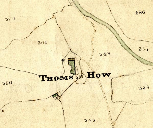 KCR204.jpg courtesy of Mark Cropper Plan of part of the Township of Longsleddale, Westmorland, made regarding the Kendal Corn Rent Act, ie a tithe award map, scale about 20 inches to 1 mile, Kendal, Westmorland, 1836. "THOMS HOW" item:- private collection : 370 Image © see bottom of page |
|
|
|
||
| Kendal Corn Rent Act 1836 |
||
|
|
||
| evidence:- | old map:- Fields 1875 |
|
| source data:- | courtesy of Ruth Fishwick 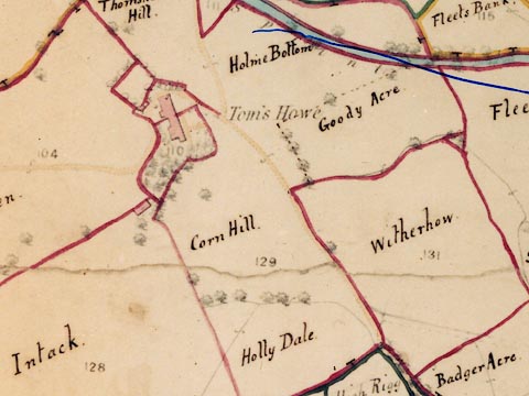 LFld0233.jpg |
|
|
|
||
| evidence:- | textbook:- EPNS Westmorland 1967 placename:- Thoms Howe placename:- Town How |
|
| source data:- | Book, The Place Names of Westmorland, two volumes, by A H Smith,
published for the English Place Name Society by Cambridge
University Press, Cambridgeshire, 1967 |
|
|
|
||
| census records |
||
|
|
||
| directory entries |
||
|
|
||
| evidence:- | map:- OS Six Inch (1956) placename:- Tom's Howe |
|
| source data:- | Map series, various editions with the national grid, scale about
6 inches to 1 mile, published by the Ordnance Survey,
Southampton, Hampshire, scale 1 to 10560 from 1950s to 1960s,
then 1 to 10000 from 1960s to 2000s, superseded by print on
demand from digital data.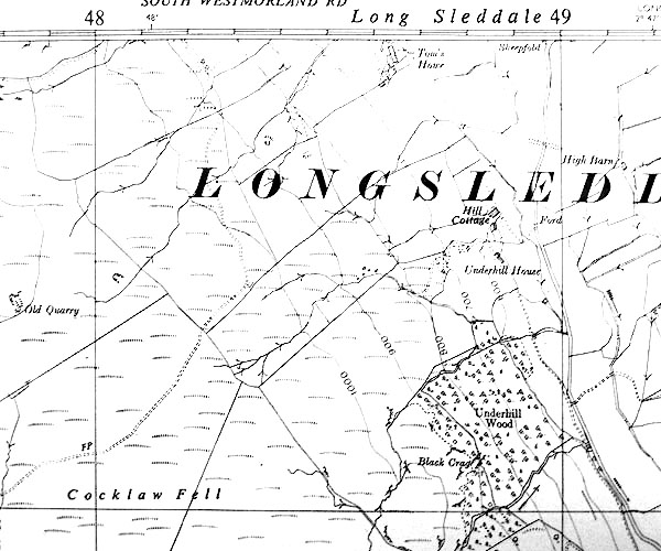 SINY4804.jpg "Tom's Howe" |
|
|
|
||
| evidence:- | shepherds guide:- Wilson 1913 placename:- Tomshow |
|
| source data:- | Book, New Shepherd's Guide for Cumberland, Westmorland, and
Lancashire, by Thomas Wilson, 1913.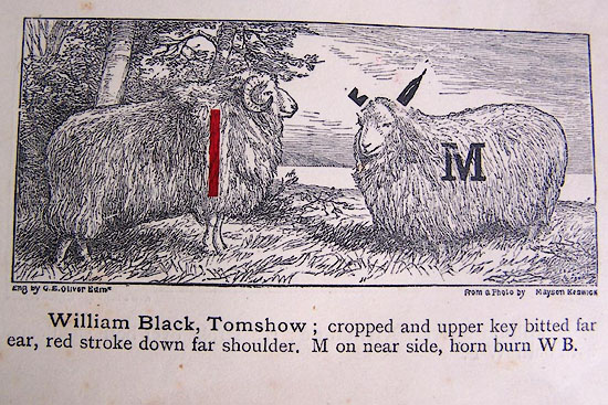 WL1p369c.jpg "William Black, Tomshow; cropped and upper key bitted far ear, red stroke down far shoulder, M on near side, horn burn W B." item:- private collection : 329 Image © see bottom of page |
|
|
|
||
| evidence:- | shepherds guide:- Hodgson 1849 placename:- Thomshow |
|
| source data:- | Book, Shepherd's Guide, or a Delineation of the Wool and Ear
Marks of the Different Stocks of Sheep, Lancashire, Cumberland,
and Westmorland, by William Hodgson, Normoss, Corney,
Cumberland, 1849.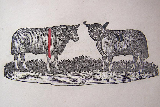 HG2p593a.jpg "JOHN MATTINSON, Thomshow." "Cropped and upper fold bitted far ear, a stroke down the far shoulder, M on the near side, MM on the horns, and a figure." item:- Kendal Library : 39 Image © see bottom of page |
|
|
|
||
| evidence:- | shepherds guide:- Walker 1817 placename:- Thomshow |
|
| source data:- | Shepherds guide, The Shepherd's Guides or a Delineation of the
Wool and Ear Marks on the Different Stocks of Sheep ..., in
Westmorland, by Joseph Walker, printed by W Stephen, Penrith,
Cumberland, 1817.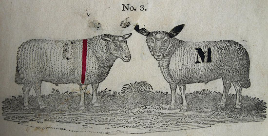 WK13L03.jpg courtesy of George Akrigg "No.3 - MICHAEL MATTINSON, Thomshow:" "Cropped far ear and upper bitted stump, a red mark down the far shoulder, M on the near side, MM and a figure on the horns." item:- private collection : 91 Image © see bottom of page |
|
|
|
||
| evidence:- | shepherds guide:- Lamb 1937 placename:- Toms Howe |
|
| source data:- | Book, Lamb's Shepherds' Guide for Cumberland, Westmorland and
Lancashire, by R H Lamb, published by the Herald Printing Co,
Penrith, Cumberland, 1937.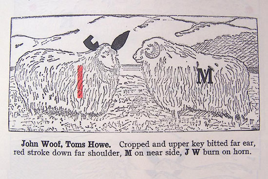 LM1p319b.jpg "John Woof, Toms Howe. Cropped and upper key bitted far ear, red stroke down far shoulder, M on near side, J W burn on horn." item:- Kendal Library : 40 Image © see bottom of page |
|
|
|
||
 BRI05.jpg (taken 27.8.2009) 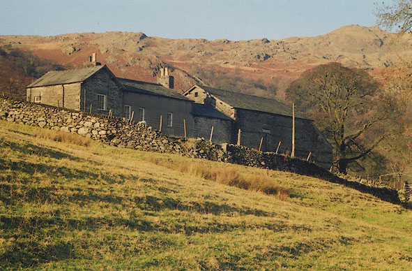 BIG06.jpg (taken 4.12.2003) 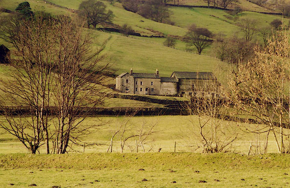 BIH28.jpg (taken 24.1.2004) 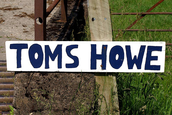 BQY23.jpg (taken 29.6.2009) |
||
|
|
||
 Lakes Guides menu.