 Old Cumbria Gazetteer
 |
 |
|
| included in:- |
 Coniston Water Coniston Water |
|
| viewpoint, Peel Ness | ||
| locality:- | High Peel Near | |
| locality:- | Peel Ness | |
| civil parish:- | Colton (formerly Lancashire) | |
| county:- | Cumbria | |
| locality type:- | viewpoint | |
| coordinates:- | SD29769184 (about) | |
| 1Km square:- | SD2991 | |
| 10Km square:- | SD29 | |
|
|
||
| evidence:- | descriptive text:- West 1778 (11th edn 1821) placename:- station, Coniston, West 2 |
|
| source data:- | Guide book, A Guide to the Lakes, by Thomas West, published by
William Pennington, Kendal, Cumbria once Westmorland, and in
London, 1778 to 1821. goto source Page 49:- "STATION II. When you are opposite to the peninsula last described proceed through a gate on the left hand, and from the rocky eminence you have a general view of the lake, both ways. To the south, a sweet bay is formed between the horns of two peninsulas, and beyond that a fine sheet of water appears, terminated by the promontories which form the straits, through which the lake has its outlet. From thence the coast is beautifully diversified by a number of green eminences crowned with wood, and sequestered cottages interspersed among them half concealed by yew trees; and, above them, a wave of rocky, spiral mountains, dressed in brown vegetation, form the most romantic scenes. Between this and a wooded eminence, a green hill, cut into inclosures to" goto sourcePage 50:- "the very top, in some parts patched with rock and little groves, has a beautiful appearance; especially when contrasted with the barren scenes on one hand, and the deep shade of a waving wood on the other. At the foot of this cultivated tract, and on the margin of the lake, a few white houses, partly concealed by a grove, look like enchanted seats on a fairy ground. Behind these a barren bleak mountain frowns in sullen majesty, and down his furrowed side the Black-beck of Torver rolls its fretted torrent. Just at your feet lies the oblong rocky isle of Peel; and near it the dark points of half-immersed rocks just show themselves by turns. Here is the finest picture of the lake, and when it is smooth the whole is seen reflected on the shining surface of the watery mirror. On the western side the coast is steep rocks. The eastern side is much embayed. The high end of the lake is here in view, yet it seems to wind both ways behind the opposite promontories. The range of naked rocks that cross the head of the lake appear now awful, from their sable hue, and behind them, the immense mass of Cove, Rydal-head, and many nameless mountains, have a most stupendous appearance, and seeming inaccessible height. A succession of pretty bays open to the traveller as he advances; the banks become more wooded," goto sourcePage 51:- "and more cultivation appears. On the western margin stands the lady of the lake, Coniston-hall, concealed in a grove of tall trees, and above it, the village of the same name. The hall has only changed masters twice since the conquest, and has belonged to the family of Fleming most of time." |
|
|
|
||
| evidence:- | old map:- Crosthwaite 1783-94 (Con) |
|
| source data:- | Map, uncoloured engraving, An Accurate Map of Coniston Lake,
scale about 3 inches to 1 mile, by Peter Crosthwaite, Keswick,
Cumberland, 1788, version published 1809.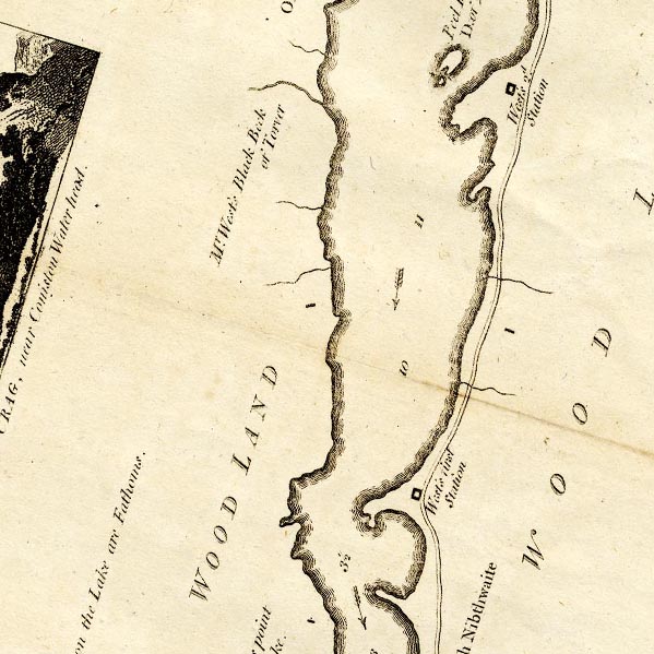 CTESD29V.jpg "West's 2d. Station" square symbol item:- JandMN : 182.5 Image © see bottom of page |
|
|
|
||
| evidence:- | old map:- Crosthwaite 1783-94 (Con) placename:- station, Coniston, West 2 |
|
| source data:- | Series of maps, An Accurate Map of the Matchless Lake of
Derwent, of the Grand Lake of Windermere, of the Beautiful Lake
of Ullswater, of Broadwater or Bassenthwaite Lake, of Coniston
Lake, of Buttermere, Crummock and Loweswater Lakes, and
Pocklington's Island, by Peter Crosthwaite, Kendal, Cumberland
now Cumbria, 1783 to 1794. "West's 2d. Station" level with Peel Island. |
|
|
|
||
| MN photo:- |
The viewpoint on the highest point of Peel Ness, High Peel Near, has gone; tree planting
has grown up, and all you see is glimpses of a panorama between the branches, it won't
be much better in winter with the leaves gone. Tree planting as conservation might
be a good thing, but are you conserving the landscape or the tourists' appreciation
of it? |
|
| The first four panoramas are taken from Peel Ness: from the shore at the north end,
from the shore part way down, and from two points at the south end, one on a rocky
eminence the other from the shore. The pictures are taken to enable comparison with
watercolour paintings by Stephen Penn, 1732 and 1733, which clearly allow a great
a deal of artistic licence. His viewpoint is up in the air; and his directions in
his titles are just plain wrong. |
||
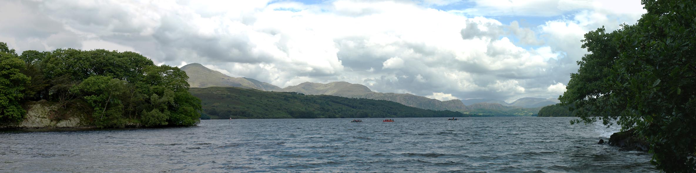 Click to enlarge BTJ53.jpg From north shore of Peel Ness, (taken 13.8.2010) 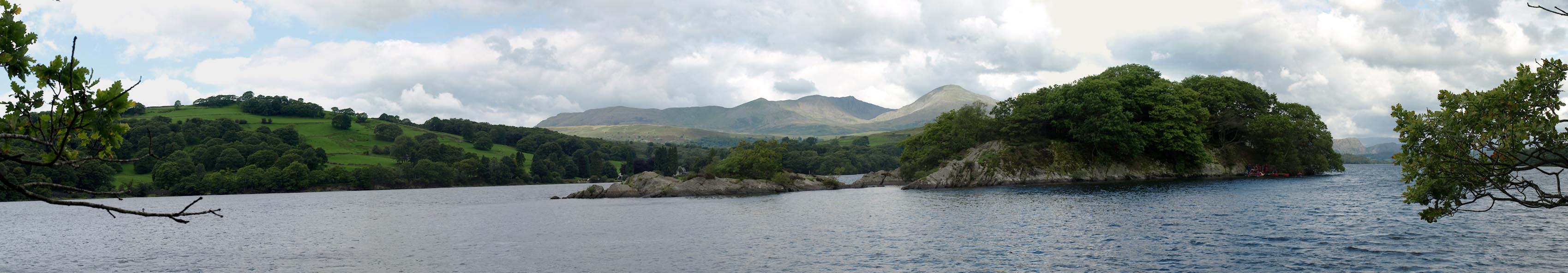 Click to enlarge BTJ54.jpg From west shore of Peel Ness, (taken 13.8.2010)  Click to enlarge BTJ55.jpg From a rocky eminence, south end of Peel Ness, (taken 13.8.2010)  Click to enlarge BTJ56.jpg From the shore below the rocky eminence, south end of Peel Ness, (taken 13.8.2010) |
||
|
|
||
| MN photo:- |
Two panoramas were taken from further north on the lake shore. These might help resolve
what Stephen Penn could have seen in his SW view. |
|
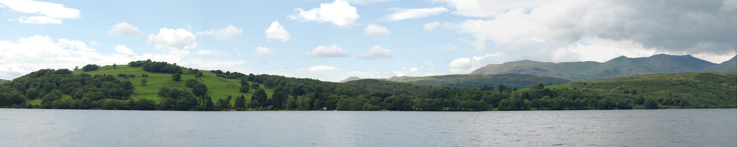 Click to enlarge BTJ57.jpg (taken 13.8.2010) 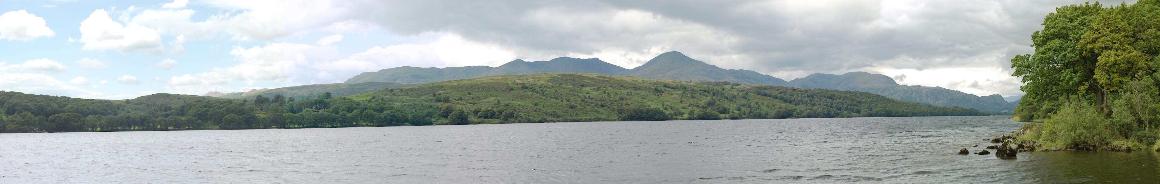 Click to enlarge BTJ58.jpg (taken 13.8.2010) |
||
|
|
||
| indexing | ||
| person:- | author : West, Thomas |
|
| place:- | Coniston Water | |
| date:- | 1778 |
|
| period:- | 18th century, late | |
| period:- | 1780s | |
| item:- | guide book; Guide to the Lakes |
|
|
|
||
Lakes Guides menu.