 Old Cumbria Gazetteer
 |
 |
|
| Stangrah, Whicham | ||
| Stangrah | ||
| Stangrah Farm | ||
| civil parish:- | Whicham (formerly Cumberland) | |
| county:- | Cumbria | |
| locality type:- | buildings | |
| coordinates:- | SD11298528 | |
| 1Km square:- | SD1185 | |
| 10Km square:- | SD18 | |
|
|
||
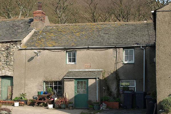 BSN62.jpg (taken 16.4.2010) 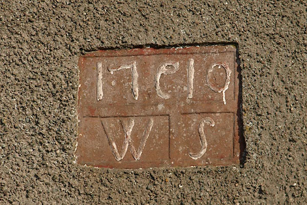 BSN63.jpg Date stone, "17[C]10 / W S" (taken 16.4.2010) |
||
|
|
||
| evidence:- | old map:- OS County Series (Cmd 87 8) placename:- Stangrah |
|
| source data:- | Maps, County Series maps of Great Britain, scales 6 and 25
inches to 1 mile, published by the Ordnance Survey, Southampton,
Hampshire, from about 1863 to 1948. |
|
|
|
||
| evidence:- | old map:- Donald 1774 (Cmd) placename:- Stangrow |
|
| source data:- | Map, hand coloured engraving, 3x2 sheets, The County of Cumberland, scale about 1
inch to 1 mile, by Thomas Donald, engraved and published by Joseph Hodskinson, 29
Arundel Street, Strand, London, 1774.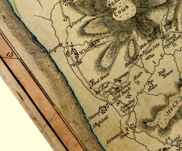 D4SD18SW.jpg "Stangrow" block or blocks, labelled in lowercase; a hamlet or just a house item:- Carlisle Library : Map 2 Image © Carlisle Library |
|
|
|
||
| evidence:- | database:- Listed Buildings 2010 placename:- Stangrah Farm item:- date stone (1719) |
|
| source data:- | courtesy of English Heritage "STANGRAH FARMHOUSE AND ATTACHED BARNS / / A 595 / WHICHAM / COPELAND / CUMBRIA / II / 76378 / SD1129685281" |
|
|
|
||
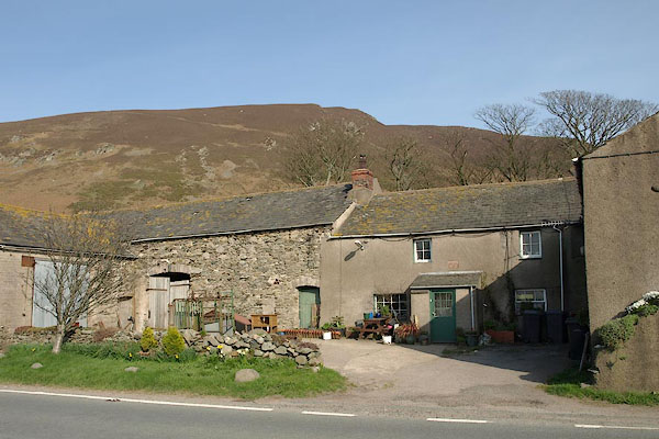 BSN61.jpg (taken 16.4.2010) |
||
|
|
||
 Lakes Guides menu.