 Old Cumbria Gazetteer
 |
 |
|
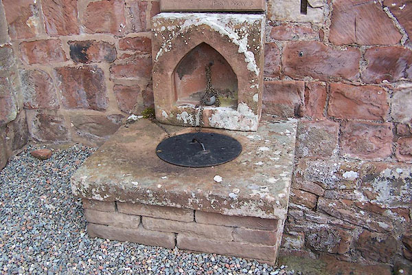
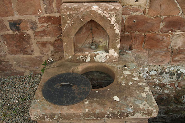
| St Oswald's Well, Kirkoswald | ||
| St Oswald's Well | ||
| site name:- | St Oswald's Church | |
| locality:- | Kirkoswald | |
| civil parish:- | Kirkoswald (formerly Cumberland) | |
| county:- | Cumbria | |
| locality type:- | well | |
| coordinates:- | NY55504088 | |
| 1Km square:- | NY5540 | |
| 10Km square:- | NY54 | |
|
|
||
| MN photo:- |
At the west end of St Oswald's Church. |
|
 BJU30.jpg (taken 26.8.2005) 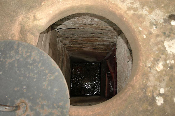 BUK96.jpg Clear trickling water. (taken 29.4.2011) |
||
|
|
||
| evidence:- | old map:- OS County Series (Cmd 40 10) |
|
| source data:- | Maps, County Series maps of Great Britain, scales 6 and 25
inches to 1 mile, published by the Ordnance Survey, Southampton,
Hampshire, from about 1863 to 1948. "Well" |
|
|
|
||
| evidence:- | drawing:- Butler 1982-92 |
|
| source data:- | St Oswald's Well, Kirkoswald drawn by David Butler courtesy of David Butler 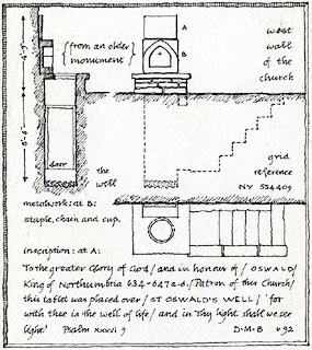 click to enlarge click to enlargePR1443.jpg On a plaque above:- "[To the greater Glory of God / and in honour of / OSWALD / King of Northumbria 634-647 a.d. / Patron of this Church / this tablet was placed over / ST OSWALD'S WELL / 'for with thee is the well of life / and in Thy light shall we see light']" Psalms 36 9 item:- private collection : 377 Image © see bottom of page |
|
|
|
||
 BUK97.jpg (taken 29.4.2011) |
||
|
|
||
 Lakes Guides menu.