 Old Cumbria Gazetteer
 |
 |
|
|||||||||||||||||||||||
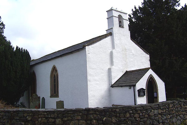
| St Andrew, Borrowdale | |||||||||||||||||||||||||
| St Andrew's Church | |||||||||||||||||||||||||
| Borrowdale Church | |||||||||||||||||||||||||
| locality:- | Stonethwaite | ||||||||||||||||||||||||
| locality:- | Borrowdale | ||||||||||||||||||||||||
| civil parish:- | Borrowdale (formerly Cumberland) | ||||||||||||||||||||||||
| county:- | Cumbria | ||||||||||||||||||||||||
| locality type:- | church | ||||||||||||||||||||||||
| coordinates:- | NY25791399 | ||||||||||||||||||||||||
| 1Km square:- | NY2513 | ||||||||||||||||||||||||
| 10Km square:- | NY21 | ||||||||||||||||||||||||
|
|
|||||||||||||||||||||||||
 BLT93.jpg (taken 3.4.2006) 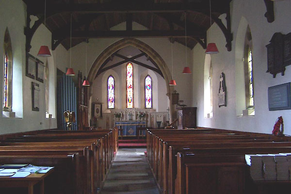 BLT94.jpg (taken 3.4.2006) |
|||||||||||||||||||||||||
|
|
|||||||||||||||||||||||||
| evidence:- | old map:- Mercator 1595 (edn?) placename:- Borodale Chapel |
||||||||||||||||||||||||
| source data:- | Map, hand coloured engraving, Northumbria, Cumberlandia, et
Dunelmensis Episcopatus, ie Northumberland, Cumberland and
Durham etc, scale about 6.5 miles to 1 inch, by Gerard Mercator,
Duisberg, Germany, about 1595.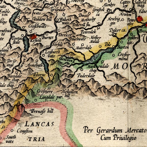 MER8CumF.jpg "Borodale chap." circle item:- JandMN : 169 Image © see bottom of page |
||||||||||||||||||||||||
|
|
|||||||||||||||||||||||||
| evidence:- | old map:- Gents Mag 1751 placename:- Borrodale Chapel |
||||||||||||||||||||||||
| source data:- | Map, uncoloured engraving, Map of the Black Lead Mines in
Cumberland, and area, scale about 2 miles to 1 inch, by George
Smith, published in the Gentleman's Magazine, 1751.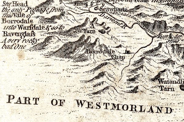 GM1309.jpg "Borrodale Chap" church item:- JandMN : 114 Image © see bottom of page |
||||||||||||||||||||||||
|
|
|||||||||||||||||||||||||
| evidence:- | old map:- Donald 1774 (Cmd) |
||||||||||||||||||||||||
| source data:- | Map, hand coloured engraving, 3x2 sheets, The County of Cumberland, scale about 1
inch to 1 mile, by Thomas Donald, engraved and published by Joseph Hodskinson, 29
Arundel Street, Strand, London, 1774.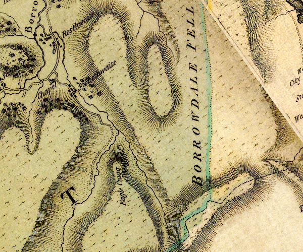 D4NY21SE.jpg "Chapel" church item:- Carlisle Library : Map 2 Image © Carlisle Library |
||||||||||||||||||||||||
|
|
|||||||||||||||||||||||||
| evidence:- | old text:- Gents Mag |
||||||||||||||||||||||||
| source data:- | Magazine, The Gentleman's Magazine or Monthly Intelligencer or
Historical Chronicle, published by Edward Cave under the
pseudonym Sylvanus Urban, and by other publishers, London,
monthly from 1731 to 1922. goto source goto sourceGentleman's Magazine 1795 p.52-53 p.52 "... Before we came to Barrowdale chapel, which is situated on the left, the valley expands, and the two streams divide, which form the Darwent by their union. The area of Barrowdale chapel" p.53 "is scarce equal to that of a pigeon cote, and its height much less. ..." |
||||||||||||||||||||||||
|
|
|||||||||||||||||||||||||
| evidence:- | descriptive text:- Ford 1839 (3rd edn 1843) |
||||||||||||||||||||||||
| source data:- | Guide book, A Description of Scenery in the Lake District, by
Rev William Ford, published by Charles Thurnam, Carlisle, by W
Edwards, 12 Ave Maria Lane, Charles Tilt, Fleet Street, William
Smith, 113 Fleet Street, London, by Currie and Bowman,
Newcastle, by Bancks and Co, Manchester, by Oliver and Boyd,
Edinburgh, and by Sinclair, Dumfries, 1839. goto source Page 68:- "..." "Leaving Rosthwaite to proceed onwards to Wast Water, whither we shall pursue our journey, on the left is the neat small chapel belonging to this dale." goto sourcePage 69:- "It is situated at the foot of steep mountains, and was rebuilt in 1706, Joseph Harris being chapel-warden, as an inscription declares. ..." goto sourcePage 168:- "Rossthwaite.- Near this village is the Chapel of Ease, standing at the point whence the three vales or grains of this extensive valley diverge." |
||||||||||||||||||||||||
|
|
|||||||||||||||||||||||||
| evidence:- | old map:- Nurse 1918 |
||||||||||||||||||||||||
| source data:- | Map, The Diocese of Carlisle, Cumberland, Westmorland, and
Lancashire North of the Sands, scale about 4 miles to 1 inch, by
Rev Euston J Nurse, published by Charles Thurnam and Sons, 11
English Street, Carlisle, Cumberland, 2nd edn 1939.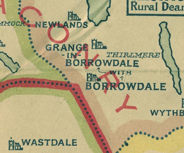 NUR1NY21.jpg "GRANGE-IN-BORROWDALE WITH BORROWDALE" item:- JandMN : 27 Image © see bottom of page |
||||||||||||||||||||||||
|
|
|||||||||||||||||||||||||
 BRM13.jpg (taken 20.9.2009) |
|||||||||||||||||||||||||
|
|
|||||||||||||||||||||||||
 stained glass stained glass |
|||||||||||||||||||||||||
|
|
|||||||||||||||||||||||||
| evidence:- | old print:- Sylvan 1847 placename:- Rosthwaite Chapel |
||||||||||||||||||||||||
| source data:- | Print, engraving, Rosthwaite Chapel, presumably St Andrew's Church, Stonethwaite,
Borrowdale, Cumberland, published by John Johnstone, Paternoster Row, London, et al,
1847.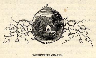 click to enlarge click to enlargeSYL151.jpg On p.202 of Sylvan's Pictorial Guide to the English Lakes. printed at bottom:- "ROSTHWAITE CHAPEL." item:- Armitt Library : A1201.51 Image © see bottom of page |
||||||||||||||||||||||||
|
|
|||||||||||||||||||||||||
| incumbents:- |
|
||||||||||||||||||||||||
|
|
|||||||||||||||||||||||||
| Rushbearing 1760s |
|||||||||||||||||||||||||
|
|
|||||||||||||||||||||||||
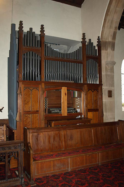 BVJ66.jpg Organ, by Wilkinson, Kendal. (taken 18.9.2011) 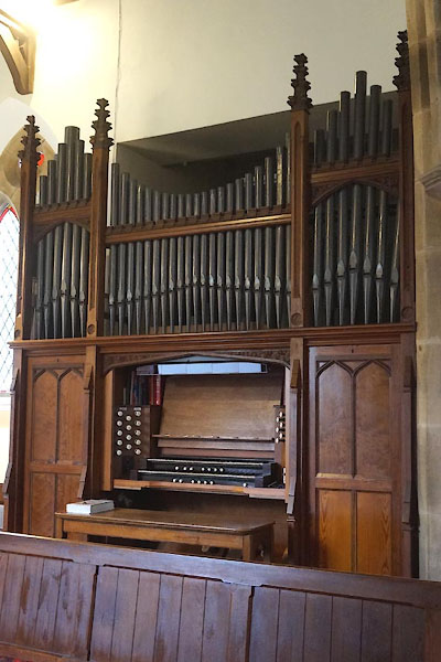 CCZ77.jpg Organ. (taken 13.5.2015) 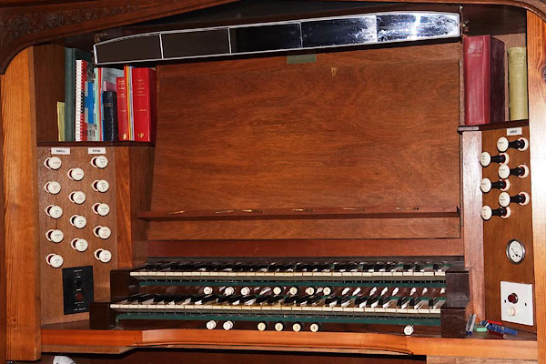 CCZ78.jpg Organ. (taken 13.5.2015) 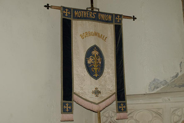 BVJ67.jpg Mothers Union banner. (taken 18.9.2011) 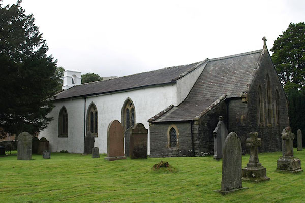 BVJ65.jpg (taken 18.9.2011) 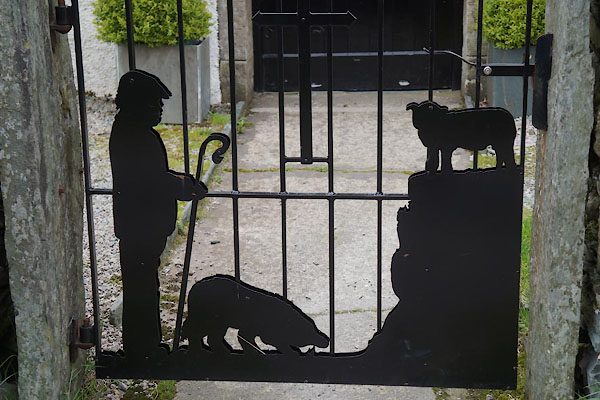 CCZ71.jpg Gate. (taken 13.5.2015) |
|||||||||||||||||||||||||
|
|
|||||||||||||||||||||||||
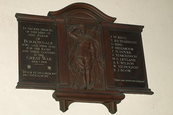 BVJ68.jpg War memorial, World War I. (taken 18.9.2011) |
|||||||||||||||||||||||||
|
|
|||||||||||||||||||||||||
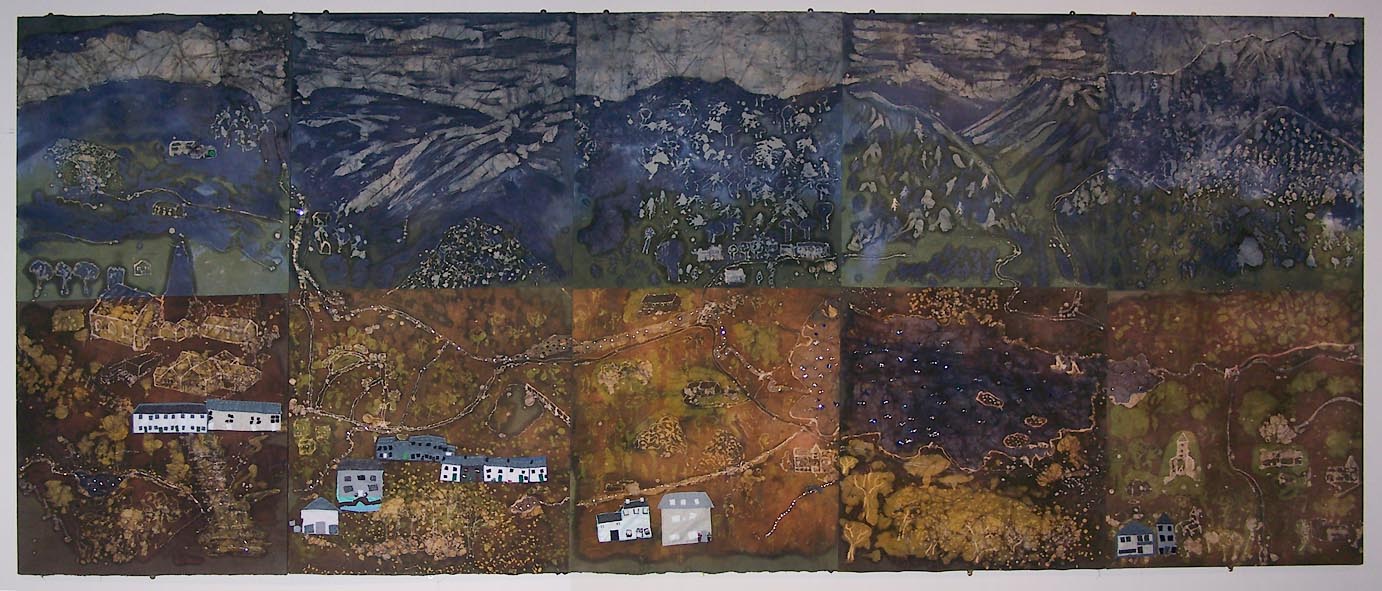 Click to enlarge BTO99.jpg (taken 22.9.2010) |
|||||||||||||||||||||||||
| The Borrowdale Batik |
|||||||||||||||||||||||||
| Made by children at Borrowdale CE Primary School, under the guidance of Diane Cannon,
a local artist, for the Borrowdale Story Project, 2009. They drew places they liked
to explore, Johny's Wood, Fairy Glen, landmarks, Bowderstone, Stockley Bridge, Ashness
Bridge, and buildings, Moot Hall, High Lodore Farm, the church and school. |
|||||||||||||||||||||||||
| Indonesian wax resist technique was used to build layers of colour for the sky, mountains,
woods and fields. Sequins highlight the water. Applique pictures finish the scene. |
|||||||||||||||||||||||||
|
|
|||||||||||||||||||||||||
| notes:- |
The earliest known christian settlements here date from about 1200, but the first
indication of a church is a reference to Chapel Farm in 1615. Records say that Borrowdale
Chapel was consecrated in 1687. It was a chapel to Crosthwaite, but was granted a
churchyard for burials in 1765. There were major repairs about 1981. |
||||||||||||||||||||||||
| : 1981 (2nd end): Parish of Borrowdale with Grange, The |
|||||||||||||||||||||||||
|
|
|||||||||||||||||||||||||
| dedication | |||||||||||||||||||||||||
| person:- | : St Andrew |
||||||||||||||||||||||||
| place:- | Borrowdale with Grange / Carlisle Diocese | ||||||||||||||||||||||||
|
|
|||||||||||||||||||||||||
Lakes Guides menu.