 Old Cumbria Gazetteer
 |
 |
|
| Shepherd Bridge, Coniston | ||
| Shepherd Bridge | ||
| site name:- | Yewdale Beck | |
| locality:- | Yewdale | |
| civil parish:- | Coniston (formerly Lancashire) | |
| county:- | Cumbria | |
| locality type:- | packhorse bridge | |
| locality type:- | bridge (?perhaps) | |
| coordinates:- | SD30489782 | |
| 1Km square:- | SD3097 | |
| 10Km square:- | SD39 | |
|
|
||
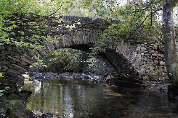 BZL01.jpg (taken 15.10.2013) 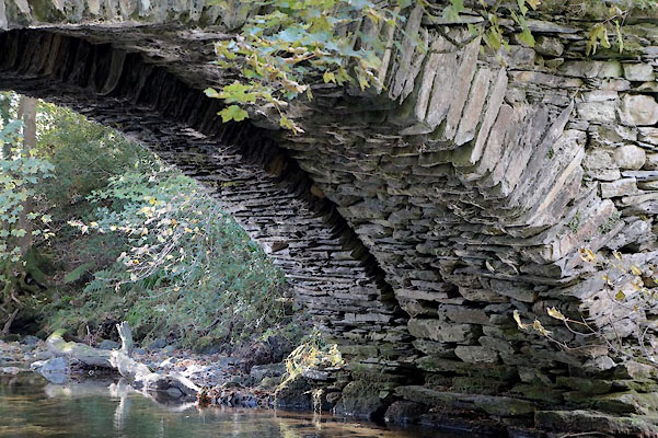 BZL02.jpg Under, evidence of widening. (taken 15.10.2013) 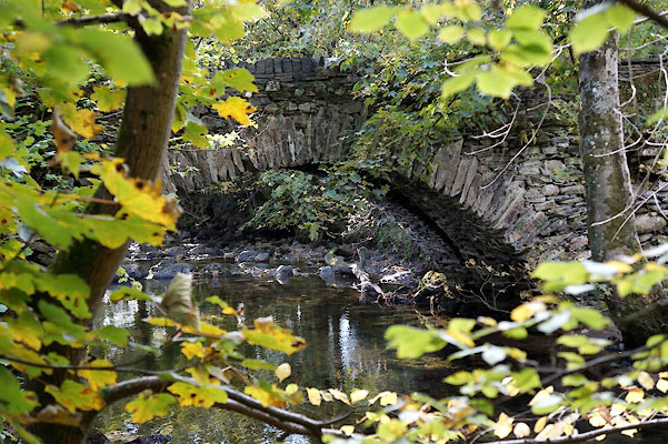 BZL03.jpg (taken 15.10.2013) |
||
|
|
||
| evidence:- | old map:- OS County Series (Lan 4 4) placename:- Shepherd Bridge |
|
| source data:- | Maps, County Series maps of Great Britain, scales 6 and 25
inches to 1 mile, published by the Ordnance Survey, Southampton,
Hampshire, from about 1863 to 1948. |
|
|
|
||
| evidence:- | old print:- Green 1814 (plate 4) placename:- Shepherds Bridge |
|
| source data:- | Print, uncoloured soft ground etching, Shepherds Bridge in Yewdale, Coniston, Lancashire,
by William Green, Ambleside, Westmorland, 1814.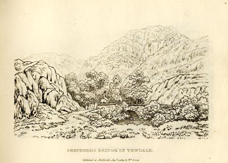 click to enlarge click to enlargeGN0904.jpg Plate 4 in Sixty Small Prints. printed at top right:- "4" printed at bottom:- "SHEPHERDS BRIDGE IN YEWDALE. / Published at Ambleside Augst. 1, 1814, by Wm. Green." item:- Armitt Library : A6656.4 Image © see bottom of page |
|
|
|
||
| evidence:- | old print:- Green 1814 (plate 4) placename:- Shepherds Bridge |
|
| source data:- | Print, tinted soft ground etching, Shepherds Bridge in Yewdale, Coniston, Lancashire,
by William Green, Ambleside, Westmorland, 1814.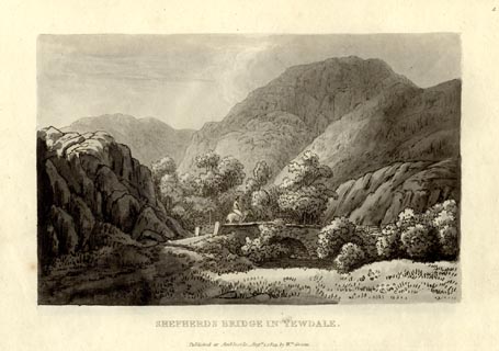 click to enlarge click to enlargeGN1004.jpg Plate 4 in Sixty Small Prints. printed at top right:- "4" printed at bottom:- "SHEPHERDS BRIDGE IN YEWDALE. / Published at Ambleside Augst. 1, 1814, by Wm. Green." item:- Armitt Library : A6653.4 Image © see bottom of page |
|
|
|
||
 Lakes Guides menu.