 Old Cumbria Gazetteer
 |
 |
|
| Shap Summit, Shap Rural | ||
| Shap Summit | ||
| site name:- | Lancaster and Carlisle Railway | |
| civil parish:- | Shap Rural (formerly Westmorland) | |
| county:- | Cumbria | |
| locality type:- | hill | |
| locality type:- | railway summit | |
| coordinates:- | NY57031112 (about) | |
| 1Km square:- | NY5711 | |
| 10Km square:- | NY51 | |
| altitude:- | 916 feet | |
| altitude:- | 279m | |
|
|
||
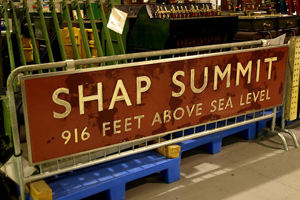 BPQ94.jpg Notice:- "SHAP SUMMIT / 916 ABOVE SEA LEVEL" (taken 2008) courtesy of the National Railway Museum. |
||
|
|
||
| evidence:- | old map:- OS County Series (Wmd 21 6) placename:- Shap Summit item:- railway signal |
|
| source data:- | Maps, County Series maps of Great Britain, scales 6 and 25
inches to 1 mile, published by the Ordnance Survey, Southampton,
Hampshire, from about 1863 to 1948.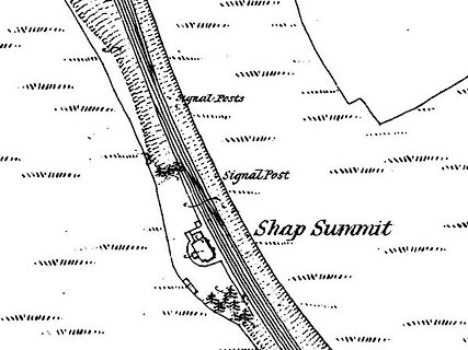 click to enlarge click to enlargeCSRY0178.jpg "Shap Summit / Signal Post" |
|
|
|
||
| evidence:- | old map:- LMS 1920s maps item:- gradient post |
|
| source data:- | Railway map, lithograph, 23 pages of strip maps, The Journey in
Brief, the Route London to Carlisle, published by the London
Midland and Scottish Railway, LMS, 1920s.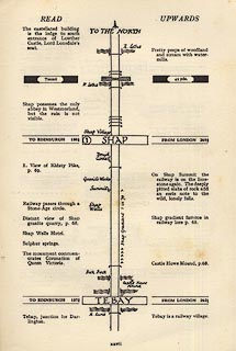 click to enlarge click to enlargeLS3p27.jpg "Shap Gradient 1 in 75" "On Shap Summit the railway is on the limestone again. The deeply pitted slabs of rock add an eerie note to the wild, lonely fells. / Shap gradient famous in railway lore ..." item:- JandMN : 95.2 Image © see bottom of page |
|
|
|
||
| evidence:- | old print:- LMS 1920s |
|
| source data:- | Shap Summit, gradient post, published in the LMS Route Book No.3, The Track of the
Royal Scot, by the London, Midland and Scottish Railway, LMS, 1920s.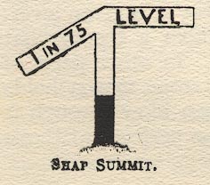 click to enlarge click to enlargeLS1E36.jpg item:- JandMN : 95.9 Image © see bottom of page |
|
|
|
||
| hearsay:- |
From the north the climb is 4 miles at 1 in 75. |
|
|
|
||
 Lakes Guides menu.