 Old Cumbria Gazetteer
 |
 |
|
| Settle, North Yorkshire | ||
| Settle | ||
| county:- | North Yorkshire | |
| locality type:- | buildings | |
| 1Km square:- | SD8163 | |
| 10Km square:- | SD86 | |
|
|
||
| evidence:- | old text:- Pennant 1773 placename:- Settle item:- Castleberg, Settle; coiner |
|
| source data:- | Book, A Tour from Downing to Alston Moor, 1773, by Thomas
Pennant, published by Edward Harding, 98 Pall Mall, London, 1801. goto source goto sourcePennant's Tour 1773, page 111 "I descended an exceedingly tedious and steep road, having on the right a range of rocky hills with broken precipitous fronts. At the foot of a monstrous lime-stone rock, called Castleberg, that threatens destruction, lies Settle, a small town in a little vale, exactly resembling a shabby French town with a place in the middle. Numbers of coiners and filers lived about the place, at this time entirely out of work, by reason of the recent salutary law respecting the weight of gold." "I dined here at the neatest and most comfortable little inn I ever was at, rendered more agreeable by the civility and attention of the landlady. This is a market town, and has a small trade in knit-worsted stockings, which are made" goto sourcePennant's Tour 1773, page 112 "here from two to five shillings a pair. The great hill of Penygent is seen from hence, and is about six miles distant." "Settle is destitute of a church; its parish is that of Giggleswick, higher up the vale, which I passed after crossing the Ribble, which hurries from its source a few miles higher, on the back of Wharnside-hill, between Blea-moor and Snays-fell." "This parish was one of the most ancient manors belonging to the Percies. I believe it to have been included among the eighty-six in this county granted by the Conqueror to William de Perci, one of his Norman followers; but the first time I find mention of the manor of Settle, as their property, is in 1230, the fifteenth of Henry III." "..." |
|
|
|
||
| evidence:- | descriptive text:- West 1778 (11th edn 1821) |
|
| source data:- | Guide book, A Guide to the Lakes, by Thomas West, published by
William Pennington, Kendal, Cumbria once Westmorland, and in
London, 1778 to 1821. goto source Addendum; Mr Gray's Journal, 1769 Page 219:- "..." "... In approaching Settle, the crags on the left grew nearer to our way, till we ascended Brunton-brow into a chearful valley (though thin of trees) to Giggleswick, a village with a small piece of water by its side, covered with cots: near it a church which belongs also to Settle; and half a mile farther, having passed the Ribble over a bridge, I arrived there; it is a small market town standing directly under a rocky fell; there are not in it above a dozen good-looking houses, the rest are old and low, with little wooden porticos in front. My inn pleased me much (though small) for the neatness and civility of the" goto sourcePage 220:- "good woman that kept it; so I lay there two nights, ..." goto sourceTour to the Caves in the West Riding of Yorkshire, late 18th century Page 276:- "..." "About a quarter of a mile before we arrived at Settle, we turned to the right, along the road towards Kirkby-Lonsdale, about a mile, under the high and romantic rocks called Giggleswick-scar, ..." goto sourcePage 277:- "..." "As we approached towards Settle, in our return, a white rock, like a tower, called Castlebar, immediately above the town, and about twenty or thirty yards in perpendicular height, engaged our attention. The precipice is partly natural, and partly a work of art. It is made deeper and more dangerous every day, in consequence of stones being got from its bottom and sides, to supply an adjoining lime-kiln." "Settle is irregularly built; has a large and spacious market-place, and some good houses in it. Though by no means an inconsiderable town, either for trade, riches, or number of inhabitants, it has no church or chapel: the church is at Giggleswick, about a mile off, which appeared to be the court end of the parish, consisting chiefly of gentlemen's houses." "From Settle we proceeded eastward, over the moors and mountains, ..." |
|
|
|
||
| evidence:- | descriptive text:- Otley 1823 (8th edn 1849) |
|
| source data:- | Guide book, A Concise Description of the English Lakes, the
mountains in their vicinity, and the roads by which they may be
visited, with remarks on the mineralogy and geology of the
district, by Jonathan Otley, published by the author, Keswick,
Cumberland now Cumbria, by J Richardson, London, and by Arthur
Foster, Kirkby Lonsdale, Cumbria, 1823; published 1823-49,
latterly as the Descriptive Guide to the English Lakes. goto source Page 206:- "SETTLE may be approached by two routes, each of which is interesting. The first is by the common road, including Buckhaw Brow, and the Ebbing and Flowing Well ..." goto sourcePage 207:- "..." "... The other road to Settle, by Cross Streets, leads the tourist through the retired hamlet of Lawkland, with its fine old hall, built in the reign of Elizabeth, and having been in the possession of the Inglebys from that period. By this latter route, the road lies through the town of Giggleswick, in the church-yard of which is the burial place of Archdeacon Paley. Half a mile from Giggleswick is Settle, a flourishing town - the mart of the Craven district. A handsome Town Hall has lately been erected here, which contains an extensive library, and an excellent news-room. The most remarkable feature of the place is an enormous rock, called Castleber, which raises it brusque front over the eastern portion of the town, and seems to threaten it with destruction. At its base are various shady serpentine walks, and seats; and the summit is easily ascended by a pathway cut in the rock. Here a succession of very beautiful views is obtained of the valley of the Ribble, with Pennygant in the north, and Pendlehill in the south; while, to the north-west, the top of Ingleborough is just seen rising behind the rugged summit of the hill above Mains Park." |
|
|
|
||
| evidence:- | old map:- Ford 1839 map placename:- Settle |
|
| source data:- | Map, uncoloured engraving, Map of the Lake District of
Cumberland, Westmoreland and Lancashire, scale about 3.5 miles
to 1 inch, published by Charles Thurnam, Carlisle, and by R
Groombridge, 5 Paternoster Row, London, 3rd edn 1843.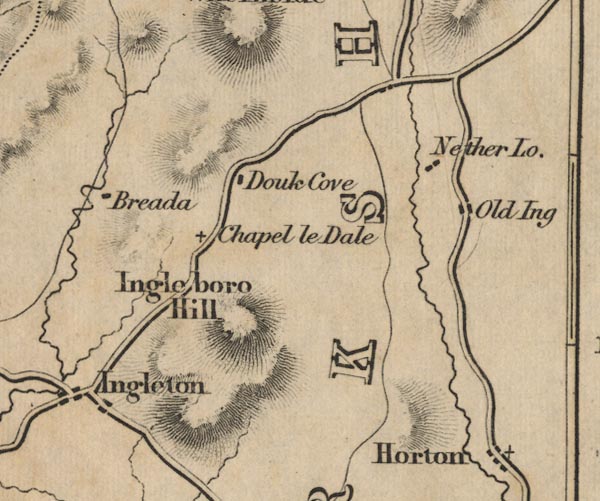 FD02SD77.jpg "SETTLE" item:- JandMN : 100.1 Image © see bottom of page |
|
|
|
||
Lakes Guides menu.