 Old Cumbria Gazetteer
 |
 |
|
| Sebergham Bridge, Sebergham | ||
| Sebergham Bridge | ||
| site name:- | Caldew, River | |
| locality:- | Sebergham | |
| civil parish:- | Sebergham (formerly Cumberland) | |
| county:- | Cumbria | |
| locality type:- | bridge | |
| coordinates:- | NY35734185 | |
| 1Km square:- | NY3541 | |
| 10Km square:- | NY34 | |
|
|
||
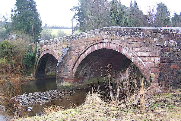 BLR83.jpg (taken 24.3.2006) 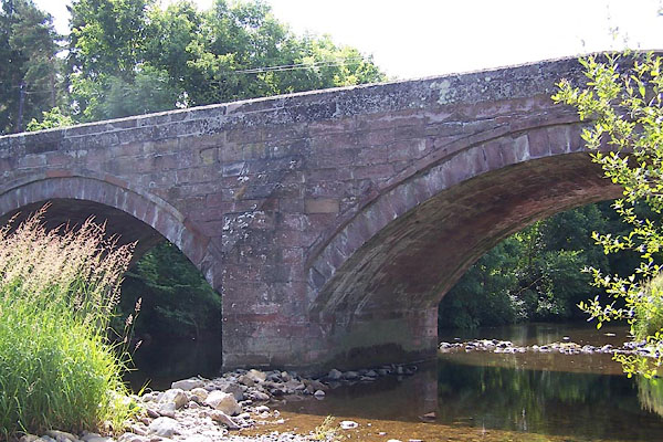 BJQ26.jpg (taken 13.7.2005) |
||
|
|
||
| evidence:- | old map:- OS County Series (Cmd 38 6) |
|
| source data:- | Maps, County Series maps of Great Britain, scales 6 and 25
inches to 1 mile, published by the Ordnance Survey, Southampton,
Hampshire, from about 1863 to 1948. "Bridge" |
|
|
|
||
| evidence:- | old map:- Donald 1774 (Cmd) |
|
| source data:- | Map, hand coloured engraving, 3x2 sheets, The County of Cumberland, scale about 1
inch to 1 mile, by Thomas Donald, engraved and published by Joseph Hodskinson, 29
Arundel Street, Strand, London, 1774.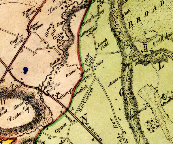 D4NY34SE.jpg "Bridge" double line across a river; a bridge over the Caldew item:- Carlisle Library : Map 2 Image © Carlisle Library |
|
|
|
||
| evidence:- | old map:- Laurie and Whittle 1806 placename:- Sebergham Bridge |
|
| source data:- | Road map, Completion of the Roads to the Lakes, scale about 10
miles to 1 inch, by Nathaniel Coltman? 1806, published by Robert
H Laurie, 53 Fleet Street, London, 1834. click to enlarge click to enlargeLw18.jpg "Sebergham Bridge 296½" bridge; distance from London item:- private collection : 18.18 Image © see bottom of page |
|
|
|
||
| evidence:- | old map:- Otley 1818 |
|
| source data:- | Map, uncoloured engraving, The District of the Lakes,
Cumberland, Westmorland, and Lancashire, scale about 4 miles to
1 inch, by Jonathan Otley, 1818, engraved by J and G Menzies,
Edinburgh, Scotland, published by Jonathan Otley, Keswick,
Cumberland, et al, 1833.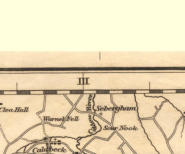 OT02NY34.jpg Implied by a road across the stream. item:- JandMN : 48.1 Image © see bottom of page |
|
|
|
||
| evidence:- | old map:- Bell 1892 placename:- Sebergham Bridge |
|
| source data:- | Map, colour lithograph, Road Map of Cumberland, by George Joseph
Bell, scale about 2.5 miles to 1 inch, printed by Charles
Thurnam and Sons, Carlisle, Cumberland, 1892.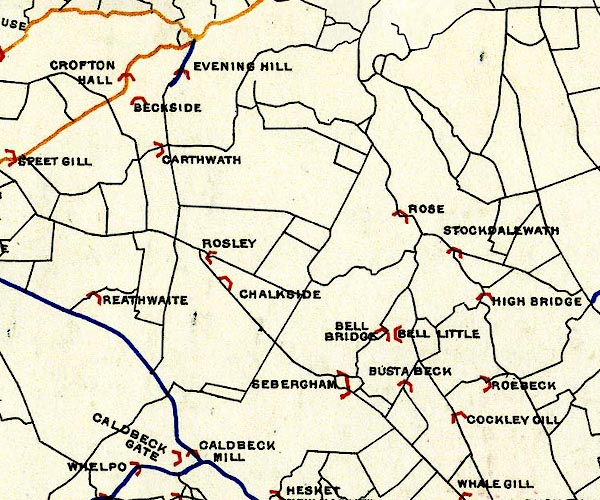 BEL9NY34.jpg "SEBERGHAM" bridge symbol Road map of Cumberland showing County Bridges item:- Carlisle Library : Map 38 Image © Carlisle Library |
|
|
|
||
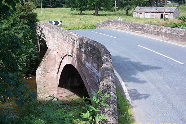
| evidence:- | database:- Listed Buildings 2010 placename:- Sebergham Bridge |
|
| source data:- | courtesy of English Heritage "SEBERGHAM BRIDGE / / / SEBERGHAM / ALLERDALE / CUMBRIA / II / 72477 / NY3573141851" |
|
| source data:- | courtesy of English Heritage "Road bridge. 1689 for Alexander Denton, with C19 &C20 repairs. Large blocks of red sandstone. 2 segmental arches on central pier with splayed cutwaters. Solid parapets with chamfered coping, ending to west with square stone piers; those on east side removed for parapet extension." |
|
|
|
||
| evidence:- | old print:- |
|
| source data:- | Print, Sebergham Bridge, Sebergham, Cumberland, by Samuel Middiman, engraved by John
Greig, published by J Walker, 16 Rosomans Street, London, 1802.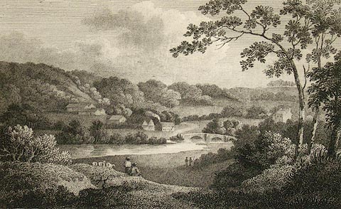 click to enlarge click to enlargePR1180.jpg Summertime; distant view of Sebergham Bridge and the village beside it, viewed from an elevated perspective. In the foreground two figures rest beside their sheep. Wooded hills rise in the distance. item:- Tullie House Museum : 1976.169.2.17 Image © Tullie House Museum |
|
|
|
||
 BJQ25.jpg (taken 13.7.2005) |
||
|
|
||
 Lakes Guides menu.