 Old Cumbria Gazetteer
 |
 |
|
| Scots' Dike, Kirkandrews | ||
| Scots' Dike | ||
| locality:- | Debatable Land | |
| civil parish:- | Kirkandrews (formerly Cumberland) | |
| county:- | Cumbria | |
| locality type:- | boundary | |
| locality type:- | national boundary | |
| coordinates:- | NY37557337 (etc) | |
| 1Km square:- | NY3773 | |
| 10Km square:- | NY37 | |
| current boundary | ||
| locality:- | Cumbria boundary | |
|
|
||
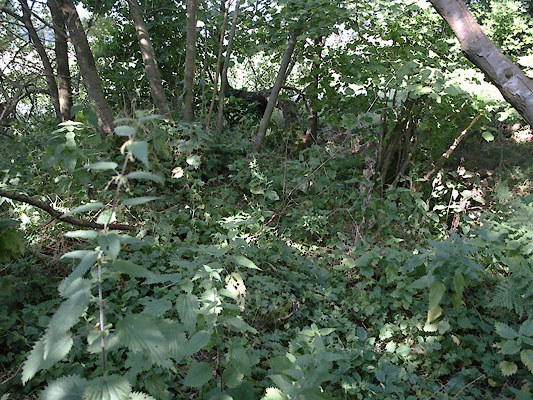
| MN photo:- |
In the strip of woodland it is possible to make out a shallow ditch and a low bank
- the dike. |
|
 BTM43.jpg West end of the boundary. (taken 3.9.2010) 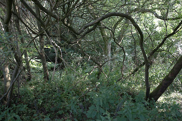 BTM44.jpg West end of the boundary. (taken 3.9.2010) 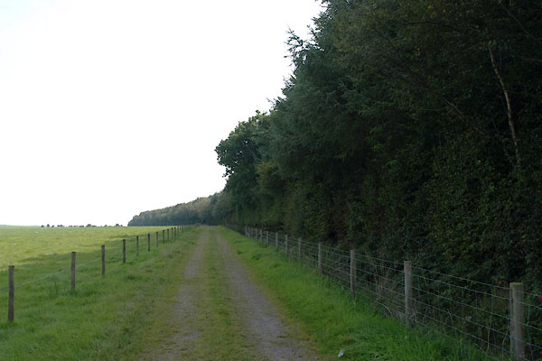 BTM45.jpg West end, view of the wood from the N side. (taken 3.9.2010) |
||
|
|
||
| evidence:- | old map:- OS County Series (Cmd 6 6) placename:- Scots' Dike |
|
| source data:- | Maps, County Series maps of Great Britain, scales 6 and 25
inches to 1 mile, published by the Ordnance Survey, Southampton,
Hampshire, from about 1863 to 1948. |
|
|
|
||
| evidence:- | old map:- Donald 1774 (Cmd) placename:- Scots Dyke |
|
| source data:- | Map, hand coloured engraving, 3x2 sheets, The County of Cumberland, scale about 1
inch to 1 mile, by Thomas Donald, engraved and published by Joseph Hodskinson, 29
Arundel Street, Strand, London, 1774.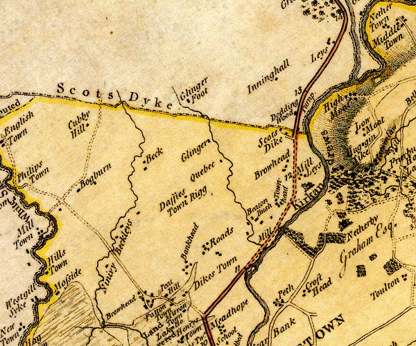 D4NY37SE.jpg "Scots Dyke" national boundary, with Scotland item:- Carlisle Library : Map 2 Image © Carlisle Library |
|
|
|
||
| evidence:- | old map:- Ford 1839 map placename:- Scots Dike |
|
| source data:- | Map, uncoloured engraving, Map of the Lake District of
Cumberland, Westmoreland and Lancashire, scale about 3.5 miles
to 1 inch, published by Charles Thurnam, Carlisle, and by R
Groombridge, 5 Paternoster Row, London, 3rd edn 1843.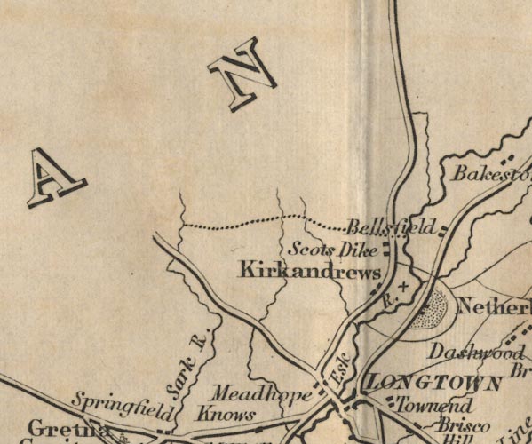 FD02NY37.jpg "Scots Dike" national boundery, dotted line. item:- JandMN : 100.1 Image © see bottom of page |
|
|
|
||
| notes:- |
boundary dyke |
|
| Perriam, D R &Robinson, J: 1998: Medieval Fortified Buildings of Cumbria: CWAAS::
ISBN 1 873124 23 6 |
||
|
|
||
 Lakes Guides menu.