 Old Cumbria Gazetteer
 |
 |
|
| Scales Hall, Skelton | ||
| Scales Hall | ||
| civil parish:- | Skelton (formerly Cumberland) | |
| county:- | Cumbria | |
| locality type:- | buildings | |
| coordinates:- | NY42594001 | |
| 1Km square:- | NY4240 | |
| 10Km square:- | NY44 | |
|
|
||
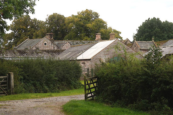 CFO76.jpg (taken 7.10.2016) |
||
|
|
||
| evidence:- | old map:- OS County Series (Cmd 39 9) placename:- Scales Hall |
|
| source data:- | Maps, County Series maps of Great Britain, scales 6 and 25
inches to 1 mile, published by the Ordnance Survey, Southampton,
Hampshire, from about 1863 to 1948. |
|
|
|
||
| evidence:- | just possibly descriptive text:- Simpson 1746 placename:- Scales |
|
| source data:- | Atlas, three volumes of maps and descriptive text published as
'The Agreeable Historian, or the Compleat English Traveller
...', by Samuel Simpson, 1746. goto source goto source"... Scales, the Seat of the late John Brougham, Esq; one of the Commissioners of the Excise." |
|
|
|
||
| evidence:- | old map:- Donald 1774 (Cmd) placename:- Scales Hall |
|
| source data:- | Map, hand coloured engraving, 3x2 sheets, The County of Cumberland, scale about 1
inch to 1 mile, by Thomas Donald, engraved and published by Joseph Hodskinson, 29
Arundel Street, Strand, London, 1774.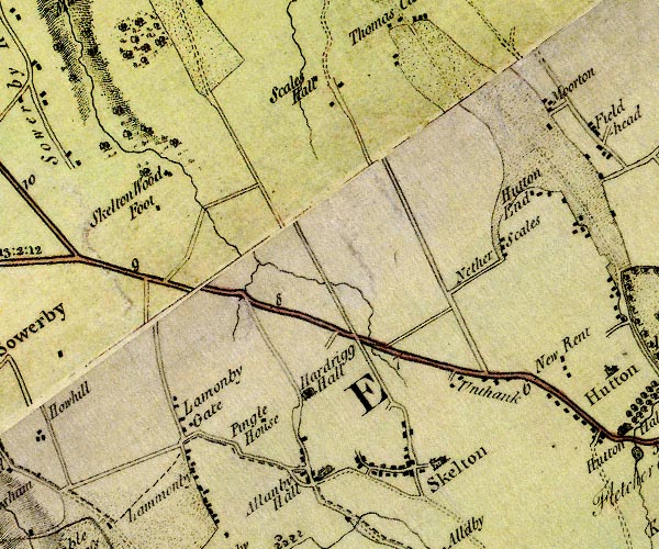 D4NY43NW.jpg "Scales Hall" block or blocks, labelled in lowercase; a hamlet or just a house item:- Carlisle Library : Map 2 Image © Carlisle Library |
|
|
|
||
| evidence:- | database:- Listed Buildings 2010 placename:- Scales Hall |
|
| source data:- | courtesy of English Heritage "SCALES HALL AND BARN ADJOINING / / / SKELTON / EDEN / CUMBRIA / I / 73982 / NY4259140014" |
|
|
|
||
| evidence:- | database:- Listed Buildings 2010 |
|
| source data:- | courtesy of English Heritage "GATEHOUSE AND CURTAIN WALL OF SCALES HALL / / / SKELTON / EDEN / CUMBRIA / I / 73986 / NY4262140015" |
|
|
|
||
| notes:- |
16th century hall, gateway, perhaps a moat |
|
| Perriam, D R &Robinson, J: 1998: Medieval Fortified Buildings of Cumbria: CWAAS::
ISBN 1 873124 23 6; plan and illustration |
||
|
|
||
Lakes Guides menu.