 Old Cumbria Gazetteer
 |
 |
|
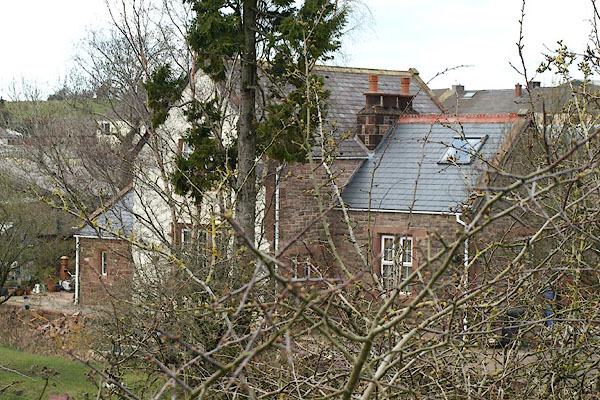
| Rowrah Station, Lamplugh | ||
| Rowrah Station | ||
| site name:- | Whitehaven, Cleator and Egremont Railway | |
| site name:- | Rowrah and Kelton Fell Railway (perhaps) | |
| locality:- | Rowrah | |
| civil parish:- | Lamplugh (formerly Cumberland) | |
| county:- | Cumbria | |
| locality type:- | railway station | |
| coordinates:- | NY05961857 (?) | |
| 1Km square:- | NY0518 | |
| 10Km square:- | NY01 | |
| SummaryText:- | Opened 1864; closed 1931. | |
|
|
||
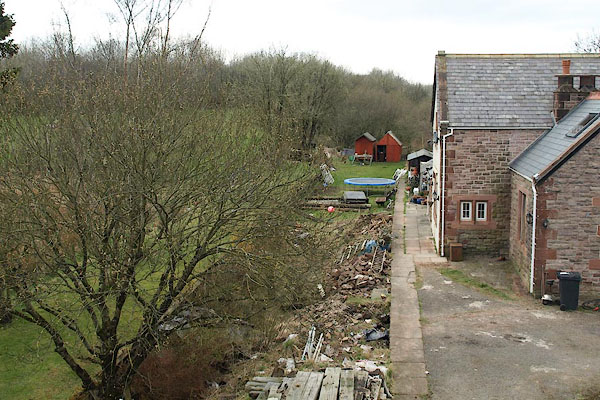 BPA30.jpg (taken 16.4.2008) 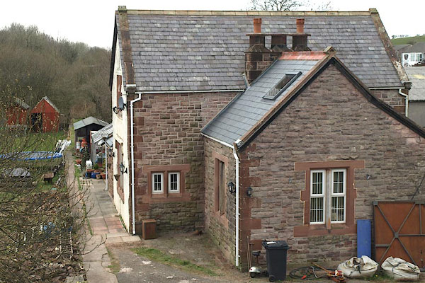 BPA31.jpg (taken 16.4.2008) |
||
|
|
||
| evidence:- | old map:- OS County Series (Cmd 68 1) placename:- Rowrah Station item:- railway signal; goods shed |
|
| source data:- | Maps, County Series maps of Great Britain, scales 6 and 25
inches to 1 mile, published by the Ordnance Survey, Southampton,
Hampshire, from about 1863 to 1948. OS County Series (Cmd 68 2) 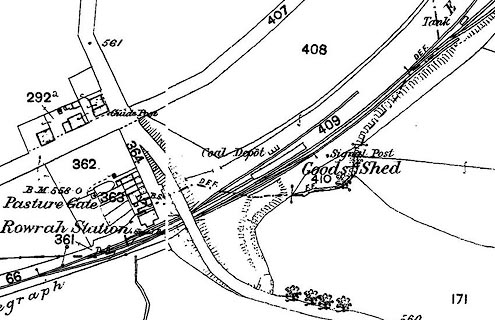 click to enlarge click to enlargeCSRY0087.jpg "Rowrah Station / Coal Depot / Goods Shed / Signal Post / [Signal Box]" |
|
|
|
||
| evidence:- | old map:- Postlethwaite 1877 (3rd edn 1913) |
|
| source data:- | Map, uncoloured engraving, Map of the Lake District Mining Field, Westmorland, Cumberland,
Lancashire, scale about 5 miles to 1 inch, by John Postlethwaite, published by W H
Moss and Sons, 13 Lowther Street, Whitehaven, Cumberland, 1877 edn 1913.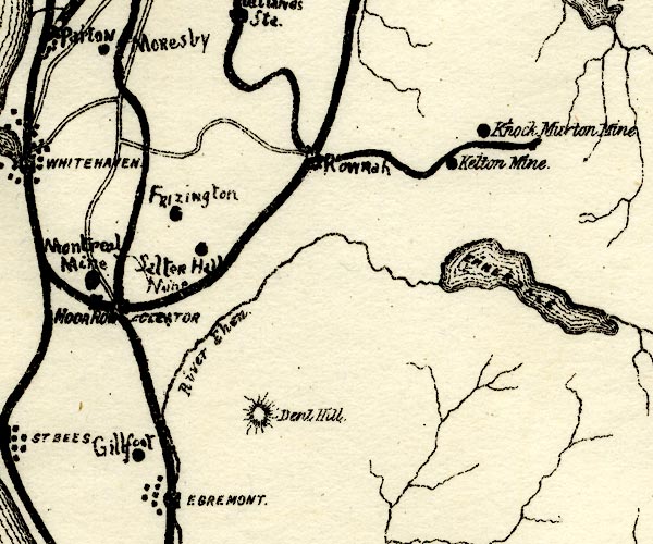 PST2NY01.jpg "Rowrah" station on railway? item:- JandMN : 162.2 Image © see bottom of page |
|
|
|
||
 BPA32.jpg (taken 16.4.2008) |
||
|
|
||
 Lakes Guides menu.