 Old Cumbria Gazetteer
 |
 |
|
|
| Rowrah and Kelton Fell Railway | |||
| Rowrah and Kelton Fell Mineral Railway | |||
| Baird's Line | |||
| civil parish:- | Arlecdon and Frizington (formerly Cumberland) | ||
| civil parish:- | Lamplugh (formerly Cumberland) | ||
| county:- | Cumbria | ||
| locality type:- | railway | ||
|
|
|||
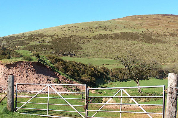 BMA30.jpg Railway embankment on Kelton Fell. (taken 3.5.2006) 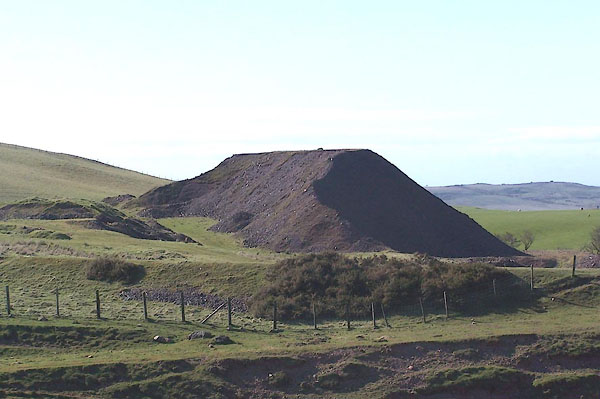 BMA29.jpg Railway embankment in front of the pit bing at keltonfell Top. (taken 3.5.2006) |
|||
|
|
|||
BMA29.jpg Keltonfell pit bing and a Rowrah and Kelton Fell Railway embankment. (taken 3.5.2006) |
|||
|
|
|||
| hearsay:- |
3 miles long. It was out of use by 1927, and lifted 1934. |
||
| The route was from Rowrah, Arlecdon and Frizington, to Kelton Fell, Lamplugh, Cumbria. |
|||
|
|
|||
| person:- | railway company : Rowrah and Kelton Fell Railway |
||
| date:- | 1874 |
||
|
|
|||
| person:- | quarry company : Salter Quarry Co |
||
|
|
|||
| goes through:- | [Rowrah Junction, Arlecdon and Frizington] Rowrah Station, Lamplugh Rowrah Station, Lamplugh[Kelton Fell Line Junction, Lamplugh] [Rowrah Junction, Lamplugh] Kirkland Goods Sidings, Lamplugh railway bridge, Kirkland railway bridge, Lamplugh railway bridge, Lamplugh (4) mine, Kelton Fell Kelton Fell sidings, Lamplugh16.7.1874: authorized - 1877: opened - 1927: disused - |
||
|
|
|||
Lakes Guides menu.