 Old Cumbria Gazetteer
 |
 |
|
| Rash Bridge, Rash | ||
| Rash Bridge | ||
| site name:- | Dee, River | |
| locality:- | Rash | |
| civil parish:- | Dent (formerly Yorkshire) | |
| county:- | Cumbria | |
| locality type:- | bridge | |
| coordinates:- | SD65908990 | |
| 1Km square:- | SD6589 | |
| 10Km square:- | SD68 | |
|
|
||
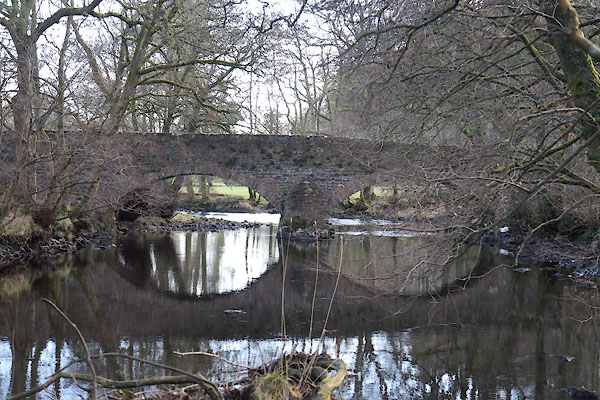 CCD93.jpg (taken 5.12.2014) |
||
|
|
||
| evidence:- | old map:- OS County Series (Yrk 63 7) placename:- Rash Bridge |
|
| source data:- | Maps, County Series maps of Great Britain, scales 6 and 25
inches to 1 mile, published by the Ordnance Survey, Southampton,
Hampshire, from about 1863 to 1948. |
|
|
|
||
| evidence:- | database:- Listed Buildings 2010 placename:- Rash Bridge |
|
| source data:- | courtesy of English Heritage "RASH BRIDGE / / / DENT / SOUTH LAKELAND / CUMBRIA / II / 484360 / SD6590789898" |
|
| source data:- | courtesy of English Heritage "Public road bridge. Probably C18. Coursed rubble. Central pier with triangular cutwaters on both sides, 2 low segmental arches with rubble voussoirs, parapets with flat coping." |
|
|
|
||
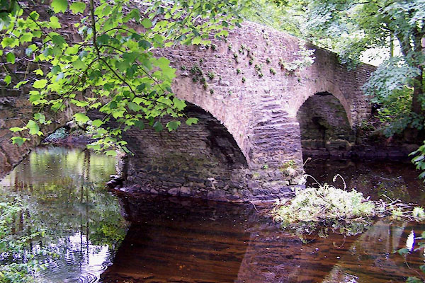 BJW11.jpg The river bed strata are tipped up layers. (taken 23.9.2005) |
||
|
|
||
 Lakes Guides menu.