 Old Cumbria Gazetteer
 |
 |
|
| Raby Cote, Holme East Waver | ||
| out of sight | ||
| Raby Cote | ||
| civil parish:- | Holme East Waver (formerly Cumberland) | |
| county:- | Cumbria | |
| locality type:- | buildings | |
| coordinates:- | NY17945240 | |
| 1Km square:- | NY1752 | |
| 10Km square:- | NY15 | |
|
|
||
| evidence:- | old map:- OS County Series (Cmd 21 14) placename:- Raby Cote |
|
| source data:- | Maps, County Series maps of Great Britain, scales 6 and 25
inches to 1 mile, published by the Ordnance Survey, Southampton,
Hampshire, from about 1863 to 1948. |
|
|
|
||
| evidence:- | old map:- Saxton 1579 placename:- Rabycotes |
|
| source data:- | Map, hand coloured engraving, Westmorlandiae et Cumberlandiae Comitatus ie Westmorland
and Cumberland, scale about 5 miles to 1 inch, by Christopher Saxton, London, engraved
by Augustinus Ryther, 1576, published 1579-1645.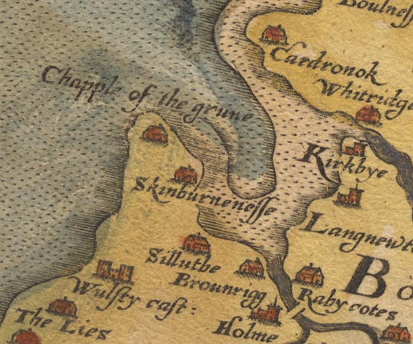 Sax9NY15.jpg Building, symbol for a hamlet, which may or may not have a nucleus. "Rabycotes" item:- private collection : 2 Image © see bottom of page |
|
|
|
||
| evidence:- | old map:- Speed 1611 (Cmd) placename:- Raby Cotes |
|
| source data:- | Map, hand coloured engraving, Cumberland and the Ancient Citie
Carlile Described, scale about 4 miles to 1 inch, by John Speed,
1610, published by J Sudbury and George Humble, Popes Head
Alley, London, 1611-12.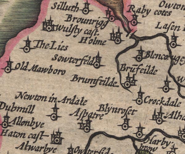 SP11NY14.jpg "Raby cotes" circle, tower item:- private collection : 16 Image © see bottom of page |
|
|
|
||
| evidence:- | old map:- Jansson 1646 placename:- Raby Cotes |
|
| source data:- | Map, hand coloured engraving, Cumbria and Westmoria, ie
Cumberland and Westmorland, scale about 3.5 miles to 1 inch, by
John Jansson, Amsterdam, Netherlands, 1646.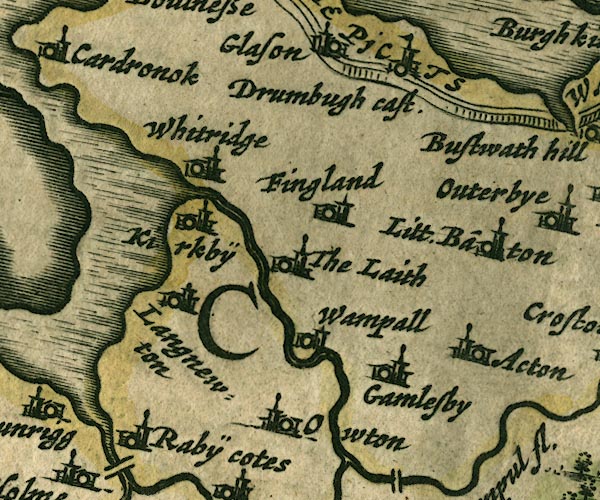 JAN3NY25.jpg "RabÿCotes" Buildings and tower. item:- JandMN : 88 Image © see bottom of page |
|
|
|
||
| evidence:- | old map:- Morden 1695 (Cmd) placename:- Raby Cotes |
|
| source data:- | Map, uncoloured engraving, Cumberland, scale about 4 miles to 1
inch, by Robert Morden, 1695, published by Abel Swale, the
Unicorn, St Paul's Churchyard, Awnsham, and John Churchill, the
Black Swan, Paternoster Row, London, 1695-1715.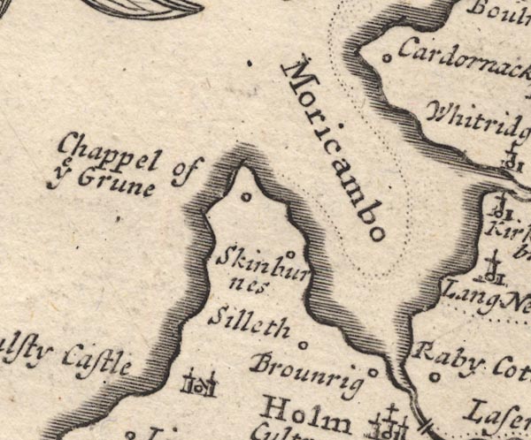 MD12NY15.jpg "Raby Cotes" Circle. item:- JandMN : 90 Image © see bottom of page |
|
|
|
||
| evidence:- | descriptive text:- Simpson 1746 placename:- Raby Cate |
|
| source data:- | Atlas, three volumes of maps and descriptive text published as
'The Agreeable Historian, or the Compleat English Traveller
...', by Samuel Simpson, 1746. goto source goto source"... Raby Cate, Mrs. Chamber's. ..." |
|
|
|
||
| evidence:- | old map:- Bowen and Kitchin 1760 placename:- Rabycotes |
|
| source data:- | Map, hand coloured engraving, A New Map of the Counties of
Cumberland and Westmoreland Divided into their Respective Wards,
scale about 4 miles to 1 inch, by Emanuel Bowen and Thomas
Kitchin et al, published by T Bowles, Robert Sayer, and John
Bowles, London, 1760.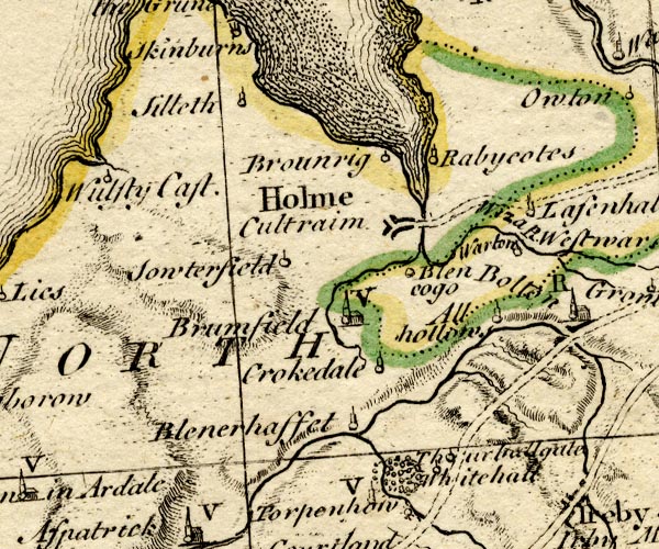 BO18NY14.jpg "Rabycotes" circle, tower item:- Armitt Library : 2008.14.10 Image © see bottom of page |
|
|
|
||
| evidence:- | old map:- Donald 1774 (Cmd) placename:- Raby Coat |
|
| source data:- | Map, hand coloured engraving, 3x2 sheets, The County of Cumberland, scale about 1
inch to 1 mile, by Thomas Donald, engraved and published by Joseph Hodskinson, 29
Arundel Street, Strand, London, 1774.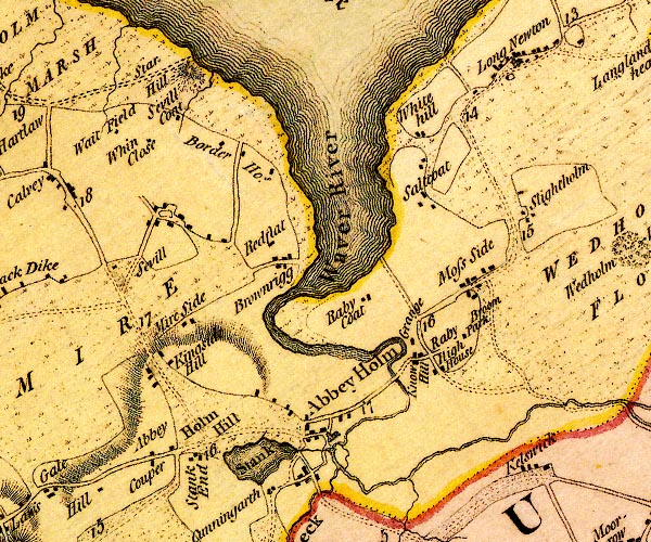 D4NY15SE.jpg "Raby Coat" block or blocks, labelled in lowercase; a hamlet or just a house item:- Carlisle Library : Map 2 Image © Carlisle Library |
|
|
|
||
| evidence:- | database:- Listed Buildings 2010 placename:- Raby Cote item:- date stone (1513) |
|
| source data:- | courtesy of English Heritage "RABY COTE AND ADJOINING BARN / / / HOLME EAST WAVER / ALLERDALE / CUMBRIA / II / 71974 / NY1795852386" |
|
|
|
||
| evidence:- | database:- Listed Buildings 2010 |
|
| source data:- | courtesy of English Heritage "BARN ADJOINING TO THE NORTH OF RABY COTE / / / HOLME EAST WAVER / ALLERDALE / CUMBRIA / II / 71975 / NY1793552412" |
|
|
|
||
Lakes Guides menu.