 Old Cumbria Gazetteer
 |
 |
|
| Oxendale, Lakes | ||
| Oxendale | ||
| civil parish:- | Lakes (formerly Westmorland) | |
| county:- | Cumbria | |
| locality type:- | valley | |
| coordinates:- | NY27120522 (etc) | |
| 1Km square:- | NY2705 | |
| 10Km square:- | NY20 | |
|
|
||
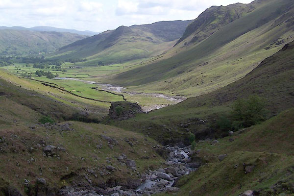 BUP49.jpg (taken 19.5.2011) |
||
|
|
||
| evidence:- | old map:- OS County Series (Wmd 25 5) placename:- Oxendale |
|
| source data:- | Maps, County Series maps of Great Britain, scales 6 and 25
inches to 1 mile, published by the Ordnance Survey, Southampton,
Hampshire, from about 1863 to 1948. OS County Series (Wmd 25 6) |
|
|
|
||
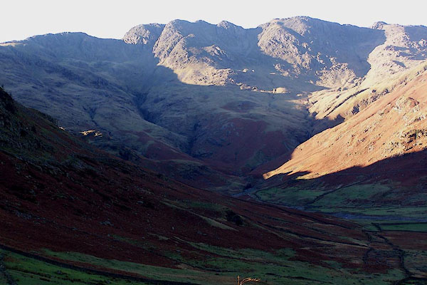 BLK24.jpg Oxendale from the E; Crinkle Crags at the head. (taken 17.11.2005) |
||
|
|
||
 Lakes Guides menu.