 Old Cumbria Gazetteer
 |
 |
|
| Morland | ||
| civil parish:- | Morland (formerly Westmorland) | |
| county:- | Cumbria | |
| locality type:- | buildings | |
| locality type:- | market town (once) | |
| coordinates:- | NY598225 | |
| 1Km square:- | NY5922 | |
| 10Km square:- | NY52 | |
|
|
||
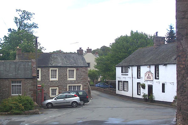 BMD26.jpg The Square, Morland. (taken 29.5.2006) |
||
|
|
||
| evidence:- | old map:- OS County Series (Wmd 8 11) placename:- Morland |
|
| source data:- | Maps, County Series maps of Great Britain, scales 6 and 25
inches to 1 mile, published by the Ordnance Survey, Southampton,
Hampshire, from about 1863 to 1948. |
|
|
|
||
| evidence:- | old map:- Saxton 1579 placename:- Morlam |
|
| source data:- | Map, hand coloured engraving, Westmorlandiae et Cumberlandiae Comitatus ie Westmorland
and Cumberland, scale about 5 miles to 1 inch, by Christopher Saxton, London, engraved
by Augustinus Ryther, 1576, published 1579-1645.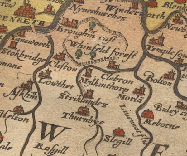 Sax9NY52.jpg Church, symbol for a parish or village, with a parish church. "Morla~" item:- private collection : 2 Image © see bottom of page |
|
|
|
||
| evidence:- | old map:- Speed 1611 (Wmd) placename:- Morlan |
|
| source data:- | Map, hand coloured engraving, The Countie Westmorland and
Kendale the Cheif Towne, scale about 2.5 miles to 1 inch, by
John Speed, 1610, published by George Humble, Popes Head Alley,
London, 1611-12. SP14NY62.jpg "Morlan" circle, building and tower item:- Armitt Library : 2008.14.5 Image © see bottom of page |
|
|
|
||
| evidence:- | old map:- Jansson 1646 placename:- Morlan |
|
| source data:- | Map, hand coloured engraving, Cumbria and Westmoria, ie
Cumberland and Westmorland, scale about 3.5 miles to 1 inch, by
John Jansson, Amsterdam, Netherlands, 1646.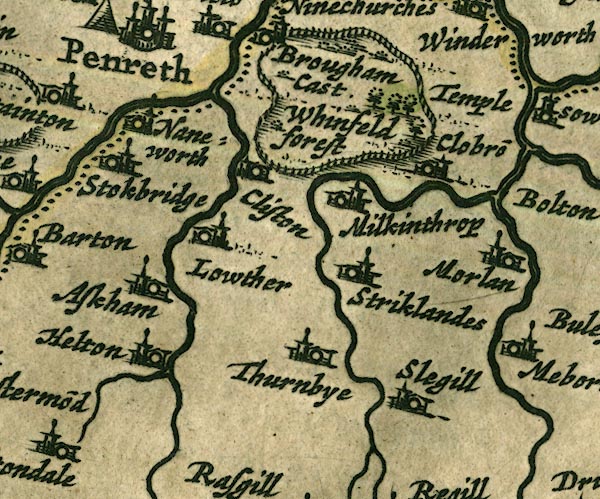 JAN3NY52.jpg "Morlan" Buildings and tower. item:- JandMN : 88 Image © see bottom of page |
|
|
|
||
| evidence:- | old map:- Morden 1695 (Cmd) placename:- Morlan |
|
| source data:- | Map, uncoloured engraving, Cumberland, scale about 4 miles to 1
inch, by Robert Morden, 1695, published by Abel Swale, the
Unicorn, St Paul's Churchyard, Awnsham, and John Churchill, the
Black Swan, Paternoster Row, London, 1695-1715.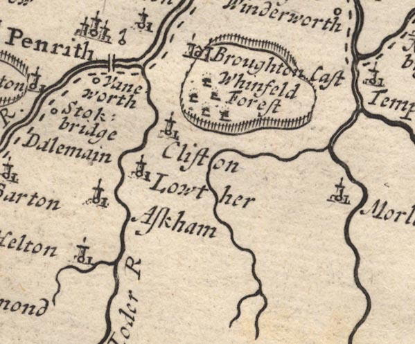 MD12NY52.jpg "Morlan" Circle, building and tower. item:- JandMN : 90 Image © see bottom of page |
|
|
|
||
| evidence:- | old map:- Morden 1695 (Wmd) placename:- Morland |
|
| source data:- | Map, hand coloured engraving, Westmorland, scale about 2.5 miles to 1 inch, by Robert
Morden, published by Abel Swale, the Unicorn, St Paul's Churchyard, Awnsham, and John
Churchill, the Black Swan, Paternoster Row, London, 1695.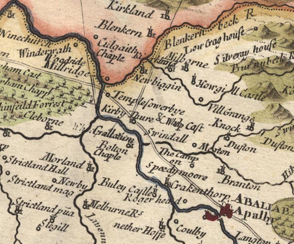 MD10NY62.jpg "Morland" Circle, building and tower. item:- JandMN : 24 Image © see bottom of page |
|
|
|
||
| evidence:- | old map:- Simpson 1746 map (Wmd) placename:- Morland |
|
| source data:- | Map, uncoloured engraving, Westmorland, scale about 8 miles to 1
inch, printed by R Walker, Fleet Lane, London, 1746. SMP2NYL.jpg "Morland" Circle. item:- Dove Cottage : 2007.38.59 Image © see bottom of page |
|
|
|
||
| evidence:- | old map:- Bowen and Kitchin 1760 placename:- Morland |
|
| source data:- | Map, hand coloured engraving, A New Map of the Counties of
Cumberland and Westmoreland Divided into their Respective Wards,
scale about 4 miles to 1 inch, by Emanuel Bowen and Thomas
Kitchin et al, published by T Bowles, Robert Sayer, and John
Bowles, London, 1760. BO18NY51.jpg "Morland / V" circle, building and tower, vicarage item:- Armitt Library : 2008.14.10 Image © see bottom of page |
|
|
|
||
| evidence:- | old map:- Jefferys 1770 (Wmd) placename:- Morland |
|
| source data:- | Map, 4 sheets, The County of Westmoreland, scale 1 inch to 1
mile, surveyed 1768, and engraved and published by Thomas
Jefferys, London, 1770. J5NY52SE.jpg "MORLAND" blocks, labelled in block caps; village or parish?, a river running down the street item:- National Library of Scotland : EME.s.47 Image © National Library of Scotland |
|
|
|
||
| evidence:- | old map:- West 1784 map placename:- Morland |
|
| source data:- | Map, hand coloured engraving, A Map of the Lakes in Cumberland,
Westmorland and Lancashire, scale about 3.5 miles to 1 inch,
engraved by Paas, 53 Holborn, London, about 1784. Ws02NY52.jpg item:- Armitt Library : A1221.1 Image © see bottom of page |
|
|
|
||
| evidence:- | old map:- Cary 1789 (edn 1805) placename:- Morland |
|
| source data:- | Map, uncoloured engraving, Westmoreland, scale about 2.5 miles
to 1 inch, by John Cary, London, 1789; edition 1805. CY24NY52.jpg "Morland" blocks, church symbol, labelled in upright lowercase; village item:- JandMN : 129 Image © see bottom of page |
|
|
|
||
| evidence:- | old map:- Cooper 1808 placename:- Morland |
|
| source data:- | Map, hand coloured engraving, Westmoreland ie Westmorland, scale
about 9 miles to 1 inch, by H Cooper, 1808, published by R
Phillips, Bridge Street, Blackfriars, London, 1808. click to enlarge click to enlargeCOP4.jpg "Morland" circle; village or hamlet item:- Dove Cottage : 2007.38.53 Image © see bottom of page |
|
|
|
||
| evidence:- | old map:- Hall 1820 (Wmd) placename:- Morland |
|
| source data:- | Map, hand coloured engraving, Westmoreland ie Westmorland, scale
about 14.5 miles to 1 inch, by Sidney Hall, London, 1820,
published by Samuel Leigh, 18 Strand, London, 1820-31. click to enlarge click to enlargeHA18.jpg "Morland" circle, italic lowercase text; settlement item:- Armitt Library : 2008.14.58 Image © see bottom of page |
|
|
|
||
| evidence:- | old text:- Gents Mag item:- Essay on the Characteristics |
|
| source data:- | Magazine, The Gentleman's Magazine or Monthly Intelligencer or
Historical Chronicle, published by Edward Cave under the
pseudonym Sylvanus Urban, and by other publishers, London,
monthly from 1731 to 1922. goto source goto sourceGentleman's Magazine 1825 part 1 p.516 "Compendium of County History. - Westmorland." "Of MORLAND Dr. Brown, author of the 'Essay on the Characteristics,' was Vicar." |
|
|
|
||
| evidence:- | old map:- Ford 1839 map placename:- Morland |
|
| source data:- | Map, uncoloured engraving, Map of the Lake District of
Cumberland, Westmoreland and Lancashire, scale about 3.5 miles
to 1 inch, published by Charles Thurnam, Carlisle, and by R
Groombridge, 5 Paternoster Row, London, 3rd edn 1843. FD02NY52.jpg "Morland" item:- JandMN : 100.1 Image © see bottom of page |
|
|
|
||
| evidence:- | old map:- Garnett 1850s-60s H placename:- Morland |
|
| source data:- | Map of the English Lakes, in Cumberland, Westmorland and
Lancashire, scale about 3.5 miles to 1 inch, published by John
Garnett, Windermere, Westmorland, 1850s-60s. GAR2NY52.jpg "Morland" blocks, settlement item:- JandMN : 82.1 Image © see bottom of page |
|
|
|
||
| evidence:- | market notes:- placename:- Morland item:- market |
|
| source data:- | www.history.ac.uk/cmh/gaz/gazweb2.htmPalmer's Index No.93:: Public Record Office | |
|
|
||
 Post Office maps Post Office maps |
||
|
|
||
| hearsay:- |
Granted the right to hold a weekly market and an annual fair, 1362. |
|
|
|
||
| hearsay:- |
Morland House, in the middle of the village was the original tudor parsonage. During
the 19th century, Rev William Rice Markham was Vicar here. He greatly extended the
house to its present size. At about the time of his death, the family acquired the
house for their own and built a new Vicarage and kept the old house for themselves. |
|
| Hall Farm is originally tudor. It has been extensively rebuilt in very recent times.
It had a wonderful dark oak staircase. Hall Farm used to be the main farm in the centre
of the village; it and its steading are now a small housing estate, and the land is
now farmed from Lowergate Farm. |
||
|
|
||
Lakes Guides menu.