 Old Cumbria Gazetteer
 |
 |
|
| Monk Coniston, Coniston | ||
| Monk Coniston | ||
| civil parish:- | Coniston (formerly Lancashire) | |
| county:- | Cumbria | |
| locality type:- | locality | |
| coordinates:- | SD31809825 (etc) | |
| 1Km square:- | SD3198 | |
| 10Km square:- | SD39 | |
|
|
||
| evidence:- | old map:- Crosthwaite 1783-94 (Con) placename:- Monk Coniston |
|
| source data:- | Map, uncoloured engraving, An Accurate Map of Coniston Lake,
scale about 3 inches to 1 mile, by Peter Crosthwaite, Keswick,
Cumberland, 1788, version published 1809.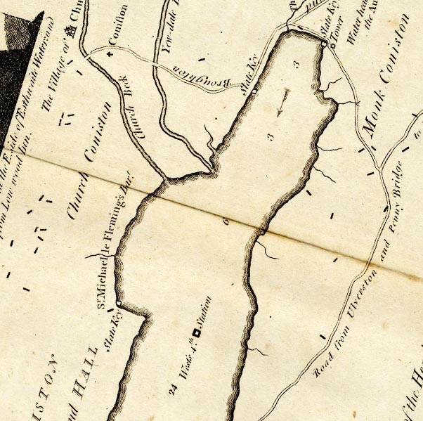 CTESD39D.jpg "Monk Coniston" scatter of blocks for building/s item:- JandMN : 182.5 Image © see bottom of page |
|
|
|
||
| evidence:- | old map:- Ford 1839 map placename:- Monk Conistone |
|
| source data:- | Map, uncoloured engraving, Map of the Lake District of
Cumberland, Westmoreland and Lancashire, scale about 3.5 miles
to 1 inch, published by Charles Thurnam, Carlisle, and by R
Groombridge, 5 Paternoster Row, London, 3rd edn 1843.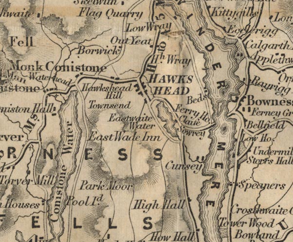 FD02SD39.jpg "Monk Conistone" item:- JandMN : 100.1 Image © see bottom of page |
|
|
|
||
 Lakes Guides menu.