 Old Cumbria Gazetteer
 |
 |
|
| Mirehouse, Bassenthwaite | ||
| Mirehouse | ||
| Mire House | ||
| civil parish:- | Bassenthwaite (formerly Cumberland) | |
| county:- | Cumbria | |
| locality type:- | buildings | |
| locality type:- | museum | |
| locality type:- | art gallery | |
| locality type:- | garden | |
| coordinates:- | NY23172837 | |
| 1Km square:- | NY2328 | |
| 10Km square:- | NY22 | |
|
|
||
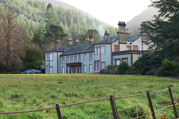 BPV75.jpg (taken 17.12.2008) 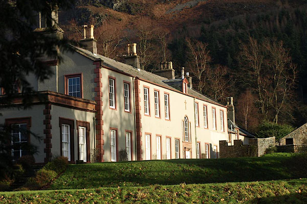 BPV76.jpg (taken 17.12.2008) |
||
|
|
||
| evidence:- | possibly old map:- Ogilby 1675 (plate 96) placename:- Basinthwait |
|
| source data:- | Road strip map, hand coloured engraving, the Road from Kendal to
Cockermouth, and the Road from Egremond to Carlisle, scale about
1 inch to 1 mile, by John Ogilby, London, 1675.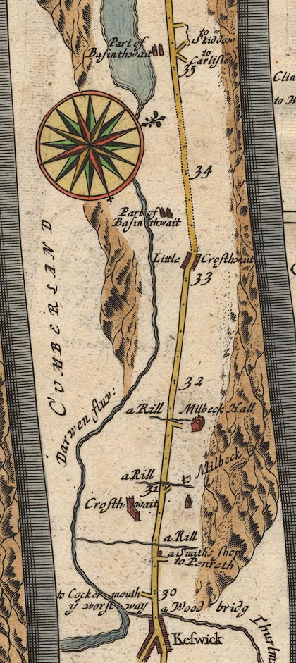 OG96m030.jpg In mile 33, Cumberland. "Part of Basinthwait" houses between the road and the river on the left. item:- JandMN : 22 Image © see bottom of page |
|
|
|
||
| evidence:- | old map:- Donald 1774 (Cmd) placename:- Mire House |
|
| source data:- | Map, hand coloured engraving, 3x2 sheets, The County of Cumberland, scale about 1
inch to 1 mile, by Thomas Donald, engraved and published by Joseph Hodskinson, 29
Arundel Street, Strand, London, 1774.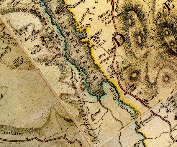 D4NY22NW.jpg "Mire House / Storey Esq" house item:- Carlisle Library : Map 2 Image © Carlisle Library |
|
|
|
||
| evidence:- | old map:- Crosthwaite 1783-94 (Bas) placename:- Mirehouse |
|
| source data:- | Map, uncoloured engraving, An Accurate Map of Broadwater or
Bassenthwaite Lake, scale about 3 inches to 1 mile, by Peter
Crosthwaite, Keswick, Cumberland, 1783, version published 1800.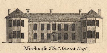 CT06Vgn5.jpg "Mirehouse Thos. Storie's Esqr." item:- Armitt Library : 1959.191.4 Image © see bottom of page |
|
|
|
||
| evidence:- | old map:- Crosthwaite 1783-94 (Bas) placename:- Mirehouse |
|
| source data:- | Map, uncoloured engraving, An Accurate Map of Broadwater or
Bassenthwaite Lake, scale about 3 inches to 1 mile, by Peter
Crosthwaite, Keswick, Cumberland, 1783, version published 1800.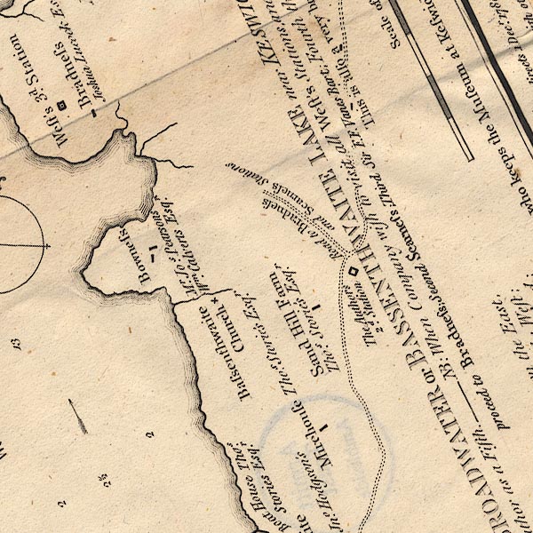 CT6NY22J.jpg "Mirehouse / Thos. Stories Esqr." item:- Armitt Library : 1959.191.4 Image © see bottom of page |
|
|
|
||
| evidence:- | old text:- Clarke 1787 placename:- Mire House item:- placename, Mirehouse; inclosure; draining; oak; ash; fir; tree |
|
| source data:- | Guide book, A Survey of the Lakes of Cumberland, Westmorland,
and Lancashire, written and published by James Clarke, Penrith,
Cumberland, and in London etc, 1787; published 1787-93. goto source goto sourcePage 99:- "..." "We now approach Mire-House, so called, I apprehend, from its being situated behind a bog or mire. This bog, along with other lands at the division of the common, was allotted to Thomas Storey, Esq; who hath drained and planted it with oak, ash, fir, &c. The trees in general thrive very well, and will in a short time take away the gloomy view of the barren mountain Ullock, (to use Mr Gray's word,) one of Skiddow's cubs, from the house, and Skiddow will be seen over their lofty tops piercing the clouds." "Mr West called Armathwaite, (Mr Spedding's,) the Queen of the vale; but never saw the king, or names him, (viz. Mire-House.) Mr Pennant passed it unnoticed; Mr Gray and Mr Hutchinson the same; how then dare I recommend its situation? By telling the reader, that behind the house, and towards the water, it has the richest pastures, and most fertile ground; that it is near the head of the Lake, and fronts downwards, and has the best view of the vale of Bassenthwaite, on account of its elevated situation; that it is a modern built house with two wings, and from a bow-window in one of them is the best perspective view in all this part; indeed not so fine a sheet of water before it as Armathwaite, but a far better view of the bays and peninsulas of the Lake, Wythop-Brows, &c. I cannot paint to the reader all the advantages of view Mire-House has, unless I were determined to dedicate a whole volume to that purpose. Let the traveller, however, be witness to the beauties of the place, and the hospitality of its worthy owner." |
|
|
|
||
| evidence:- | old map:- Clarke 1787 map (Bassenthwaite Lake) placename:- Mirehouse |
|
| source data:- | Map, A Map of Broadwater and its Environs, ie Bassenthwaite
Lake, scale about 6.5 ins to 1 mile, by James Clarke, engraved
by Neele, 352 Strand, published by James Clarke, Penrith,
Cumberland and in London etc, 1787.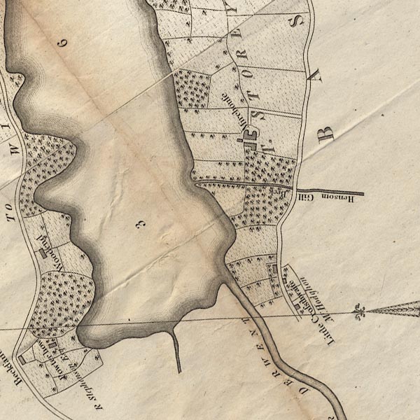 CL8NY22I.jpg "Mirehouse / T. STOREY Esqr." item:- private collection : 10.8 Image © see bottom of page |
|
|
|
||
| evidence:- | road book:- Cary 1798 (2nd edn 1802) placename:- Mirehouse |
|
| source data:- | Road book, itineraries, Cary's New Itinerary, by John Cary, 181
Strand, London, 2nd edn 1802. goto source click to enlarge click to enlargeC38319.jpg page 319-320 "Between Little Crosthwaite and High Side, on l. is Mirehouse, Thomas Storey, Esq." item:- JandMN : 228.1 Image © see bottom of page |
|
|
|
||
| evidence:- | old print:- Green 1822 (plate 40) placename:- Mire House item:- chimney |
|
| source data:- | Print, uncoloured soft ground etching, Mire House, Bassenthwaite, Cumberland, by William
Green, Ambleside, Westmorland, 1822.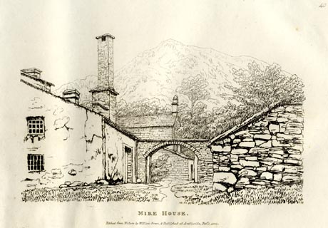 click to enlarge click to enlargeGN0840.jpg Plate 40 in Forty Etchings from Nature. printed at bottom:- "MIRE HOUSE. / Etched from Nature by William Green, &Published at Ambleside, Feby. 1, 1822." item:- Armitt Library : A6644.40 Image © see bottom of page |
|
|
|
||
| evidence:- | descriptive text:- Ford 1839 (3rd edn 1843) placename:- Mirehouse |
|
| source data:- | Guide book, A Description of Scenery in the Lake District, by
Rev William Ford, published by Charles Thurnam, Carlisle, by W
Edwards, 12 Ave Maria Lane, Charles Tilt, Fleet Street, William
Smith, 113 Fleet Street, London, by Currie and Bowman,
Newcastle, by Bancks and Co, Manchester, by Oliver and Boyd,
Edinburgh, and by Sinclair, Dumfries, 1839. goto source Page 87:- "... On the direct road to Keswick, on the right, is Mirehouse, the seat of J. Spedding, Esq. enveloped in woods. ..." |
|
|
|
||
| evidence:- | old map:- Ford 1839 map placename:- Mirehouse |
|
| source data:- | Map, uncoloured engraving, Map of the Lake District of
Cumberland, Westmoreland and Lancashire, scale about 3.5 miles
to 1 inch, published by Charles Thurnam, Carlisle, and by R
Groombridge, 5 Paternoster Row, London, 3rd edn 1843.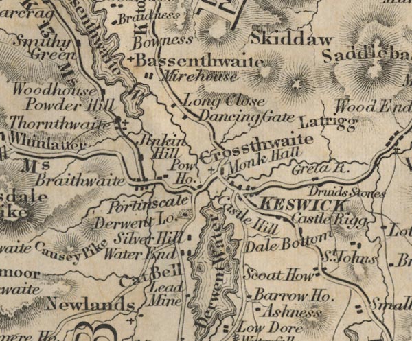 FD02NY22.jpg "Mirehouse" item:- JandMN : 100.1 Image © see bottom of page |
|
|
|
||
| evidence:- | database:- Listed Buildings 2010 placename:- Mirehouse |
|
| source data:- | courtesy of English Heritage "MIREHOUSE / / / BASSENTHWAITE / ALLERDALE / CUMBRIA / II[star] / 72102 / NY2317828378" |
|
|
|
||
| evidence:- | database:- Listed Buildings 2010 |
|
| source data:- | courtesy of English Heritage "SOUTH LODGE TO MIREHOUSE / / / UNDERSKIDDAW / ALLERDALE / CUMBRIA / II / 72192 / NY2346628141" |
|
|
|
||
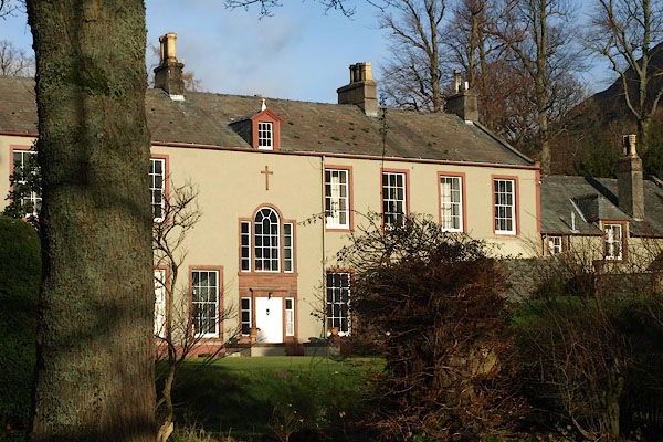 BPV79.jpg (taken 17.12.2008) 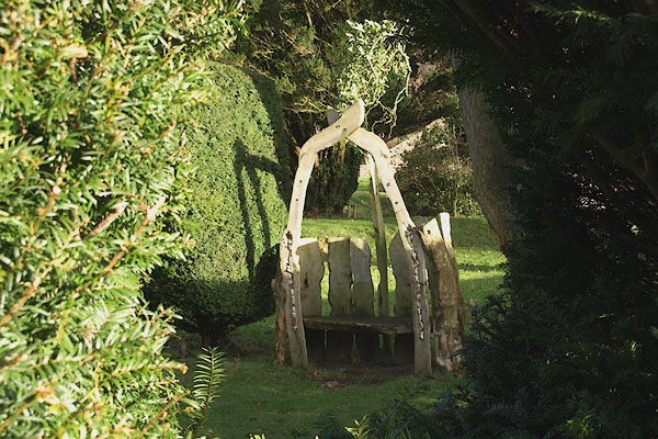 BPV77.jpg Garden seat. (taken 17.12.2008) 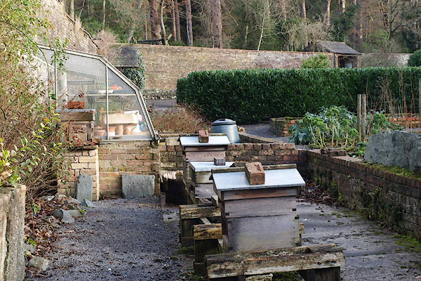 BPV78.jpg Vegetable garden, with beehives. (taken 17.12.2008) |
||
|
|
||
| hearsay:- |
The Spedding Family owned the house from 1802. |
|
| Various literary persons were entertained here; Alfred Tennyson, William Wordsworth,
Robert Southey, etc. |
||
|
|
||
| Longville, Tim &Corbett, Val (photr): 2007: Gardens of the Lake District: Lincoln,
Frances (London) |
||
|
|
||
Lakes Guides menu.