 Old Cumbria Gazetteer
 |
 |
|
| Millrigg, Culgaith | ||
| Millrigg | ||
| civil parish:- | Culgaith (formerly Cumberland) | |
| county:- | Cumbria | |
| locality type:- | buildings | |
| coordinates:- | NY60792826 | |
| 1Km square:- | NY6028 | |
| 10Km square:- | NY62 | |
|
|
||
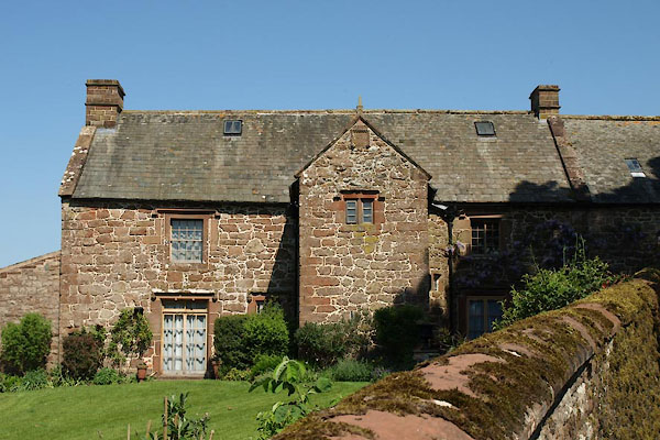 BWN06.jpg (taken 25.5.2012) 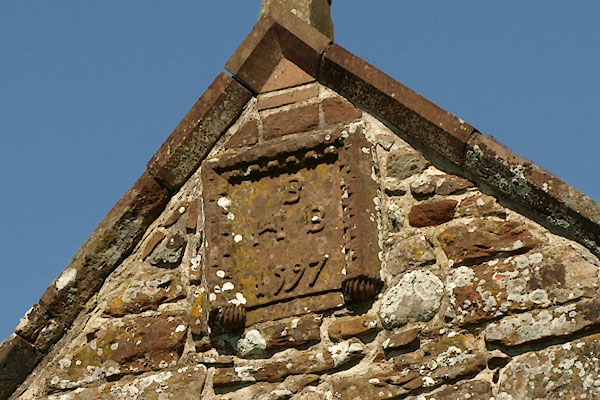 BWN07.jpg Date stone:- "B / H B / 1597" (taken 25.5.2012) |
||
|
|
||
| evidence:- | old map:- OS County Series (Cmd 59 8) placename:- Millrigg |
|
| source data:- | Maps, County Series maps of Great Britain, scales 6 and 25
inches to 1 mile, published by the Ordnance Survey, Southampton,
Hampshire, from about 1863 to 1948. |
|
|
|
||
| evidence:- | old map:- Morden 1695 (Wmd) placename:- Millridge |
|
| source data:- | Map, hand coloured engraving, Westmorland, scale about 2.5 miles to 1 inch, by Robert
Morden, published by Abel Swale, the Unicorn, St Paul's Churchyard, Awnsham, and John
Churchill, the Black Swan, Paternoster Row, London, 1695.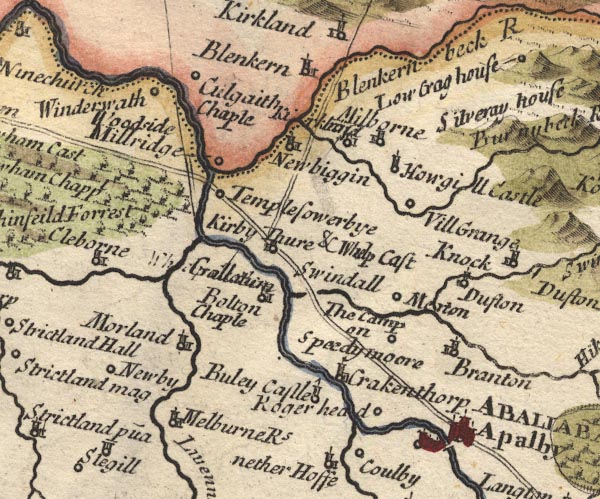 MD10NY62.jpg "Millridge" Circle. item:- JandMN : 24 Image © see bottom of page |
|
|
|
||
| evidence:- | possibly old map:- Bowen and Kitchin 1760 placename:- Milbridge |
|
| source data:- | Map, hand coloured engraving, A New Map of the Counties of
Cumberland and Westmoreland Divided into their Respective Wards,
scale about 4 miles to 1 inch, by Emanuel Bowen and Thomas
Kitchin et al, published by T Bowles, Robert Sayer, and John
Bowles, London, 1760.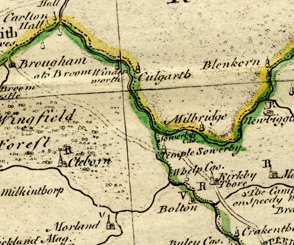 BO18NY52.jpg "Milbridge" circle, tower item:- Armitt Library : 2008.14.10 Image © see bottom of page |
|
|
|
||
| evidence:- | old map:- Jefferys 1770 (Wmd) placename:- Mill Rigg |
|
| source data:- | Map, 4 sheets, The County of Westmoreland, scale 1 inch to 1
mile, surveyed 1768, and engraved and published by Thomas
Jefferys, London, 1770.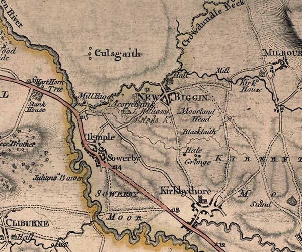 J5NY62NW.jpg "Mill Rigg" circle, labelled in italic lowercase text; settlement, farm, house, or hamlet? item:- National Library of Scotland : EME.s.47 Image © National Library of Scotland |
|
|
|
||
| evidence:- | old map:- Donald 1774 (Cmd) placename:- Millrigg |
|
| source data:- | Map, hand coloured engraving, 3x2 sheets, The County of Cumberland, scale about 1
inch to 1 mile, by Thomas Donald, engraved and published by Joseph Hodskinson, 29
Arundel Street, Strand, London, 1774.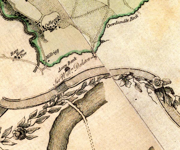 D4NY62NW.jpg "Millrigg" block or blocks, labelled in lowercase; a hamlet or just a house item:- Carlisle Library : Map 2 Image © Carlisle Library |
|
|
|
||
| evidence:- | old map:- Ford 1839 map placename:- Mellrig |
|
| source data:- | Map, uncoloured engraving, Map of the Lake District of
Cumberland, Westmoreland and Lancashire, scale about 3.5 miles
to 1 inch, published by Charles Thurnam, Carlisle, and by R
Groombridge, 5 Paternoster Row, London, 3rd edn 1843. FD02NY52.jpg "Mellrig" item:- JandMN : 100.1 Image © see bottom of page |
|
|
|
||
| evidence:- | database:- Listed Buildings 2010 placename:- Millrigg item:- date stone (1597); date stone (1669); coat of arms |
|
| source data:- | courtesy of English Heritage "MILLRIGG AND DWELLING ADJOINING TO NORTH WEST / / B6412 / CULGAITH / EDEN / CUMBRIA / II[star] / 73144 / NY6079428263" |
|
|
|
||
| evidence:- | database:- Listed Buildings 2010 |
|
| source data:- | courtesy of English Heritage "BARN TO NORTH OF MILLRIGG / / B6412 / CULGAITH / EDEN / CUMBRIA / II / 73145 / NY6079828279" |
|
|
|
||
 sundial sundial |
||
|
|
||
| notes:- |
16th century house, possible defensive features |
|
| Perriam, D R &Robinson, J: 1998: Medieval Fortified Buildings of Cumbria: CWAAS::
ISBN 1 873124 23 6 |
||
|
|
||
 Lakes Guides menu.