 Old Cumbria Gazetteer
 |
 |
|
| milestone, Dacre | ||
| site name:- | road, Patterdale to Penrith (?) | |
| civil parish:- | Dacre (formerly Cumberland) | |
| county:- | Cumbria | |
| locality type:- | milestone | |
| coordinates:- | NY47962691 | |
| 1Km square:- | NY4726 | |
| 10Km square:- | NY42 | |
|
|
||
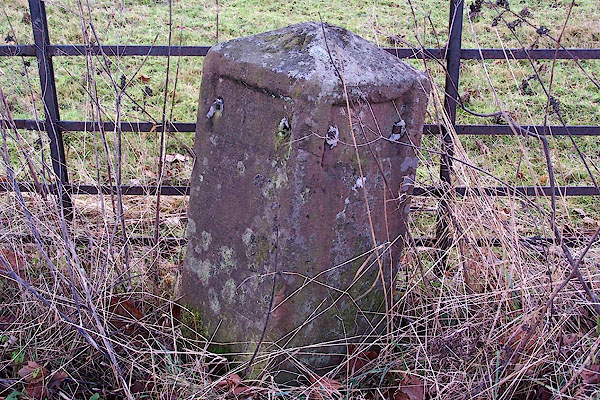 BLM24.jpg Stone with cast iron plates - missing. (taken 23.12.2005) |
||
|
|
||
| evidence:- | old map:- OS County Series (Cmd 58 11) |
|
| source data:- | Maps, County Series maps of Great Britain, scales 6 and 25
inches to 1 mile, published by the Ordnance Survey, Southampton,
Hampshire, from about 1863 to 1948. "M.S. PENRITH .. 3 ULLSWATER .. 2" |
|
|
|
||
 Lakes Guides menu.