 Old Cumbria Gazetteer
 |
 |
|
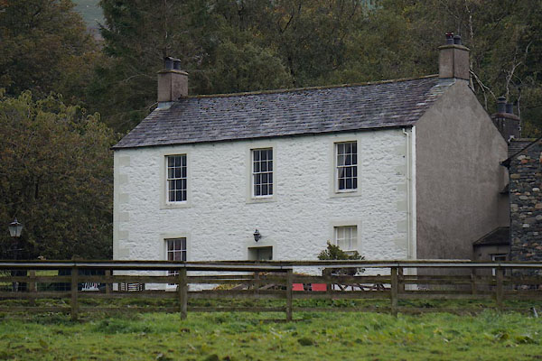
| Melbecks Farm, Bassenthwaite | ||
| Melbecks Farm | ||
| locality:- | Melbecks | |
| civil parish:- | Bassenthwaite (formerly Cumberland) | |
| county:- | Cumbria | |
| locality type:- | buildings | |
| coordinates:- | NY24333188 | |
| 1Km square:- | NY2431 | |
| 10Km square:- | NY23 | |
|
|
||
 CBU95.jpg (taken 9.10.2014) 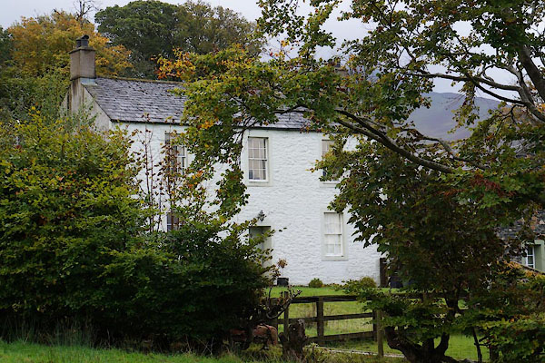 CBU94.jpg (taken 9.10.2014) |
||
|
|
||
| evidence:- | old map:- OS County Series (Cmd 47 13) placename:- Millbecks |
|
| source data:- | Maps, County Series maps of Great Britain, scales 6 and 25
inches to 1 mile, published by the Ordnance Survey, Southampton,
Hampshire, from about 1863 to 1948. |
|
|
|
||
| evidence:- | database:- Listed Buildings 2010 placename:- Melbecks Farm |
|
| source data:- | courtesy of English Heritage "MELBECKS FARMHOUSE / / / BASSENTHWAITE / ALLERDALE / CUMBRIA / II / 72110 / NY2433931886" |
|
|
|
||
 Lakes Guides menu.