 Old Cumbria Gazetteer
 |
 |
|
| Mardale Ill Bell, Kentmere | ||
| Mardale Ill Bell | ||
| civil parish:- | Kentmere (formerly Westmorland) | |
| civil parish:- | Shap Rural (formerly Westmorland) | |
| county:- | Cumbria | |
| locality type:- | hill | |
| coordinates:- | NY44751012 | |
| 1Km square:- | NY4410 | |
| 10Km square:- | NY41 | |
| altitude:- | 2493 feet | |
| altitude:- | 760m | |
|
|
||
| evidence:- | old photograph:- Marr 1916 placename:- Mardale Ill Bell |
|
| source data:- | Photograph, halftone print, Columnar structure in lava, Mardale Ill Bell, Kentmere,
Westmorland, 1916.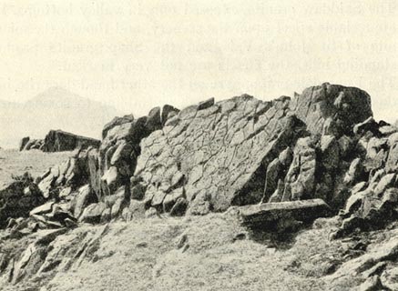 click to enlarge click to enlargeMA1209.jpg item:- JandMN : 173.17 Image © see bottom of page |
|
|
|
||
 Lakes Guides menu.