 Old Cumbria Gazetteer
 |
 |
|
| Low Wray Bay, Windermere lake | ||
| Low Wray Bay | ||
| site name:- | Windermere lake | |
| civil parish:- | Claife (formerly Lancashire) | |
| county:- | Cumbria | |
| locality type:- | bay | |
| coordinates:- | NY37610127 | |
| 1Km square:- | NY3701 | |
| 10Km square:- | NY30 | |
|
|
||
| evidence:- | old map:- OS County Series (Lan 2 11) placename:- Low Wray Bay placename:- Wray Bay, Low |
|
| source data:- | Maps, County Series maps of Great Britain, scales 6 and 25
inches to 1 mile, published by the Ordnance Survey, Southampton,
Hampshire, from about 1863 to 1948. OS County Series (Wmd 32 2) |
|
|
|
||
| evidence:- | old map:- Clarke 1787 map (Windermere N) |
|
| source data:- | Map, A Map of the Northern Part of the Lake Winandermere and its
Environs, scale about 6.5 ins to 1 mile, by James Clarke,
engraved by Samuel John Neele, 352 Strand, published by James
Clarke, Penrith, Cumberland and in London etc, 1787.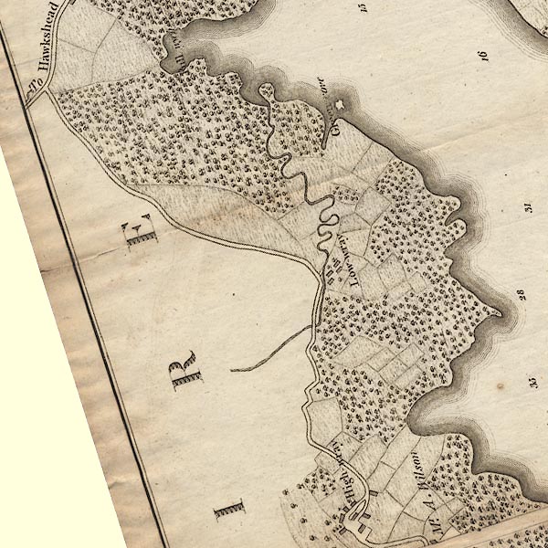 CLANY30Q.jpg item:- private collection : 10.10 Image © see bottom of page |
|
|
|
||
| evidence:- | old photograph:- Bell 1880s-1940s item:- rowing boat; boat |
|
| source data:- | Photograph, black and white, Low Wray Bay, Wray Castle Boat House and the castle behind,
Claife, Lancashire, by Herbert Bell, photographer, Ambleside, Westmorland, 1890s.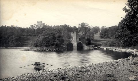 click to enlarge click to enlargeHB0839.jpg internegative at lower right:- "H. Bell" stamped at reverse:- "HERBERT BELL / Photographer / AMBLESIDE" 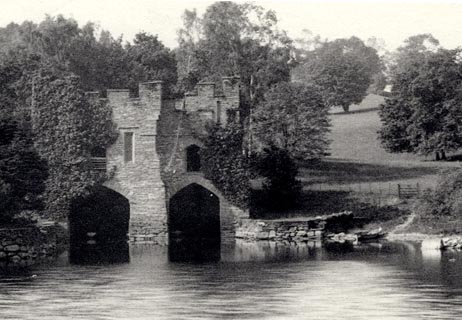 click to enlarge click to enlargeHB0840.jpg item:- Armitt Library : ALPS503 Image © see bottom of page |
|
|
|
||
| evidence:- | old photograph:- Bell 1880s-1940s item:- boat; rowing boat |
|
| source data:- | Photograph, sepia, by Windermere lake at Wray, Claife, Lancashire, by Herbert Bell,
photographer, Ambleside, Westmorland, 1890s.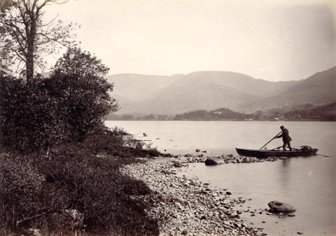 click to enlarge click to enlargeHB0850.jpg Perhaps Low Wray Bay? item:- Armitt Library : ALPS521 Image © see bottom of page |
|
|
|
||
 Lakes Guides menu.