 Old Cumbria Gazetteer
 |
 |
|
| Low Bank Ground, Coniston | ||
| Low Bank Ground | ||
| Bank Ground | ||
| Bank Ground Farm | ||
| locality:- | Bank Ground | |
| civil parish:- | Coniston (formerly Lancashire) | |
| county:- | Cumbria | |
| locality type:- | buildings | |
| coordinates:- | SD31599694 | |
| 1Km square:- | SD3196 | |
| 10Km square:- | SD39 | |
|
|
||
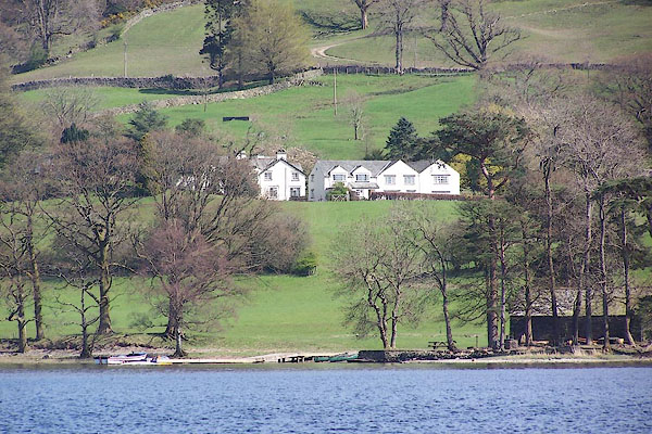 BLZ64.jpg (taken 28.4.2006) |
||
|
|
||
| evidence:- | possibly old map:- Otley 1818 placename:- Bank |
|
| source data:- | Map, uncoloured engraving, The District of the Lakes,
Cumberland, Westmorland, and Lancashire, scale about 4 miles to
1 inch, by Jonathan Otley, 1818, engraved by J and G Menzies,
Edinburgh, Scotland, published by Jonathan Otley, Keswick,
Cumberland, et al, 1833.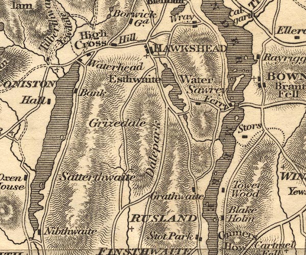 OT02SD39.jpg item:- JandMN : 48.1 Image © see bottom of page |
|
|
|
||
| evidence:- | old map:- Greenwood 1824 placename:- Town End |
|
| source data:- | Maps, Map of the County of Westmorland, scale about 1 inch to 1
mile, and Map of the County of Cumberland, scale about 1 inch to
1 mile, etc, by C and J Greenwood, published by George Pringle
jnr, 70 Queen Street, Cheapside, London, 1823 and 1824
respectively. "Town End" |
|
|
|
||
| evidence:- | probably old map:- Ford 1839 map placename:- Townsend |
|
| source data:- | Map, uncoloured engraving, Map of the Lake District of
Cumberland, Westmoreland and Lancashire, scale about 3.5 miles
to 1 inch, published by Charles Thurnam, Carlisle, and by R
Groombridge, 5 Paternoster Row, London, 3rd edn 1843.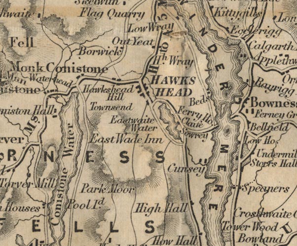 FD02SD39.jpg "Townsend" item:- JandMN : 100.1 Image © see bottom of page |
|
|
|
||
| evidence:- | possibly old map:- Garnett 1850s-60s H placename:- Coniston Bank |
|
| source data:- | Map of the English Lakes, in Cumberland, Westmorland and
Lancashire, scale about 3.5 miles to 1 inch, published by John
Garnett, Windermere, Westmorland, 1850s-60s.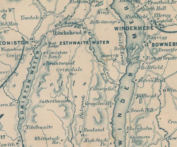 GAR2SD39.jpg "Coniston Bank" block, building item:- JandMN : 82.1 Image © see bottom of page |
|
|
|
||
| hearsay:- |
Referred to as Holly Howe by Arthur Ransome. |
|
|
|
||
 Lakes Guides menu.