 Old Cumbria Gazetteer
 |
 |
|
| Lorton Low Bridge, Low Lorton | ||
| Lorton Low Bridge | ||
| site name:- | Cocker, River | |
| locality:- | Low Lorton | |
| civil parish:- | Lorton (formerly Cumberland) | |
| civil parish:- | Blindbothel (formerly Cumberland) | |
| county:- | Cumbria | |
| locality type:- | bridge | |
| coordinates:- | NY15182564 | |
| 1Km square:- | NY1525 | |
| 10Km square:- | NY12 | |
|
|
||
 CDK91.jpg (taken 23.6.2015) 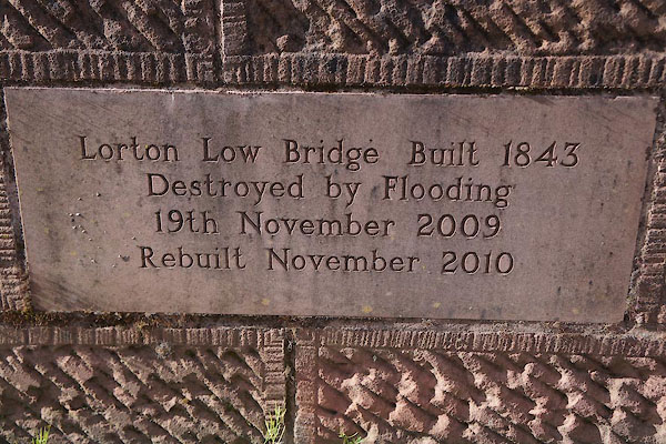 CDK92.jpg (taken 23.6.2015) |
||
|
|
||
| evidence:- | old map:- Donald 1774 (Cmd) |
|
| source data:- | Map, hand coloured engraving, 3x2 sheets, The County of Cumberland, scale about 1
inch to 1 mile, by Thomas Donald, engraved and published by Joseph Hodskinson, 29
Arundel Street, Strand, London, 1774.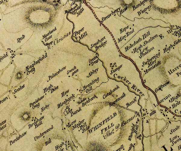 D4NY12NW.jpg double line across a river; a bridge over the Cocker at Lorton item:- Carlisle Library : Map 2 Image © Carlisle Library |
|
|
|
||
| evidence:- | old map:- Bell 1892 placename:- Low Lorton Bridge placename:- Lorton Bridge, Low |
|
| source data:- | Map, colour lithograph, Road Map of Cumberland, by George Joseph
Bell, scale about 2.5 miles to 1 inch, printed by Charles
Thurnam and Sons, Carlisle, Cumberland, 1892.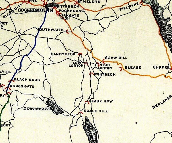 BEL9NY12.jpg "LOW LORTON" bridge symbol Road map of Cumberland showing County Bridges item:- Carlisle Library : Map 38 Image © Carlisle Library |
|
|
|
||
| evidence:- | database:- Listed Buildings 2010 placename:- Lorton Low Bridge |
|
| source data:- | courtesy of English Heritage "LORTON LOW BRIDGE / / / BLINDBOTHEL / ALLERDALE / CUMBRIA / II / 72532 / NY1517925648" |
|
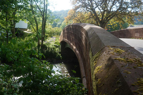
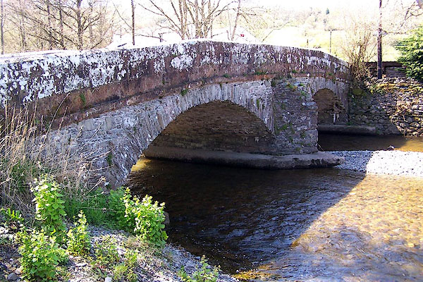
| source data:- | courtesy of English Heritage "Roadbridge. Early C19. Slate rubble with red sandstone parapet. 2 segmental arches on central splayed cutwater. Solid ashlar parapet with saddle-back coping. This lies partly in Lorton C.P." |
|
|
|
||
| MN photo:- |
The old bridge was built 1843 and replaced by a new bridge after the floods of 2009. |
|
 BLZ98.jpg (taken 3.5.2006) 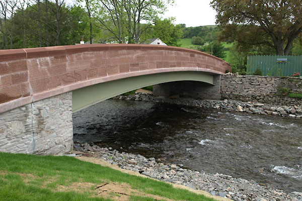 BUO39.jpg (taken 13.5.2011) |
||
|
|
||
 Lakes Guides menu.