 Old Cumbria Gazetteer
 |
 |
|
| Linefoot Junction, Broughton Moor | ||
| Linefoot Junction | ||
| site name:- | Derwent branch railway | |
| site name:- | Cleator and Workington Junction Railway | |
| civil parish:- | Broughton Moor (formerly Cumberland) | |
| county:- | Cumbria | |
| locality type:- | railway junction | |
| coordinates:- | NY07903360 (guess) | |
| 1Km square:- | NY0733 | |
| 10Km square:- | NY03 | |
|
|
||
| evidence:- | old map:- Postlethwaite 1877 (3rd edn 1913) |
|
| source data:- | Map, uncoloured engraving, Map of the Lake District Mining Field, Westmorland, Cumberland,
Lancashire, scale about 5 miles to 1 inch, by John Postlethwaite, published by W H
Moss and Sons, 13 Lowther Street, Whitehaven, Cumberland, 1877 edn 1913.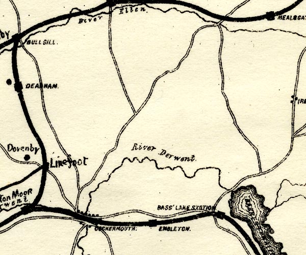 PST2NY13.jpg "Linefoot" railway junction, no clear station symbol item:- JandMN : 162.2 Image © see bottom of page |
|
|
|
||
 Lakes Guides menu.