 Old Cumbria Gazetteer
 |
 |
|
| Lily Mere, Killington | ||
| runs into:- |  Killington Reservoir, Killington Killington Reservoir, Killington |
|
|
|
||
| Lily Mere | ||
| civil parish:- | Killington (formerly Westmorland) | |
| county:- | Cumbria | |
| locality type:- | tarn | |
| coordinates:- | SD60419152 (etc) | |
| 1Km square:- | SD6091 | |
| 10Km square:- | SD69 | |
|
|
||
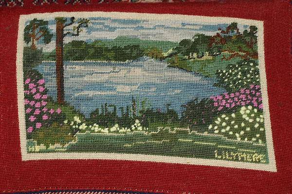 BTY91.jpg Embroidered kneeler, All Saints, Killington. (taken 28.1.2011) |
||
|
|
||
| evidence:- | old map:- OS County Series (Wmd 39 8) placename:- Lily Mere |
|
| source data:- | Maps, County Series maps of Great Britain, scales 6 and 25
inches to 1 mile, published by the Ordnance Survey, Southampton,
Hampshire, from about 1863 to 1948. OS County Series (Wmd 39 12) |
|
|
|
||
| evidence:- | old map:- Garnett 1850s-60s H placename:- Lily Tarn |
|
| source data:- | Map of the English Lakes, in Cumberland, Westmorland and
Lancashire, scale about 3.5 miles to 1 inch, published by John
Garnett, Windermere, Westmorland, 1850s-60s.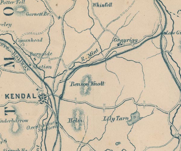 GAR2SD59.jpg "Lily Tarn" outline with shore form lines, lake or tarn item:- JandMN : 82.1 Image © see bottom of page |
|
|
|
||
Lakes Guides menu.