 |
 |
   |
|
|
|
Liddel Strength |
|
Liddel Mote |
| locality:- |
Liddel |
| civil parish:- |
Kirkandrews (formerly Cumberland) |
| county:- |
Cumbria |
| locality type:- |
earthwork |
| locality type:- |
castle |
| locality type:- |
motte and bailey |
| coordinates:- |
NY40177416 |
| 1Km square:- |
NY4074 |
| 10Km square:- |
NY47 |
|
|
| evidence:- |
old map:- OS County Series (Cmd 6 7)
placename:- Liddel Strength
|
| source data:- |
Maps, County Series maps of Great Britain, scales 6 and 25
inches to 1 mile, published by the Ordnance Survey, Southampton,
Hampshire, from about 1863 to 1948.
"Liddel Strength (Remains of)"
|
|
|
| evidence:- |
old map:- Saxton 1579
placename:- Mote, The
|
| source data:- |
Map, hand coloured engraving, Westmorlandiae et Cumberlandiae Comitatus ie Westmorland
and Cumberland, scale about 5 miles to 1 inch, by Christopher Saxton, London, engraved
by Augustinus Ryther, 1576, published 1579-1645.
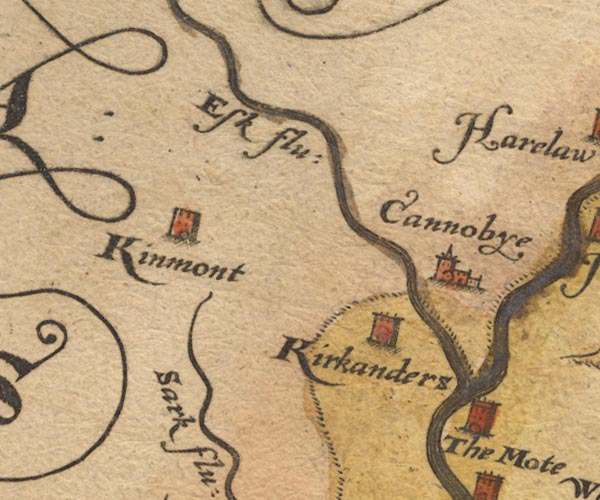
Sax9NY37.jpg
Tower, symbol for a house, hall, tower, etc. "The Mote"
item:- private collection : 2
Image © see bottom of page
|
|
|
| evidence:- |
old map:- Burghley 1590 (facsimile)
placename:- Mote, Ye
|
| source data:- |
Facsimile map, A Platt of the Opposete Border of Scotland to ye West Marches of England,
parts of Cumberland and Scotland including the Debateable Land, from a manuscript
drawn for William Cecil, Lord Burghley, about 1590, published by R B Armstrong, 1897.
courtesy of the National Library of Scotland
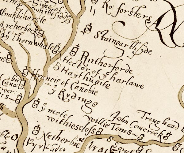
M048NY47.jpg
"ye mote"
circle, tower, cross
item:- National Library of Scotland : MS6113 f.267
Image © National Library of Scotland |
|
|
| evidence:- |
old map:- Mercator 1595 (edn?)
placename:- Mothe, The
|
| source data:- |
Map, hand coloured engraving, Northumbria, Cumberlandia, et
Dunelmensis Episcopatus, ie Northumberland, Cumberland and
Durham etc, scale about 6.5 miles to 1 inch, by Gerard Mercator,
Duisberg, Germany, about 1595.
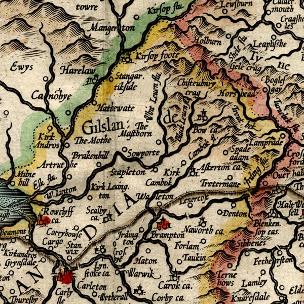
MER8CumA.jpg
"The Mothe"
circle
item:- JandMN : 169
Image © see bottom of page
|
|
|
| evidence:- |
old text:-
placename:- Mote of Lyddell
|
| source data:- |
James VI of Scotland, later James I, wrote to Henry Leigh, the english deputy Warden,
advising that he was undertaking a punitive expedition against his lawless subjects
of the scottish West March, November 1597, and asking for a little coperation from
England:- "... we have resolved to passe forward uppon them with fyre and sword upon Tuesday
next, to their extermination and wreike ... and intreat yow that yow wilbe in redynes
with some sufficient force, to remaine at the Mote of Lyddell ... for hawlding them
in that syde, ..."
|
|
|
| evidence:- |
old map:- Keer 1605
placename:- Mote, The
|
| source data:- |
Map, hand coloured engraving, Westmorland and Cumberland, scale
about 16 miles to 1 inch, probably by Pieter van den Keere, or
Peter Keer, about 1605 edition perhaps 1676.
 click to enlarge click to enlarge
KER8.jpg
"The Mote"
dot, circle and tower; village
item:- Dove Cottage : 2007.38.110
Image © see bottom of page
|
|
|
| evidence:- |
old map:- Speed 1611 (Cmd)
placename:- Mote, The
|
| source data:- |
Map, hand coloured engraving, Cumberland and the Ancient Citie
Carlile Described, scale about 4 miles to 1 inch, by John Speed,
1610, published by J Sudbury and George Humble, Popes Head
Alley, London, 1611-12.
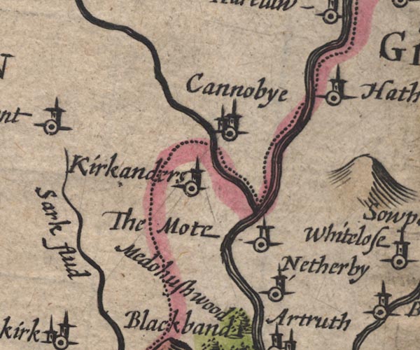
SP11NY37.jpg
"The Mote"
circle, tower
item:- private collection : 16
Image © see bottom of page
|
|
|
| evidence:- |
probably old map:- Jenner 1643
placename:- Modre, Ye
|
| source data:- |
Tables of distances with a maps, Westmerland, scale about 16
miles to 1 inch, and Cumberland, scale about 21 miles to 1 inch,
published by Thomas Jenner, London, 1643; published 1643-80.

JEN4Sq.jpg
"y Modre"
circle
|
|
|
| evidence:- |
old map:- Jansson 1646
placename:- Mote, The
|
| source data:- |
Map, hand coloured engraving, Cumbria and Westmoria, ie
Cumberland and Westmorland, scale about 3.5 miles to 1 inch, by
John Jansson, Amsterdam, Netherlands, 1646.
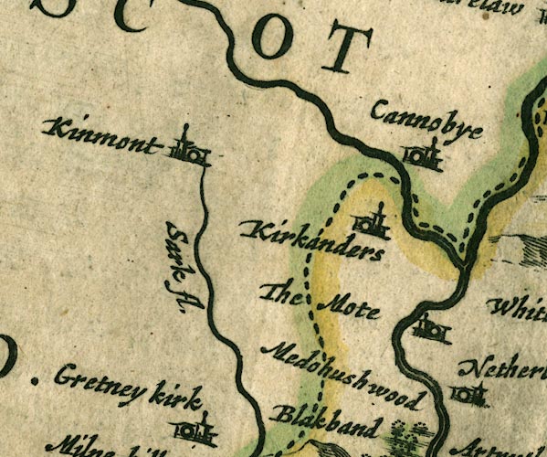
JAN3NY37.jpg
"The Mote"
Buildings and tower.
item:- JandMN : 88
Image © see bottom of page
|
|
|
| evidence:- |
old map:- Ogilby 1675 (plate 62)
placename:- Mote, The
|
| source data:- |
Raod strip map, uncoloured engraving, the Road from Carlisle to
Barwick, scale about 1 inch to 1 mile, by John Ogilby, London,
1675.
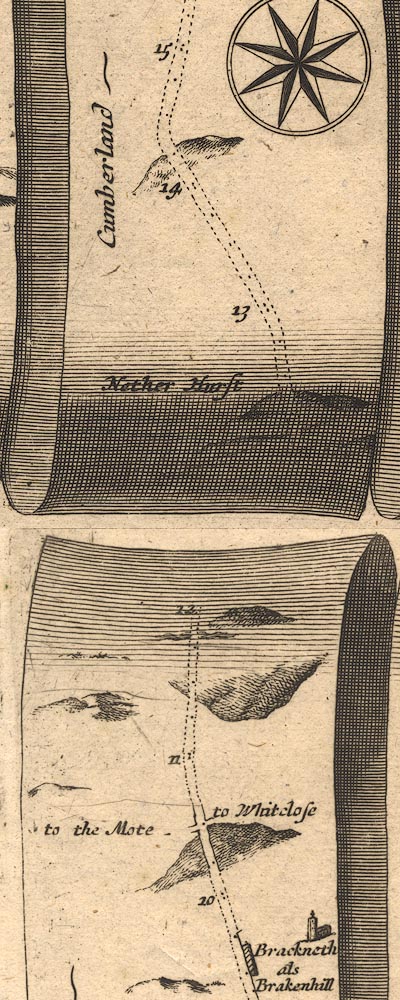
OG62m010.jpg
In mile 10, Cumberland.
Crossroads, left:- "to the Mote"
right:- "to Whitclose"
item:- JandMN : 83
Image © see bottom of page
|
|
|
| evidence:- |
old map:- Morden 1695 (Cmd)
placename:- Mote, The
|
| source data:- |
Map, uncoloured engraving, Cumberland, scale about 4 miles to 1
inch, by Robert Morden, 1695, published by Abel Swale, the
Unicorn, St Paul's Churchyard, Awnsham, and John Churchill, the
Black Swan, Paternoster Row, London, 1695-1715.
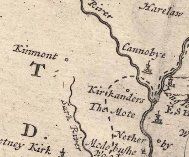
MD12NY37.jpg
"The Mote"
Circle, building and tower.
item:- JandMN : 90
Image © see bottom of page
|
|
|
| evidence:- |
probably old map:- Bowen and Kitchin 1760
placename:- Mote, The
|
| source data:- |
Map, hand coloured engraving, A New Map of the Counties of
Cumberland and Westmoreland Divided into their Respective Wards,
scale about 4 miles to 1 inch, by Emanuel Bowen and Thomas
Kitchin et al, published by T Bowles, Robert Sayer, and John
Bowles, London, 1760.
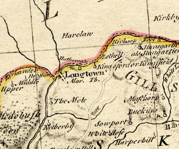
BO18NY47.jpg
"The Mote"
circle and line
item:- Armitt Library : 2008.14.10
Image © see bottom of page
|
|
|
| evidence:- |
probably old map:- Donald 1774 (Cmd)
|
| source data:- |
Map, hand coloured engraving, 3x2 sheets, The County of Cumberland, scale about 1
inch to 1 mile, by Thomas Donald, engraved and published by Joseph Hodskinson, 29
Arundel Street, Strand, London, 1774.
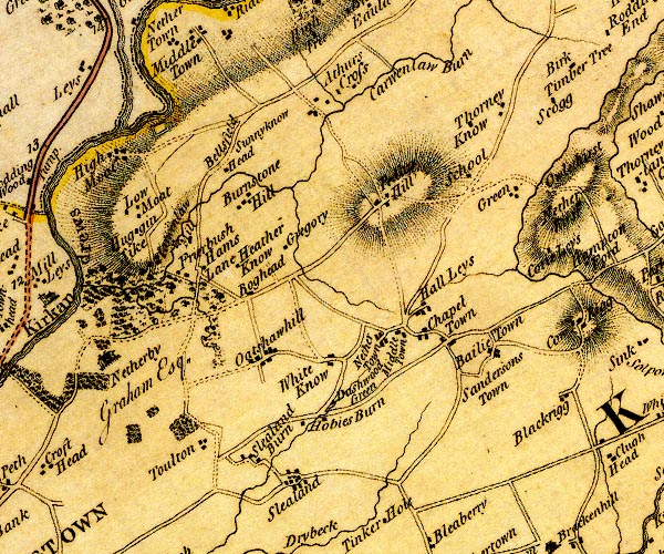
D4NY47SW.jpg
rectangular outline
item:- Carlisle Library : Map 2
Image © Carlisle Library |
|
|
| evidence:- |
old text:- Camden 1789
placename:- Liddel Castle
|
| source data:- |
Book, Britannia, or A Chorographical Description of the Flourishing Kingdoms of England,
Scotland, and Ireland, by William Camden, 1586, translated from the 1607 Latin edition
by Richard Gough, published London, 1789.
 goto source goto source
Page 176:- "..."
"Where the river Lidd falls into the Esk was formerly, as I have been told, Liddel,
a castle and barony of the Estotevilles, who "held lands in Cornage which earl Ranulph
gave to Turgis Brundas," as we find in an antient inquisition; but from Estoteville
it came by inheritance to the Wakes, and by them to the earls of Kent; but John earl
of Kent, gave it to king Edward III. and king Richard II. to John of Gaunt duke of
Lancaster. ..."
|
|
|
| evidence:- |
old text:- Camden 1789 (Gough Additions)
placename:- Liddel's Strength
placename:- Lithel
placename:- Mote, The
|
| source data:- |
Book, Britannia, or A Chorographical Description of the Flourishing Kingdoms of England,
Scotland, and Ireland, by William Camden, 1586, translated from the 1607 Latin edition
by Richard Gough, published London, 1789.
 goto source goto source
Page 197:- "..."
""Lithel was a moted place of a gentleman called Sir Walter Seleby, the which was killed
there, and the place destroyed in king Edward III's time, when the Scotts went to
Durham.""
"Liddel's Strength, or the Mote, a strong entrenchment, with a double ditch two miles
south-west (sic) of Netherby, small, or rather circular, on a steep and lofty clay
cliff above the river Liddel, commanding a vast extent of view, has at one end a very
high mount, in the middle the foundation of a square building, perhaps the praetorium.
It is defended by a sort of half moon, with a vast foss and dike. It was stormed by
David II. king of Scotland. Sir Walter would have compounded for his ransom, but the
Conqueror, after causing his two sons to be strangled before his face, ordered his
head to be struck off."
|
|
|
| evidence:- |
perhaps old map:- Cooper 1808
placename:- Moat
|
| source data:- |
Map, uncoloured engraving, Cumberland, scale about 10.5 miles to
1 inch, drawn and engraved by Cooper, published by R Phillips,
Bridge Street, Blackfriars, London, 1808.
 click to enlarge click to enlarge
COP3.jpg
"Moat"
circle; village or hamlet
item:- JandMN : 86
Image © see bottom of page
|
|
|
| evidence:- |
old text:- Gents Mag
placename:- Liddel Castle
|
| source data:- |
Magazine, The Gentleman's Magazine or Monthly Intelligencer or
Historical Chronicle, published by Edward Cave under the
pseudonym Sylvanus Urban, and by other publishers, London,
monthly from 1731 to 1922.
 goto source goto source
Gentleman's Magazine 1819 part 1 p.505
From the Compendium of County History:- "1346. Liddel castle taken by assault, its governor Sir Walter Selby beheaded, and
Lanercost priory plundered, by David Bruce King of Scotland."
|
|
|
| evidence:- |
old print:- Curwen 1913
placename:- Liddel Motte
|
| source data:- |
Print, halftone photograph, Liddel Motte from the inner bailey, Liddel Strength, Kirkandrews,
Cumberland, published for the Cumberland and Westmorland Antiquarian and Archaeological
Society by Titus Wilson, Kendal, Westmorland, 1913.
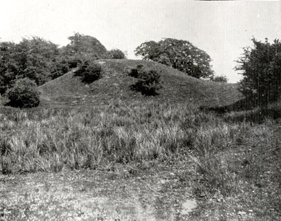 click to enlarge click to enlarge
CW0101.jpg
Tipped in opposite p.24 of The Castles and Fortified Towers of Cumberland, Westmorland,
and Lancashire North of the Sands, by John F Curwen.
item:- Armitt Library : A782.1
Image © see bottom of page
|
|
|
| evidence:- |
old print:- Curwen 1913
placename:- Liddel Motte
|
| source data:- |
Print, halftone photograph, Liddel Motte detail, Liddel Strength, Kirkandrews, Cumberland,
published for the Cumberland and Westmorland Antiquarian and Archaeological Society
by Titus Wilson, Kendal, Westmorland, 1913.
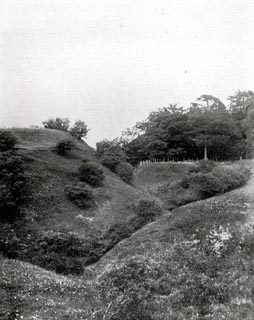 click to enlarge click to enlarge
CW0104.jpg
Tipped in opposite p.28 of The Castles and Fortified Towers of Cumberland, Westmorland,
and Lancashire North of the Sands, by John F Curwen.
item:- Armitt Library : A782.4
Image © see bottom of page
|
|
|
| evidence:- |
old print:- Curwen 1913
placename:- Liddel Motte
|
| source data:- |
Print, halftone photograph, Liddel Motte from the outer bailey, Liddel Strength, Kirkandrews,
Cumberland, published for the Cumberland and Westmorland Antiquarian and Archaeological
Society by Titus Wilson, Kendal, Westmorland, 1913.
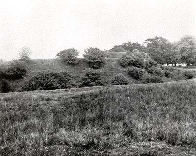 click to enlarge click to enlarge
CW0102.jpg
Tipped in opposite p.25 of The Castles and Fortified Towers of Cumberland, Westmorland,
and Lancashire North of the Sands, by John F Curwen.
item:- Armitt Library : A782.2
Image © see bottom of page
|
|
|
| evidence:- |
site plan:- Curwen 1913
placename:- Liddel Motte
|
| source data:- |
Site plan, lithograph, Plan of Liddel Motte, Liddel Strength, Kirkandrews, Cumberland,
scale about 1 to 1300, published for the Cumberland and Westmorland Antiquarian and
Archaeological Society by Titus Wilson, Kendal, Westmorland, 1913.
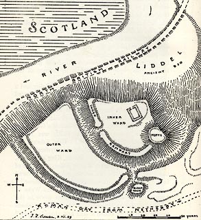 click to enlarge click to enlarge
CW0103.jpg
On p.26 of The Castles and Fortified Towers of Cumberland, Westmorland, and Lancashire
North of the Sands, by John F Curwen.
printed at bottom:- "PLAN OF LIDDEL MOTTE."
item:- Armitt Library : A782.3
Image © see bottom of page
|
|
|
notes:-
|
The Mote on old maps seems more likely to be Liddel Strength than Highmoat or Lowmoat.
|
|
Beware: on some maps the Mote and Netherby are shown south of Longtown.
|
|
|
notes:-
|
earthworks, possible site of a tower; but also lists a tower or motte separately a
little further south
|
|
Perriam, D R &Robinson, J: 1998: Medieval Fortified Buildings of Cumbria: CWAAS::
ISBN 1 873124 23 6; illustrations
|
|
|


 click to enlarge


 goto source
 goto source
 click to enlarge
 goto source
 click to enlarge
 click to enlarge
 click to enlarge
 click to enlarge