 Old Cumbria Gazetteer
 |
 |
|
||||||||||||||||||||||||
| Langdale Pikes, Lakes | ||||||||||||||||||||||||||
| Langdale Pikes | ||||||||||||||||||||||||||
| locality:- | Great Langdale | |||||||||||||||||||||||||
| civil parish:- | Lakes (formerly Westmorland) | |||||||||||||||||||||||||
| county:- | Cumbria | |||||||||||||||||||||||||
| locality type:- | hill | |||||||||||||||||||||||||
| coordinates:- | NY27810723 (etc) | |||||||||||||||||||||||||
| 1Km square:- | NY2707 | |||||||||||||||||||||||||
| 10Km square:- | NY20 | |||||||||||||||||||||||||
|
|
||||||||||||||||||||||||||
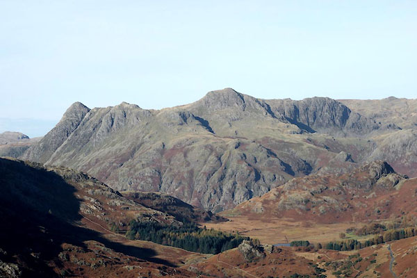 CBZ78.jpg (taken 29.10.2014) 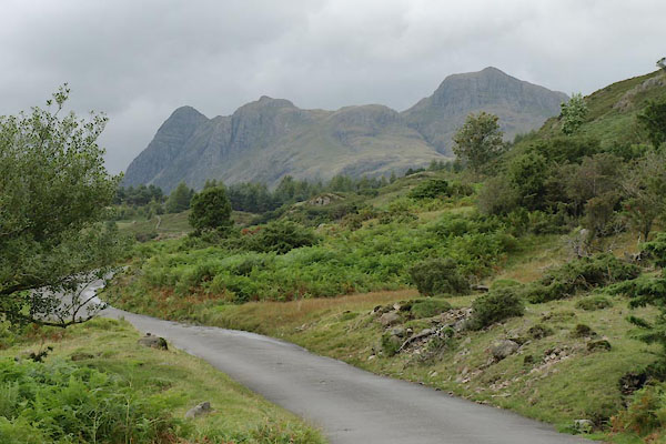 BTJ50.jpg Pike of Stickle on the left, then two summits of Loft Crag, Dungeon Ghyll, and the height of Harrison Stickle. (taken 12.5.2008) |
||||||||||||||||||||||||||
|
|
||||||||||||||||||||||||||
| evidence:- | old map:- OS County Series (Wmd 25 2) placename:- Langdale Pikes |
|||||||||||||||||||||||||
| source data:- | Maps, County Series maps of Great Britain, scales 6 and 25
inches to 1 mile, published by the Ordnance Survey, Southampton,
Hampshire, from about 1863 to 1948. |
|||||||||||||||||||||||||
|
|
||||||||||||||||||||||||||
| evidence:- | old map:- Jefferys 1770 (Wmd) placename:- Langdale Pykes |
|||||||||||||||||||||||||
| source data:- | Map, 4 sheets, The County of Westmoreland, scale 1 inch to 1
mile, surveyed 1768, and engraved and published by Thomas
Jefferys, London, 1770.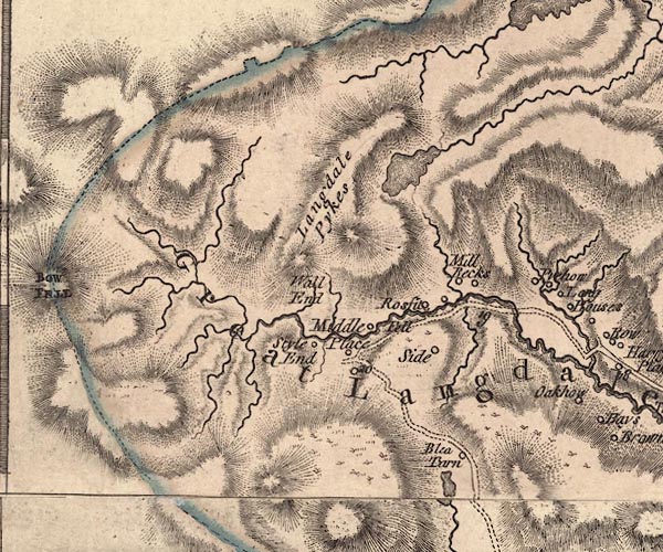 J5NY20NE.jpg "Langdale Pykes" hill hachuring; hill or mountain item:- National Library of Scotland : EME.s.47 Image © National Library of Scotland |
|||||||||||||||||||||||||
|
|
||||||||||||||||||||||||||
| evidence:- | descriptive text:- West 1778 (11th edn 1821) placename:- Pike a Stickle placename:- Steel Pike |
|||||||||||||||||||||||||
| source data:- | Guide book, A Guide to the Lakes, by Thomas West, published by
William Pennington, Kendal, Cumbria once Westmorland, and in
London, 1778 to 1821. goto source goto source goto source goto sourcePage 104:- "... Langdale-pike, called Pike-a-Stickle, and Steel-pike, is an accessible pyramidal rock, and commands the whole [Stake Pass]. Here nature seems to have discharged all her useless load of matter and rock, when form was first impressed on chaos. ..." "..." goto sourcePage 107:- "The prospect to the south [from Latrigg] ... full into the rocky jaws of Borrowdale, ... In the rear, Langdale-pike, advancing to the clouds his cone-like head, overlooks them all. ..." goto sourceRev Plumtre's Night Piece on Windermere, 1797 Page 230:- "..." "Say, Brathay, as I walk your side, / List'ning to your murmuring tide, / What sights, what wonders have you seen, / Passing your barrier hills between? / View'd you old Langdale's solid towers,[1] / ... / Or, rather higher Langdale's rocks, / Hardknot and his mountain twin, /" "[1] Langdale Pikes" |
|||||||||||||||||||||||||
|
|
||||||||||||||||||||||||||
| evidence:- | old map:- West 1784 map placename:- Langdale Pikes |
|||||||||||||||||||||||||
| source data:- | Map, hand coloured engraving, A Map of the Lakes in Cumberland,
Westmorland and Lancashire, scale about 3.5 miles to 1 inch,
engraved by Paas, 53 Holborn, London, about 1784.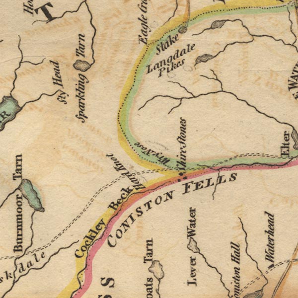 Ws02NY20.jpg Shown by a couple of small circles of hachuring. item:- Armitt Library : A1221.1 Image © see bottom of page |
|||||||||||||||||||||||||
|
|
||||||||||||||||||||||||||
| evidence:- | old drawing:- Green 1790s-1820s placename:- Langdale Pikes |
|||||||||||||||||||||||||
| source data:- | Drawing, pencil, Langdale Pikes from Loughrigg, Westmorland, by William Green, Ambleside,
Westmorland, 1800s-10s?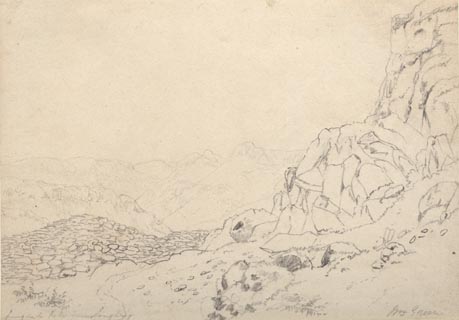 click to enlarge click to enlargePR1740.jpg ms, pencil at lower left:- "Langdale Pikes from Loughrigg" ms, pencil at lower right:- "Wm. Green" item:- Dove Cottage : 1994.118.6 Image © see bottom of page |
|||||||||||||||||||||||||
|
|
||||||||||||||||||||||||||
| evidence:- | old map:- Cooke 1802 placename:- Langdale Pikes |
|||||||||||||||||||||||||
| source data:- | Map, The Lakes, Westmorland and Cumberland, scale about 8.5
miles to 1 inch, engravedby Neele and Son, published by
Sherwood, Jones and Co, Paternoster Road, London, 1824. click to enlarge click to enlargeGRA1Lk.jpg "Langdale Pikes" hill hachuring; mountains item:- Hampshire Museums : FA2000.62.5 Image © see bottom of page |
|||||||||||||||||||||||||
|
|
||||||||||||||||||||||||||
| evidence:- | old print:- Green 1810 (plate 51) placename:- Langdale Pikes |
|||||||||||||||||||||||||
| source data:- | Print, soft ground etching, Langdale Pikes from Oak How, Great Langdale, Westmorland,
by William Green, Ambleside, Westmorland, 1809.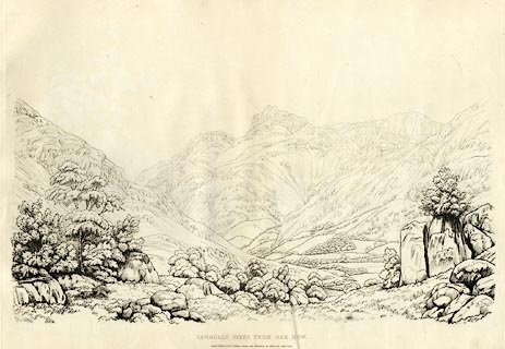 click to enlarge click to enlargeGN1251.jpg Plate 51 in Sixty Studies from Nature, 1810. printed at top right:- "51" printed at bottom:- "LANGDALE PIKES FROM OAK HOW. / Drawn &Engraved by William Green, and Published at Ambleside, Augst. 1, 1809." watermark:- "J WHATMAN / 1813" item:- Armitt Library : A6641.51 Image © see bottom of page |
|||||||||||||||||||||||||
|
|
||||||||||||||||||||||||||
| evidence:- | old print:- Green 1814 (plate 14) placename:- Langdale Pikes |
|||||||||||||||||||||||||
| source data:- | Print, uncoloured soft ground etching, Langdale Pikes from Oak How, Great Langdale,
Westmorland, by William Green, Ambleside, Westmorland, 1814.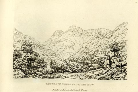 click to enlarge click to enlargeGN0914.jpg Plate 14 in Sixty Small Prints. printed at top right:- "14" printed at bottom:- "LANGDALE PIKES FROM OAK HOW. / Published at Ambleside Augst. 1, 1814, by Wm. Green." item:- Armitt Library : A6656.14 Image © see bottom of page |
|||||||||||||||||||||||||
|
|
||||||||||||||||||||||||||
| evidence:- | old print:- Green 1814 (plate 14) placename:- Langdale Pikes |
|||||||||||||||||||||||||
| source data:- | Print, tinted soft ground etching, Langdale Pikes from Oak How, Great Langdale, Westmorland,
by William Green, Ambleside, Westmorland, 1814.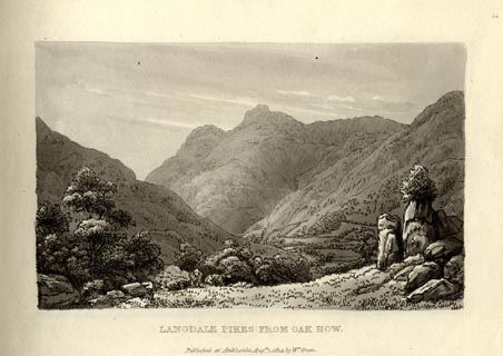 click to enlarge click to enlargeGN1014.jpg Plate 14 in Sixty Small Prints. printed at top right:- "14" printed at bottom:- "LANGDALE PIKES FROM OAK HOW. / Published at Ambleside Augst. 1, 1814, by Wm. Green." item:- Armitt Library : A6653.14 Image © see bottom of page |
|||||||||||||||||||||||||
|
|
||||||||||||||||||||||||||
| evidence:- | old print:- Green 1814 (plate 6) item:- cattle |
|||||||||||||||||||||||||
| source data:- | Print, uncoloured soft ground etching, Head of Windermere from Low Wood, Windermere,
Westmorland, by William Green, Ambleside, Westmorland, 1814.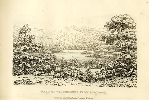 click to enlarge click to enlargeGN0906.jpg Plate 6 in Sixty Small Prints. printed at top right:- "6" printed at bottom:- "HEAD OF WINDERMERE FROM LOW WOOD. / Published at Ambleside Augst. 1, 1814, by Wm. Green." item:- Armitt Library : A6656.6 Image © see bottom of page |
|||||||||||||||||||||||||
|
|
||||||||||||||||||||||||||
| evidence:- | old print:- Green 1814 (plate 6) item:- cattle |
|||||||||||||||||||||||||
| source data:- | Print, tinted soft ground etching, Head of Windermere from Low Wood, Windermere, Westmorland,
by William Green, Ambleside, Westmorland, 1814.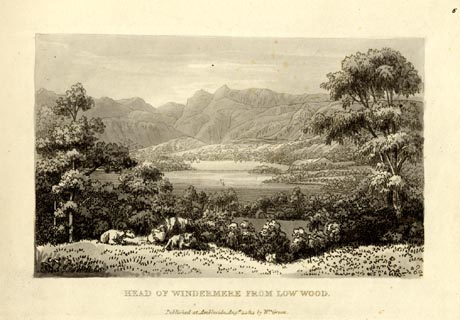 click to enlarge click to enlargeGN1006.jpg Plate 6 in Sixty Small Prints. printed at top right:- "6" printed at bottom:- "HEAD OF WINDERMERE FROM LOW WOOD. / Published at Ambleside Augst. 1, 1814, by Wm. Green." item:- Armitt Library : A6653.6 Image © see bottom of page |
|||||||||||||||||||||||||
|
|
||||||||||||||||||||||||||
| evidence:- | old print:- Green 1814 (plate 13) |
|||||||||||||||||||||||||
| source data:- | Print, uncoloured soft ground etching, Blea Tarn, Little Langdale, Westmorland, by
William Green, Ambleside, Westmorland, 1814.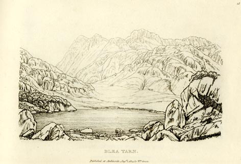 click to enlarge click to enlargeGN0913.jpg The Langdale Pikes behind. Plate 13 in Sixty Small Prints. printed at top right:- "13" printed at bottom:- "BLEA TARN. / Published at Ambleside Augst. 1, 1814, by Wm. Green." item:- Armitt Library : A6656.13 Image © see bottom of page |
|||||||||||||||||||||||||
|
|
||||||||||||||||||||||||||
| evidence:- | old print:- Green 1814 (plate 13) |
|||||||||||||||||||||||||
| source data:- | Print, tinted soft ground etching, Blea Tarn, Little Langdale, Westmorland, by William
Green, Ambleside, Westmorland, 1814.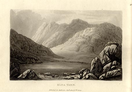 click to enlarge click to enlargeGN1013.jpg The Langdale Pikes behind. Plate 13 in Sixty Small Prints. printed at top right:- "13" printed at bottom:- "BLEA TARN. / Published at Ambleside Augst. 1, 1814, by Wm. Green." item:- Armitt Library : A6653.13 Image © see bottom of page |
|||||||||||||||||||||||||
|
|
||||||||||||||||||||||||||
| evidence:- | old print:- Green 1815 |
|||||||||||||||||||||||||
| source data:- | Print, coloured aquatint, Windermere taken near Low Wood, Westmorland, by William
Green, Ambleside, Westmorland, 1815.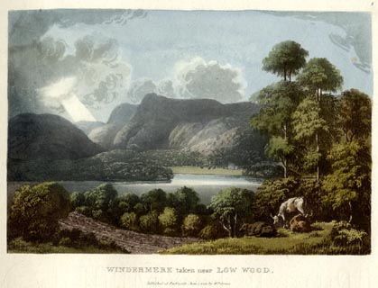 click to enlarge click to enlargeGN0507.jpg The Langdale Pikes in the background. Plate 8 in Lake Scenery. printed at upper right:- "8" printed at bottom:- "WINDERMERE taken near LOW WOOD. / Published at Ambleside, June 1, 1815, by Wm. Green." item:- Armitt Library : A6646.7 Image © see bottom of page |
|||||||||||||||||||||||||
|
|
||||||||||||||||||||||||||
| evidence:- | old print:- Green 1815 placename:- Langdale Head |
|||||||||||||||||||||||||
| source data:- | Print, coloured aquatint, Langdale Head from Wall End, Great Langdale, Westmorland,
by William Green, Ambleside, Westmorland, 1815.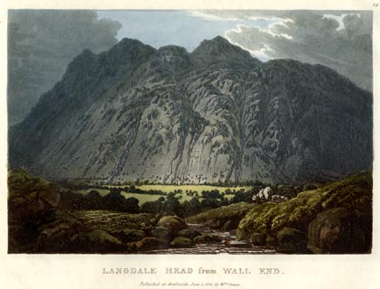 click to enlarge click to enlargeGN0513.jpg The Langdale Pikes. Plate 14 in Lake Scenery. printed at upper right:- "14" printed at bottom:- "LANGDALE HEAD from WALL END. / Published at Ambleside, June 1, 1815, by Wm. Green." item:- Armitt Library : A6646.13 Image © see bottom of page |
|||||||||||||||||||||||||
|
|
||||||||||||||||||||||||||
| evidence:- | old print:- Fielding and Walton 1821 (plate 13) placename:- Langdale Pikes |
|||||||||||||||||||||||||
| source data:- | Print, coloured aquatint, Windermere, from Troutbeck Lane, with Langdale Pikes, Westmorland,
drawn by Theodore H A Fielding, published by R Ackermann, 101 Strand, London, 1821. click to enlarge click to enlargeFW0113.jpg Tipped in opposite p.72 in A Picturesque Tour of the English Lakes. item:- Dove Cottage : 1993.R566.13 Image © see bottom of page |
|||||||||||||||||||||||||
|
|
||||||||||||||||||||||||||
| evidence:- | old print:- Otley 1823 (8th edn 1849) placename:- Langdale Pikes |
|||||||||||||||||||||||||
| source data:- | Engraving, Loughrigg Tarn with Langdale Pikes, drawn by T Binns, engraved by O Jewitt,
on p.1 of A Descriptive Guide of the English Lakes, by Jonathan Otley, 8th edition,
1849.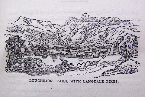 click to enlarge click to enlargeO80E01.jpg item:- Armitt Library : A1180.2 Image © see bottom of page |
|||||||||||||||||||||||||
|
|
||||||||||||||||||||||||||
| evidence:- | descriptive text:- Otley 1823 (5th edn 1834) item:- viewpoint |
|||||||||||||||||||||||||
| source data:- | Guide book, A Concise Description of the English Lakes, the
mountains in their vicinity, and the roads by which they may be
visited, with remarks on the mineralogy and geology of the
district, by Jonathan Otley, published by the author, Keswick,
Cumberland now Cumbria, by J Richardson, London, and by Arthur
Foster, Kirkby Lonsdale, Cumbria, 1823; published 1823-49,
latterly as the Descriptive Guide to the English Lakes. goto source Page 45:- "... as a picture, the fall [Skelwith Force] is better seen from the Lancashire side, where the Langdale Pikes, appearing between the cheeks of the rock, make an excellent distance." goto sourcePage 74:- "LANGDALE PIKES,[1]" "Called Pike of Stickle, and Harrison Stickle, are by their peculiar form distinguished at a great distance. They afford some good views to the south east: but being encompassed on other sides by higher mountains, the prospect is somewhat limited. ..." "[1] These Pikes should always be distinguished from the Pikes of Wasdale Head, by some called the Pikes of Scawfell." |
|||||||||||||||||||||||||
|
|
||||||||||||||||||||||||||
| evidence:- | old title page:- Rose 1832-35 (vol.1 Tit) placename:- Langdale Pikes |
|||||||||||||||||||||||||
| source data:- | Title page of a set of prints, Westmorland, Cumberland, Durham,
and Northumberland, Illustrated, pictures drawn by Thomas Allom,
George Pickering, and H Gastineau, descriptions by Thomas Rose,
published by Fisher, Son and Co, London, 1832-35.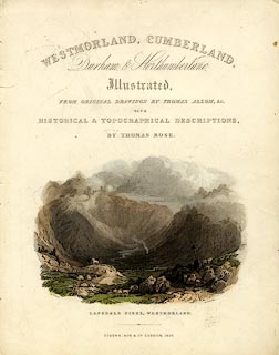 click to enlarge click to enlargePR0392.jpg Title page of a set of prints, Westmorland, Cumberland, Durham and Northumberland Illustrated, pictures drawn by Thomas Allom, George Pickering, and H Gastineau, descriptions by Thomas Rose, published by Fisher, Son and Co, London, 1832-35. The page has a hand coloured engraving of the Langdale Pikes, Westmorland, drawn by T Allom, engraved by T Jeavons. printed at :- "WESTMORLAND / CUMBERLAND, / Durham and Northumberland, / Illustrated, / FROM ORIGINAL DRAWINGS BY THOMAS ALLOM, &c. / WITH / HISTORICAL & TOPOGRAPHICAL DESCRIPTIONS, / BY THOMAS ROSE. / ... / FISHER, SON, &CO. LONDON, 1832." printed at bottom left, right, centre of print:- "T. Allom. / T. Jeavons. / LANGDALE PIKES, WESTMORLAND." item:- Dove Cottage : 2008.107.1 Image © see bottom of page |
|||||||||||||||||||||||||
|
|
||||||||||||||||||||||||||
| evidence:- | descriptive text:- Ford 1839 (3rd edn 1843) placename:- Langdale Pikes item:- altitude, Langdale Pikes |
|||||||||||||||||||||||||
| source data:- | Guide book, A Description of Scenery in the Lake District, by
Rev William Ford, published by Charles Thurnam, Carlisle, by W
Edwards, 12 Ave Maria Lane, Charles Tilt, Fleet Street, William
Smith, 113 Fleet Street, London, by Currie and Bowman,
Newcastle, by Bancks and Co, Manchester, by Oliver and Boyd,
Edinburgh, and by Sinclair, Dumfries, 1839. goto source "... THE Lake district ... consists of large masses or clusters of mountains, generally terminating in one aspiring and pre-eminent point, with the intermediate valleys occupied either by lakes and their subsidiary tarns, or by winding rivers." "The chief nuclei of these clusters are, Skiddaw and Blencathra, Helvellyn, Fairfield, Coniston Old Man, Blackcomb, Scafell, Gable, Red Pike, Grasmoor, Grisdale Pike, and the Langdale Pikes. Many noble and commanding mountains rise around these, rivalling them in height and grandeur, but still" goto sourcePage iv:- "serving as large buttresses only. In the presentation of endlessly-diversified forms, these Mountains yield to none, however individually inferior they may be, owing to their being seldom seen in a detached point of view; although, on the other hand, they have thus the advantage of forming combinations at once grand and sublime, towering above each other, or rising in ridges, like the mighty billows of the ocean." goto sourcePage 36:- "..." "LANGDALE AND THE PIKES." "'We started - and he led towards the hills, Up through an ample vale, with higher hills Before us, mountains stern and desolate; But, in the majesty of distance now Set off, and to our view appearing fair Of aspect, with aerial softness clad. And beautified with morning's purple beams.'" "The chief excursion, and one accomplished with most advantage from this station [Ambleside], is that to the two Langdales, and the Pikes. The best views are looking up the vale, that is, in a westward direction. ..." goto sourcePage 38:- "... Mill Beck, whence is commenced the ascent of the Pikes." "In a fissure of the mountain, and enclosed by gloomy rocks, is Dungeon Gill, ..." "Stickle Tarn is a circular piece of water in the bosom of the mountain, ..." "The summit of the mountain is crowned with three lofty pikes, all composed of perpendicular rocks, and seeming like pillars to support the heavens." "'-- There the sun himself, At the calm close of summer's longest day, Rests his substantial orb; between those heights, And on the top of either pinnacle, More keenly than elsewhere in night's blue vault, Sparkle the stars, as of their station proud.'" "They appear to rise not far from each other, but it takes many a weary and toilsome step to travel" goto sourcePage 39:- "from one to the other. The north-west pike is the lowest, but most regular and conical; the south, is more broken and rugged; and the east, which is the highest and most easy of ascent, overlooks the rest, and all these mountain regions, rising in masses, that are beheld with somewhat of terror. Langdale Head and Scafell Pikes are quite close. On the right are Great End in Borrowdale, Seatoller in Yewbarrow, Great Gable in Wastdale, Glaramara and Rosthwaite Cam, Grasmire, Grizedale and Causey Pikes, Lord's Seat, and the distant coasts of Cumberland and Scotland. In a northern direction are seen Skiddaw, and on the left of him Helvellyn, Fairfield, and Wansfell, Ambleside, with Windermere, Loughrigg Tarn, Elter Water, and Esthwaite Water." goto sourcePage 162:- "..." "... to the head of Great Langdale, the Langdale Pikes appear immediately in front, with Bowfell on the left. The conical pike is called Pike of Stickle, and the broad-headed pike, Harrison Stickle. ..." goto sourcePage 178:- "ELEVATION OF THE MOUNTAINS," "ACCORDING TO DIFFERENT AUTHORITIES."
|
|||||||||||||||||||||||||
|
|
||||||||||||||||||||||||||
| evidence:- | old map:- Ford 1839 map placename:- Langdale Pikes |
|||||||||||||||||||||||||
| source data:- | Map, uncoloured engraving, Map of the Lake District of
Cumberland, Westmoreland and Lancashire, scale about 3.5 miles
to 1 inch, published by Charles Thurnam, Carlisle, and by R
Groombridge, 5 Paternoster Row, London, 3rd edn 1843. FD02NY20.jpg "Langdale Pikes" Hill hachuring. item:- JandMN : 100.1 Image © see bottom of page |
|||||||||||||||||||||||||
|
|
||||||||||||||||||||||||||
| evidence:- | old drawing:- Aspland 1840s-60s |
|||||||||||||||||||||||||
| source data:- | Drawing, pencil, Langdale Pikes, Great Langdale, Westmorland, by Theophilus Lindsey
Aspland, 1847.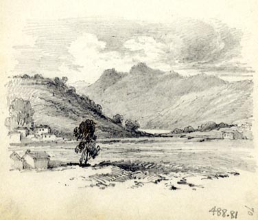 click to enlarge click to enlargeAS0281.jpg page number "70" item:- Armitt Library : 1958.488.81 Image © see bottom of page |
|||||||||||||||||||||||||
|
|
||||||||||||||||||||||||||
| evidence:- | old drawing:- Aspland 1840s-60s |
|||||||||||||||||||||||||
| source data:- | Drawing, pencil, Langdale Fells, including Langdale Pikes, Westmorland, by Theophilus
Lindsey Aspland, 1860s?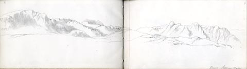 click to enlarge click to enlargeAS0404.jpg "from Sawrey Tarn" page number "4" item:- Armitt Library : 2008.60.4 Image © see bottom of page |
|||||||||||||||||||||||||
|
|
||||||||||||||||||||||||||
| evidence:- | old drawing:- Aspland 1840s-60s |
|||||||||||||||||||||||||
| source data:- | Drawing, pencil, Langdale Pikes, Great Langdale, Westmorland, by Theophilus Lindsey
Aspland, 1849.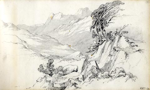 click to enlarge click to enlargeAS0153.jpg item:- Armitt Library : 1958.487.53 Image © see bottom of page |
|||||||||||||||||||||||||
|
|
||||||||||||||||||||||||||
| evidence:- | old drawing:- Aspland 1840s-60s |
|||||||||||||||||||||||||
| source data:- | Drawing, pencil, Blea Tarn and the Langdale Pikes, Langdale, Westmorland, by Theophilus
Lindsey Aspland, 1849.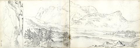 click to enlarge click to enlargeAS0154.jpg "Blea Tarn" item:- Armitt Library : 1958.487.54 Image © see bottom of page |
|||||||||||||||||||||||||
|
|
||||||||||||||||||||||||||
| evidence:- | old map:- Garnett 1850s-60s H placename:- Stickle Pikes |
|||||||||||||||||||||||||
| source data:- | Map of the English Lakes, in Cumberland, Westmorland and
Lancashire, scale about 3.5 miles to 1 inch, published by John
Garnett, Windermere, Westmorland, 1850s-60s. GAR2NY20.jpg "Stickle Pikes" hill hachuring item:- JandMN : 82.1 Image © see bottom of page |
|||||||||||||||||||||||||
|
|
||||||||||||||||||||||||||
| evidence:- | old print:- Nelson 1853 (edn 1880s) placename:- Langdale Pikes |
|||||||||||||||||||||||||
| source data:- | Print, uncoloured, Langdale Pikes, Great Langdale, Westmorland, published by Thomas
Nelson and Sons, London, 1853 edn 1880s?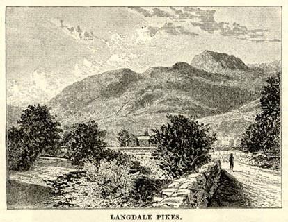 click to enlarge click to enlargeNS0318.jpg On p.48 of Views of the English Lakes, and Tourists Guide to the English Lakes. printed at bottom:- "LANGDALE PIKES." item:- JandMN : 474.19 Image © see bottom of page |
|||||||||||||||||||||||||
|
|
||||||||||||||||||||||||||
| evidence:- | old print with text:- Pyne 1853 placename:- Langdale Pikes |
|||||||||||||||||||||||||
| source data:- | Print, tinted lithograph, Langdale Pikes, Great Langdale, Westmorland, by James Baker
Pyne, engraved by W Gauci, published by Thomas Agnew and Sons, Manchester, Lancashire,
1853.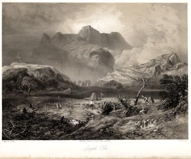 click to enlarge click to enlargePYN213.jpg "PAINTED BY J. B. PYNE. / W. GAUCI LITH. / MANCHESTER, PUBLISHED BY THOMAS AGNEW & SONS, 1853. / Langdale Pikes / M & N HANHART IMPT." From the descriptive text:- "THIS view is taken looking due north from Blea Tarn, a lakelet on Little Langdale. The name Tarn implies a small sheet of water, usually high up among the mountains. Langdale Pikes ... The higher Pike is designated Harrison Stickle, and is 2400 feet in height; the lower one is known as Pike o' Stickle, amd is some hundred feet less elevation. Stickle signifies an abrupt, sharp, pyramidal peak; from the German word stachel, a sharp point. ..." item:- Armitt Library : A6678.14 Image © see bottom of page |
|||||||||||||||||||||||||
|
|
||||||||||||||||||||||||||
| evidence:- | old print:- Pyne 1853 placename:- Langdale Pikes |
|||||||||||||||||||||||||
| source data:- | Print, coloured lithograph, Langdale Pikes, Great Langdale, Westmorland, by James
Baker Pyne, engraved by W Gauci, published by Thomas Agnew and Sons, Manchester, Lancashire,
1853.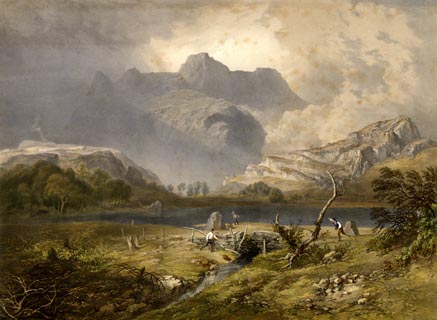 click to enlarge click to enlargePYN413.jpg item:- Armitt Library : A6677.14 Image © see bottom of page |
|||||||||||||||||||||||||
|
|
||||||||||||||||||||||||||
| evidence:- | old text:- Martineau 1855 item:- poem; Excursion, The |
|||||||||||||||||||||||||
| source data:- | Guide book, A Complete Guide to the English Lakes, by Harriet
Martineau, published by John Garnett, Windermere, Westmorland,
and by Whittaker and Co, London, 1855; published 1855-76. goto source Page 148:- "... "The two huge peaks, that from some other vale peer into this," are the Langdale Pikes and very fine is the view of them from this wild and somewhat dreary hollow [near Blea Tarn]. ..." |
|||||||||||||||||||||||||
|
|
||||||||||||||||||||||||||
| evidence:- | old text:- Martineau 1855 item:- altitude, Langdale Pikes |
|||||||||||||||||||||||||
| source data:- | Guide book, A Complete Guide to the English Lakes, by Harriet
Martineau, published by John Garnett, Windermere, Westmorland,
and by Whittaker and Co, London, 1855; published 1855-76. goto source Page 179:- "A TABLE OF THE HEIGHTS OF MOUNTAINS IN THE COUNTIES OF CUMBERLAND, WESTMORLAND, AND LANCASHIRE." "No. : Names of Mountains. : Counties. : Height in Feet above the Sea Level." "17 : Langdale Pikes : Westmorland : 2400" |
|||||||||||||||||||||||||
|
|
||||||||||||||||||||||||||
| evidence:- | old print:- Nelson 1859 placename:- Langdale Pikes |
|||||||||||||||||||||||||
| source data:- | Print, Nelson print, Head of Windermere, Westmorland, published by T Nelson and Sons,
London etc, 1859.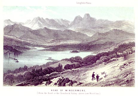 click to enlarge click to enlargeNS0503.jpg printed, bottom "HEAD OF WINDERMERE. / (From the Road to the Ttroutbeck Valley above Low Wood Inn.)" printed, top "Langdale Pikes" item:- Armitt Library : 2003.13.3 Image © see bottom of page |
|||||||||||||||||||||||||
|
|
||||||||||||||||||||||||||
| evidence:- | old print:- Nelson 1859 placename:- Langdale Pikes |
|||||||||||||||||||||||||
| source data:- | Print, Nelson print, Blea Tarn, Little Langdale, Westmorland, published by T Nelson
and Sons, London etc, 1859.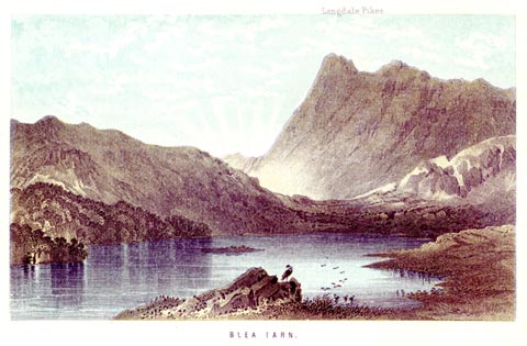 click to enlarge click to enlargeNS0508.jpg printed, bottom "BLEA TARN." printed, top "Langdale Pikes" item:- Armitt Library : 2003.13.8 Image © see bottom of page |
|||||||||||||||||||||||||
|
|
||||||||||||||||||||||||||
| evidence:- | old print:- Walton 1876 placename:- Langdale Pikes |
|||||||||||||||||||||||||
| source data:- | Print, colour lithograph, Langdale Pikes, Westmorland, from a painting by Elijah Walton,
published by W M Thompson, 20 Cockspur Street, Pall Mall, and Burlington Gallery,
Piccadilly, London, 1876. click to enlarge click to enlargeWLT310.jpg Plate 10 in English Lake Scenery, with a description by T G Bonney. item:- JandMN : 469.10 Image © see bottom of page |
|||||||||||||||||||||||||
|
|
||||||||||||||||||||||||||
| evidence:- | old photograph:- Bell 1880s-1940s |
|||||||||||||||||||||||||
| source data:- | Photograph, sepia, near Dungeon Ghyll, Great Langdale, Westmorland, by Herbert Bell,
photographer, Ambleside, Westmorland, 1890s. click to enlarge click to enlargeHB0923.jpg item:- Armitt Library : ALPS600 Image © see bottom of page |
|||||||||||||||||||||||||
|
|
||||||||||||||||||||||||||
| evidence:- | old photograph:- Bell 1880s-1940s item:- reflections |
|||||||||||||||||||||||||
| source data:- | Photograph, sepia, Blea Tarn and the Langdale Pikes, Langdale, Westmorland, by Herbert
Bell, photographer, Ambleside, Westmorland, 1890s. click to enlarge click to enlargeHB0914.jpg internegative at lower left:- "H. Bell" item:- Armitt Library : ALPS589 Image © see bottom of page |
|||||||||||||||||||||||||
|
|
||||||||||||||||||||||||||
| evidence:- | old photograph:- Bell 1880s-1940s |
|||||||||||||||||||||||||
| source data:- | Photograph, black and white, Langdale Pikes, Great Langdale in winter, Westmorland,
by Herbert Bell, photographer, Ambleside, Westmorland, 1890s. click to enlarge click to enlargeHB0645.jpg stamped on reverse:- "HERBERT BELL / Photographer / AMBLESIDE" item:- Armitt Library : ALPS308 Image © see bottom of page |
|||||||||||||||||||||||||
|
|
||||||||||||||||||||||||||
| evidence:- | old photograph:- Bell 1880s-1940s |
|||||||||||||||||||||||||
| source data:- | Photograph, black and white, Great Langdale, Westmorland, by Herbert Bell, photographer,
Ambleside, Westmorland, 1890s.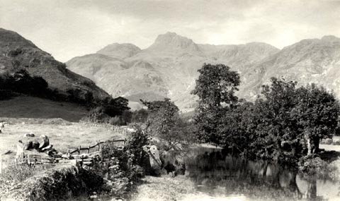 click to enlarge click to enlargeHB0636.jpg stamped on reverse:- "HERBERT BELL / Photographer / AMBLESIDE" item:- Armitt Library : ALPS298 Image © see bottom of page |
|||||||||||||||||||||||||
|
|
||||||||||||||||||||||||||
| evidence:- | old photograph:- Bell 1880s-1940s item:- snow |
|||||||||||||||||||||||||
| source data:- | Photograph, sepia, Langdale Pikes from Lingmoor in winter, Great Langdale, Westmorland,
by Herbert Bell, photographer, Ambleside, Westmorland, 1890s.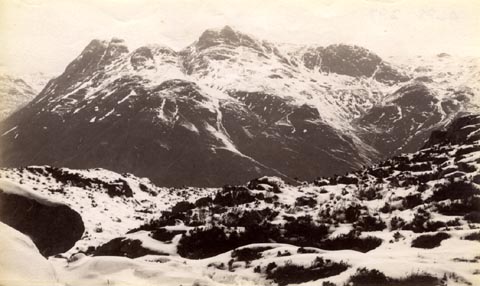 click to enlarge click to enlargeHB0635.jpg item:- Armitt Library : ALPS297 Image © see bottom of page |
|||||||||||||||||||||||||
|
|
||||||||||||||||||||||||||
| evidence:- | old photograph:- Bell 1880s-1940s |
|||||||||||||||||||||||||
| source data:- | Photograph, sepia, Langdale Pikes from Lingmoor, Great Langdale, Westmorland, by Herbert
Bell, photographer, Ambleside, Westmorland, 1890s.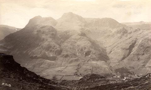 click to enlarge click to enlargeHB0634.jpg internegative at lower left:- "H. Bell" item:- Armitt Library : ALPS296 Image © see bottom of page |
|||||||||||||||||||||||||
|
|
||||||||||||||||||||||||||
| evidence:- | old photograph:- Bell 1880s-1940s |
|||||||||||||||||||||||||
| source data:- | Photograph, black and white, Langdale Pikes, Great Langdale, Westmorland, by Herbert
Bell, photographer, Ambleside, Westmorland, 1890s.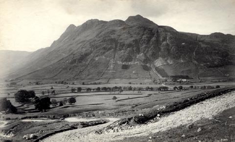 click to enlarge click to enlargeHB0633.jpg internegative at lower right:- "H. Bell" item:- Armitt Library : ALPS295 Image © see bottom of page |
|||||||||||||||||||||||||
|
|
||||||||||||||||||||||||||
| evidence:- | old photograph:- Bell 1880s-1940s |
|||||||||||||||||||||||||
| source data:- | Photograph, b/w, Great Langdale, Westmorland, by Herbert Bell, Ambleside, Westmorland,
1890s?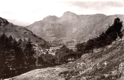 click to enlarge click to enlargeHB0268.jpg at internegative, left, right:- "91. LANGDALE. / H. BELL." item:- Armitt Library : ALPS623 Image © see bottom of page |
|||||||||||||||||||||||||
|
|
||||||||||||||||||||||||||
| evidence:- | old print:- Bemrose 1881 placename:- Langdale Pikes |
|||||||||||||||||||||||||
| source data:- | Print, uncoloured, Langdale Pikes, Great Langdale, Westmorland, published by Bemrose
and Sons, 23 Old Bailey, London and Derby, by A B Moss, Carlisle, Cumberland, and
by T Wilson, Kendal, Westmorland, about 1881.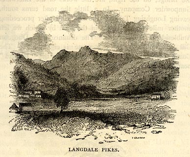 click to enlarge click to enlargeBEM114.jpg On p.53 of a Handy Guide to the English Lakes and Shap Spa. printed at bottom:- "LANGDALE PIKES." item:- JandMN : 455.16 Image © see bottom of page |
|||||||||||||||||||||||||
|
|
||||||||||||||||||||||||||
| evidence:- | old print:- Philip/Wilson 1890s |
|||||||||||||||||||||||||
| source data:- | Print, engraving, Blea Tarn and Langdale Pikes, published by
George Philip and Son, London, Philip, Son and Nephew,
Liverpool, Lancashire, and Titus Wilson, Kendal, Westmorland,
about 1895.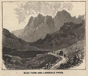 click to enlarge click to enlargePW1E20.jpg "BLEA TARN AND LANGDALE PIKES." item:- JandMN : 58.21 Image © see bottom of page |
|||||||||||||||||||||||||
|
|
||||||||||||||||||||||||||
| evidence:- | old print:- Brabant 1902 placename:- Langdale Pikes |
|||||||||||||||||||||||||
| source data:- | Print, uncoloured lithograph, Langdale Pikes and Great Langdale, Westmorland, by Edmund
H New, published by Methuen and Co, 36 Essex Street, Strand, London, 1902.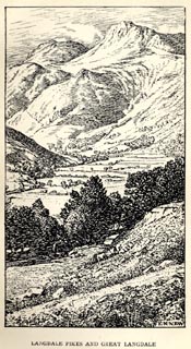 click to enlarge click to enlargeBBT103.jpg Tipped in opposite p.102 of The English Lakes, by F G Brabant. printed at bottom right:- "E. H. NEW" printed at bottom:- "LANGDALE PIKES AND GREAT LANGDALE" item:- JandMN : 502.7 Image © see bottom of page |
|||||||||||||||||||||||||
|
|
||||||||||||||||||||||||||
| evidence:- | old print:- Heaton Cooper 1905 (edn 1908) placename:- Langdale Pikes |
|||||||||||||||||||||||||
| source data:- | Print, colour halftone, Blea Tarn and Langdale Pikes, Langdale, Westmorland, from
a watercolour painting by Alfred Heaton Cooper, published by Adam and Charles Black,
London, 2nd edn 1908.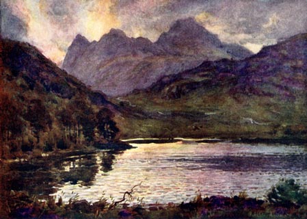 click to enlarge click to enlargeHC0169.jpg Opposite p.210 of The English Lakes, painted by Alfred Heaton Cooper, described by William T Palmer. printed at tissue opposite the print:- "BLEA TARN AND LANGDALE PIKES" printed at signed lower right:- "[A HEATON COOPER]" item:- JandMN : 468.69 Image © see bottom of page |
|||||||||||||||||||||||||
|
|
||||||||||||||||||||||||||
| evidence:- | old print:- Heaton Cooper 1905 (edn 1908) placename:- Langdale Pikes |
|||||||||||||||||||||||||
| source data:- | Print, colour halftone, Elterwater and Langdale Pikes, Westmorland, from a watercolour
painting by Alfred Heaton Cooper, published by Adam and Charles Black, London, 2nd
edn 1908.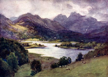 click to enlarge click to enlargeHC0174.jpg Opposite p.220 of The English Lakes, painted by Alfred Heaton Cooper, described by William T Palmer. printed at tissue opposite the print:- "ELTERWATER AND LANGDALE PIKES" printed at signed lower right:- "A HEATON COOPER" item:- JandMN : 468.74 Image © see bottom of page |
|||||||||||||||||||||||||
|
|
||||||||||||||||||||||||||
| evidence:- | text:- Mason 1907 (edn 1930) |
|||||||||||||||||||||||||
| source data:- | Text book, The Ambleside Geography Books bk.III, The Counties of
England, by Charlotte M Mason, published by Kegan Paul, Trench,
Trubner and Co, Broadway House, 68-74 Carter Lane, and the
Parents' Educational Union Office, 26 Victoria Street, London,
edn 1930. MSN1P023.txt Page 23:- "..." "... to know that ... Sca Fell Pikes and Langdale Pikes - are pairs of giants with rounded heads, that you may always recognise." |
|||||||||||||||||||||||||
|
|
||||||||||||||||||||||||||
| evidence:- | old print:- Reynolds 1915 placename:- Langdale Pikes |
|||||||||||||||||||||||||
| source data:- | Print, colour halftone, Blea Tarn and Langdale Pikes, Westmorland, from a painting
by Alfred Heaton Cooper, published by Adam and Charles Black, London, 1915.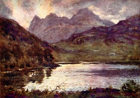 click to enlarge click to enlargeREY607.jpg "A HEATON COOPER" "BLEA TARN AND LANGDALE PIKES." item:- JandMN : 1071.7 Image © see bottom of page |
|||||||||||||||||||||||||
|
|
||||||||||||||||||||||||||
| evidence:- | old photograph:- Marr 1916 placename:- Langdale Pikes |
|||||||||||||||||||||||||
| source data:- | Photograph, halftone print, Langdale Pikes, Westmorland, 1916.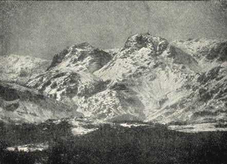 click to enlarge click to enlargeMA1207.jpg item:- JandMN : 173.15 Image © see bottom of page |
|||||||||||||||||||||||||
|
|
||||||||||||||||||||||||||
| evidence:- | old photograph:- Marr 1916 placename:- Langdale Pikes |
|||||||||||||||||||||||||
| source data:- | Photograph, halftone print, Combes, Langdale Pikes, Cumberland, 1916.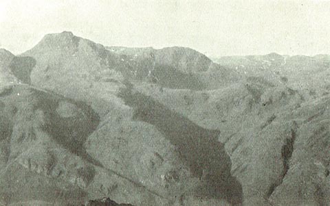 click to enlarge click to enlargeMA1215.jpg item:- JandMN : 173.23 Image © see bottom of page |
|||||||||||||||||||||||||
|
|
||||||||||||||||||||||||||
| evidence:- | old photograph:- Photochrom 1930s placename:- Langdale Pikes |
|||||||||||||||||||||||||
| source data:- | Photograph, black and white halftone print, Windermere and Langdale Pikes, Westmorland,
published by Photochrom Co, Tunbridge Wells, Kent, 1930s?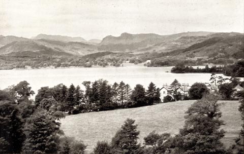 click to enlarge click to enlargePCH101.jpg printed, "Windermere and Langdale / Pikes. / ..." item:- JandMN : 1015.1 Image © see bottom of page |
|||||||||||||||||||||||||
|
|
||||||||||||||||||||||||||
| evidence:- | old map:- Dunlop 1950s placename:- Langdale Pikes |
|||||||||||||||||||||||||
| source data:- | Pictorial map, colour lithograph, A Dunlop Map of the Lake
District, scale about 4 miles to 1 inch, by J R Hart, published
by Dunlop Rubber Co, about 1950?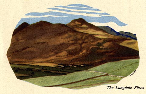 click to enlarge click to enlargeDP01E4.jpg item:- JandMN : 188 Image © see bottom of page |
|||||||||||||||||||||||||
|
|
||||||||||||||||||||||||||
| evidence:- | old print:- MacBride 1922 placename:- Langdale Pikes |
|||||||||||||||||||||||||
| source data:- | Print, colour, Lingmoor Tarn and Langdale Pikes, by Alfred Heaton Cooper, published
by Adam and Charles Black, 4-6 Soho Square, London, 2nd edn 1928.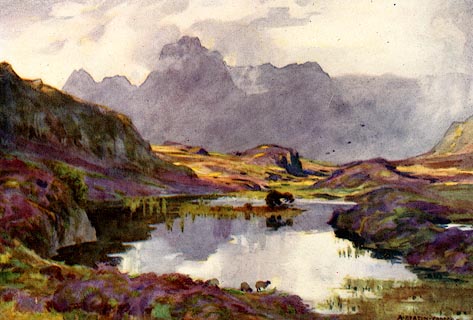 click to enlarge click to enlargeMB0127.jpg Tipped in opposite p.188 in Wild Lakeland by MacKenzie MacBride. printed at bottom:- "LINGMOOR TARN AND LANGDALE PIKES" signed at lower right:- "A. HEATON COOPER" item:- JandMN : 195.29 Image © see bottom of page |
|||||||||||||||||||||||||
|
|
||||||||||||||||||||||||||
| evidence:- | old print:- MacBride 1922 placename:- Langdale Pikes |
|||||||||||||||||||||||||
| source data:- | Print, colour, Blea Tarn and Langdale Pikes, by Alfred Heaton Cooper, published by
Adam and Charles Black, 4-6 Soho Square, London, 2nd edn 1928.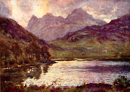 click to enlarge click to enlargeMB0120.jpg Tipped in opposite p.133 in Wild Lakeland by MacKenzie MacBride. printed at bottom:- "BLEA TARN AND LANGDALE PIKES" signed at lower right:- "A. HEATON COOPER" item:- JandMN : 195.22 Image © see bottom of page |
|||||||||||||||||||||||||
|
|
||||||||||||||||||||||||||
| evidence:- | outline view:- LMS 1920s |
|||||||||||||||||||||||||
| source data:- | Hills of Lakeland in Outline, published in the LMS Route Book No.3, The Track of the
Royal Scot, by the London, Midland and Scottish Railway, LMS, 1920s.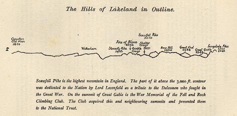 click to enlarge click to enlargeLS1E32.jpg item:- JandMN : 95.5 Image © see bottom of page |
|||||||||||||||||||||||||
|
|
||||||||||||||||||||||||||
| evidence:- | old print:- placename:- Langdale Pikes |
|||||||||||||||||||||||||
| source data:- | Print, uncoloured engraving, Langdale Pikes, Westmorland, engraved by W H J Bool?
1920s-30s?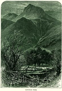 click to enlarge click to enlargePR0321.jpg Shepherds busy with sheep in the midground. On page 227 of Picturesque Europe, The Lake Country. printed at lower left:- "[WHJBOOL]" printed at bottom:- "LANGDALE PIKES." item:- Dove Cottage : 2008.107.321 Image © see bottom of page |
|||||||||||||||||||||||||
|
|
||||||||||||||||||||||||||
| evidence:- | old print:- Pearson 1900s placename:- Langdale Pikes |
|||||||||||||||||||||||||
| source data:- | Print, halftone photograph, The Langdale Pikes, across Blea Tarn, Westmorland, published
by C Arthur Pearson, Henrietta Street, London, 1900s.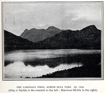 click to enlarge click to enlargePS1E45.jpg On p.123 of Pearson's Gossipy Guide to the English Lakes and Neighbouring Districts. printed at bottom:- "THE LANGDALE PIKES, ACROSS BLEA TARN. (p.122). / (pike o'Stickle is the summit to the left; Harrison Stickle to the right)." item:- Armitt Library : A1188.52 Image © see bottom of page |
|||||||||||||||||||||||||
|
|
||||||||||||||||||||||||||
| evidence:- | old print:- Pearson 1900s placename:- Langdale Pikes |
|||||||||||||||||||||||||
| source data:- | Print, halftone photograph, The Langdale Pikes, Great Langdale, Westmorland, published
by C Arthur Pearson, Henrietta Street, London, 1900s.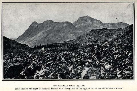 click to enlarge click to enlargePS1E11.jpg On p.21 of Pearson's Gossipy Guide to the English Lakes and Neighbouring Districts. printed at bottom:- "THE LANGDALE PIKES. (p.122). / (The Peak to the right is Harrison Stickle, with Pavey Ark to the right of it; to the left is Pike o'Stickle." item:- Armitt Library : A1188.18 Image © see bottom of page |
|||||||||||||||||||||||||
|
|
||||||||||||||||||||||||||
| evidence:- | old print:- |
|||||||||||||||||||||||||
| source data:- | Print, chromolithograph, Waterhead, Windermere, Westmorland, published by T Nelson
and Sons, London, 1900s?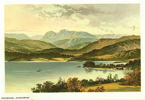 click to enlarge click to enlargePR0160.jpg From a set of prints, The Scenery of the English Lakes printed at lower right:- "T. NELSON &SONS" printed at bottom left:- "WATERHEAD - WINDERMERE" item:- Dove Cottage : 2008.107.160 Image © see bottom of page |
|||||||||||||||||||||||||
|
|
||||||||||||||||||||||||||
| evidence:- | old print:- Bogg 1898 placename:- Langdale Pikes |
|||||||||||||||||||||||||
| source data:- | Print, engraving, Blea Tarn and Langdale Pikes, Lakes, Westmorland, by Gilbert Foster,
published by Edmund Bogg, 3 Woodhouse Lane, and James Miles, Guildford Street, Leeds,
Yorkshire, 1898. click to enlarge click to enlargeBGG166.jpg Included on p.182 of Lakeland and Ribblesdale, by Edmund Bogg. item:- JandMN : 231.66 Image © see bottom of page |
|||||||||||||||||||||||||
|
|
||||||||||||||||||||||||||
| evidence:- | outline view:- Jenkinson 1875 placename:- Langdale Pikes |
|||||||||||||||||||||||||
| source data:- | Print, lithograph, outline view, Panoramic Sketches from Scawfell Pike, Cumberland,
by Edwin A Pettitt, London, published by Edward Stanford, 55 Charing Cross, London,
1875. click to enlarge click to enlargeJk01E3.jpg "... Langdale Pikes ..." item:- JandMN : 28.9 Image © see bottom of page |
|||||||||||||||||||||||||
|
|
||||||||||||||||||||||||||
| evidence:- | outline view:- Jenkinson 1875 placename:- Langdale Pikes |
|||||||||||||||||||||||||
| source data:- | Print, lithograph, outline view, Panoramic Sketches from Helvellyn, Westmorland, by
Edwin A Pettitt, London, published by Edward Stanford, 55 Charing Cross, London, 1875. click to enlarge click to enlargeJk01E1.jpg "... Langdale Pikes ..." item:- JandMN : 28.5 Image © see bottom of page |
|||||||||||||||||||||||||
|
|
||||||||||||||||||||||||||
| evidence:- | old print:- placename:- Langdale Pikes |
|||||||||||||||||||||||||
| source data:- | Print, uncoloured engraving, Blea Tarn and Langdale Pikes, Westmorland, engraved by
M Jackson, published late 19th century?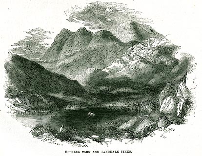 click to enlarge click to enlargePR0348.jpg On page 256 of The Land We Live In. printed at lower left:- "M. JACKSON. SC" printed at bottom:- "11.- BLEA TARN AND LANGDALE PIKES." item:- Dove Cottage : 2008.107.348 Image © see bottom of page |
|||||||||||||||||||||||||
|
|
||||||||||||||||||||||||||
| evidence:- | old print:- Nelson 1859 |
|||||||||||||||||||||||||
| source data:- | Print, engraving, Head of Windermere, drawn by Keeley Halswelle, Edinburgh, published
by T Nelson and Sons, Paternoster Row, London, and Edinburgh and New York, United
States, 1859.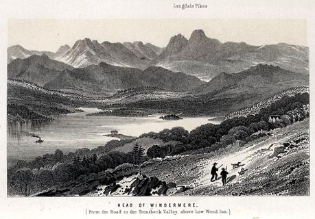 click to enlarge click to enlargeNS0113.jpg Tipped in oppposite p.296 of a guide book, The English Lakes. printed at bottom:- "HEAD OF WINDERMERE. / (From the Road to the Troutbeck Valley above Low Wood Inn.)" item:- JandMN : 336.12 Image © see bottom of page |
|||||||||||||||||||||||||
|
|
||||||||||||||||||||||||||
| evidence:- | old print:- Garnett 1850s-60s F placename:- Langdale Pikes |
|||||||||||||||||||||||||
| source data:- | Print, uncoloured engraving, Stickle Tarn, Langdale Pikes, Westmorland, engraved by
William Banks and Son, Edinburgh, published by John Garnett, Windermere, Westmorland,
1850s-60s?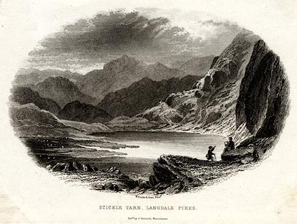 click to enlarge click to enlargeGAR726.jpg Found with Views of the English Lakes. printed at bottom:- "W. Banks &Son, Edinr. / STICKLE TARN, LANGDALE PIKES. / Pubd. by J. Garnett, Windermere." item:- JandMN : 165.26 Image © see bottom of page |
|||||||||||||||||||||||||
|
|
||||||||||||||||||||||||||
| evidence:- | old print:- Garnett 1850s-60s F |
|||||||||||||||||||||||||
| source data:- | Print, uncoloured engraving, Loughrigg Tarn, Westmorland, engraved by William Banks
and Son, Edinburgh, published by John Garnett, Windermere, Westmorland, 1850s-60s?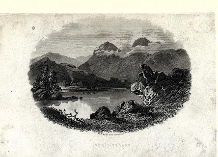 click to enlarge click to enlargeGAR720.jpg Found with Views of the English Lakes. printed at bottom:- "Engd. by W. Banks &Son Edinr. / LOUGHRIGG TARN." item:- JandMN : 165.20 Image © see bottom of page |
|||||||||||||||||||||||||
|
|
||||||||||||||||||||||||||
| evidence:- | old print:- Garnett 1850s-60s A |
|||||||||||||||||||||||||
| source data:- | Print, coloured print, Windermere Lake, from Elleray, published by John Garnett, Windermere,
Westmorland, and by Simpkin, Marshall and Co, London, 2nd edn 1860s?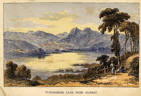 click to enlarge click to enlargeGAR6E1.jpg Frontispiece to A Guide to the English Lake District, by a Cambridge Man. item:- JandMN : 149.2 Image © see bottom of page |
|||||||||||||||||||||||||
|
|
||||||||||||||||||||||||||
| evidence:- | outline view:- Garnett 1850s-60s A |
|||||||||||||||||||||||||
| source data:- | Print, uncoloured engraving, Head of Langdale, from the Blea Tarn Road, published
by John Garnett, Windermere, Westmorland, and by Simpkin, Marshall and Co, London,
2nd edn 1860s?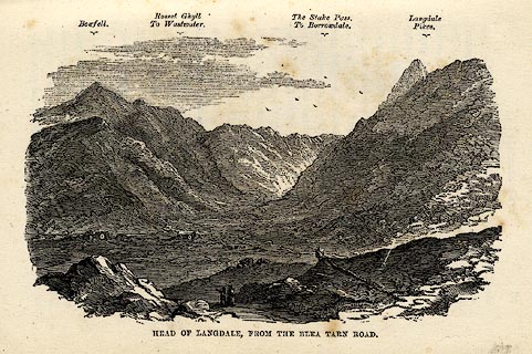 click to enlarge click to enlargeGAR6E2.jpg On p.39 of A Guide to the English Lake District, by a Cambridge Man. "...Langdale Pikes" item:- JandMN : 149.3 Image © see bottom of page |
|||||||||||||||||||||||||
|
|
||||||||||||||||||||||||||
| evidence:- | old print:- placename:- Langdale Pikes |
|||||||||||||||||||||||||
| source data:- | Print, uncoloured engraving, Langdale Pikes from Windermere, Westmorland, by ?B Foster,
engraved by E Evans, 1850s-60s?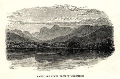 click to enlarge click to enlargePR0497.jpg printed at bottom left, right, centre:- "[B] Foster / E. EVANS SC. / LANGDALE PIKES FROM WINDERMERE" item:- Dove Cottage : 2008.107.446 Image © see bottom of page |
|||||||||||||||||||||||||
|
|
||||||||||||||||||||||||||
| evidence:- | old print:- Sylvan 1847 |
|||||||||||||||||||||||||
| source data:- | Print, engraving, Great Langdale and the Pikes, Westmorland, engraved by Thomas Gilks,
published by John Johnstone, Paternoster Row, London, et al, 1847.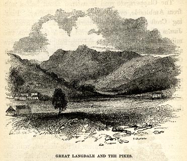 click to enlarge click to enlargeSYL123.jpg On p.72 of Sylvan's Pictorial Guide to the English Lakes. printed at bottom right, centre:- "T. GILKS [Sc] / GREAT LANGDALE AND THE PIKES." item:- Armitt Library : A1201.23 Image © see bottom of page |
|||||||||||||||||||||||||
|
|
||||||||||||||||||||||||||
| evidence:- | old print:- Atkinson 1847 (5th edn 1850) item:- sailing boat; boat; landing stage |
|||||||||||||||||||||||||
| source data:- | Print, woodcut engraving, Windermere from Low Wood Hotel, Westmorland, by T W Holme,
published by Thomas Atkinson, Kendal, Westmorland, 1850.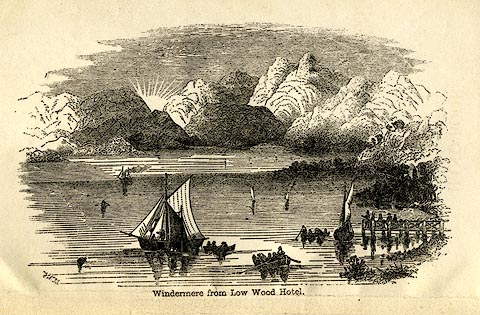 click to enlarge click to enlargeAK2E01.jpg Frontispiece to a Handbook to the English Lakes, 5th edn. printed at bottom left, centre:- "TWH / Windermere from Low Wood Hotel." item:- Armitt Library : A1144.1 Image © see bottom of page |
|||||||||||||||||||||||||
|
|
||||||||||||||||||||||||||
| evidence:- | old print:- Hudson 1842 (4th edn 1853) |
|||||||||||||||||||||||||
| source data:- | Print, uncoloured engraving, Head of Windermere from Low Wood, drawn and engraved
by W Banks, Edinburgh, published by John Hudson, Kendal, Westmorland, 1853.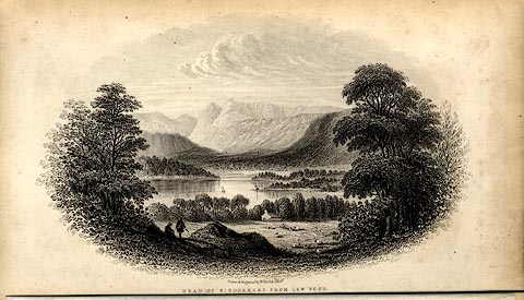 click to enlarge click to enlargeHUD1E1.jpg Frontispiece in A Complete Guide to the Lakes, edited John Hudson. printed at bottom:- "Drawn &Engraved by W. Banks, Edinr. / HEAD OF WINDERMERE FROM LOW WOOD." item:- JandMN : 327.1 Image © see bottom of page |
|||||||||||||||||||||||||
|
|
||||||||||||||||||||||||||
| evidence:- | old print:- placename:- Langdale Pikes |
|||||||||||||||||||||||||
| source data:- | Print, uncoloured engraving, The Langdale Pikes, Westmorland, drawn by W Westall,
published by Edward Moxon, Dover Street, London, 1840.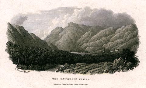 click to enlarge click to enlargePR0157.jpg printed at bottom left, centre:- "W. Westall, ARA. delt. / THE LANGDALE PIKES. / London. Edwd. Moxon, Dover Street, 1840." item:- Dove Cottage : 2008.107.157 Image © see bottom of page |
|||||||||||||||||||||||||
|
|
||||||||||||||||||||||||||
| evidence:- | outline view:- Tattersall 1836 item:- panorama |
|||||||||||||||||||||||||
| source data:- | Print, engraving, View from the Langdale Pikes, looking North, Westmorland, Cumberland
and Lancashire, drawn by George Tattersall, engraved by W F Topham, published by Sherwood
and Co, Paternoster Row, London, about 1836.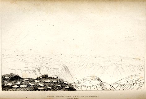 click to enlarge click to enlargeTAT113.jpg Tipped in opposite p.49 of The Lakes of England, by George Tattersall. printed at bottom:- "VIEW FROM THE LANGDALE PIKES. / looking North." printed at p.49:- "... FOUR VIEWS FROM THE SUMMIT OF HARRISON STICKLE, LANGDALE PIKES. I. LOOKING NORTH. / 1. Coniston Old Man, Lancashire. / 2. Great Carrs, Westmoreland. / 3. Gate Crag, Lancashire. / 4. Seathwaite, Lancashire. / 5. Gatescale, Westmoreland. / 6. Style End, Westmoreland. / 7. Crinkle Crag, Westmoreland. / 8. Grinston Knot, Westmoreland. / 9. The Band, Cumberland. / 10. Pike o'Bliscoe, Cumberland. / Pike o'Stickle, Westmoreland." item:- Armitt Library : A1204.14 Image © see bottom of page |
|||||||||||||||||||||||||
|
|
||||||||||||||||||||||||||
| evidence:- | outline view:- Tattersall 1836 item:- panorama |
|||||||||||||||||||||||||
| source data:- | Print, engraving, View from the Langdale Pikes, looking East, Westmorland and Cumberland,
drawn by George Tattersall, engraved by W F Topham, published by Sherwood and Co,
Paternoster Row, London, about 1836.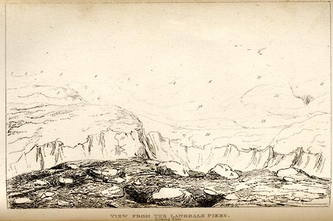 click to enlarge click to enlargeTAT114.jpg Tipped in opposite p.49 of The Lakes of England, by George Tattersall. printed at bottom:- "VIEW FROM THE LANGDALE PIKES. / looking East." printed at p.49:- "... FOUR VIEWS FROM THE SUMMIT OF HARRISON STICKLE, LANGDALE PIKES. II. LOOKING EAST. / 1. Coldbeck Fell, Cumberland. / 2. Skiddaw, Cumberland. / 3. Highraise, Cumberland. / 4. Saddleback, Cumberland. / 5. Harnspoint, Cumberland. / 6. Candle Pike, Cumberland. / 7. Candle Moor, Cumberland. / 8. Helvellyn, Cumberland and Westmoreland. / 9. Grasmere Fells, Westmoreland. / 10. Grisedale Hawse, Westmoreland. / 11. Grisedale Pike, Westmoreland. / 12. Grasmere Sets Handle, Westmoreland. / 13. Easdale Fell, Westmoreland. / 14. Cawtrey Pike, Westmoreland. / 15. Pavey Oak, Westmoreland. / 16. Benson Fell, Westmoreland. / 17. Stickle Tarn, Westmoreland." item:- Armitt Library : A1204.15 Image © see bottom of page |
|||||||||||||||||||||||||
|
|
||||||||||||||||||||||||||
| evidence:- | outline view:- Tattersall 1836 item:- panorama |
|||||||||||||||||||||||||
| source data:- | Print, engraving, View from the Langdale Pikes, looking South, Westmorland and Lancashire,
drawn by George Tattersall, engraved by W F Topham, published by Sherwood and Co,
Paternoster Row, London, about 1836.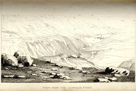 click to enlarge click to enlargeTAT115.jpg Tipped in opposite p.50 of The Lakes of England, by George Tattersall. printed at bottom:- "VIEW FROM THE LANGDALE PIKES. / looking South. / [London Pubd. ...]" printed at p.50:- "... FOUR VIEWS FROM THE SUMMIT OF HARRISON STICKLE, LANGDALE PIKES. III. LOOKING SOUTH. / 1. Grisedale Head, Westmoreland. / 2. Fairfield, Westmoreland. / 3. Grasmoor, Westmoreland. / 4. Kirkstone, Westmoreland. / 5. High Street, Westmoreland. / 6. Wansfell, Westmoreland. / 7. Kentmere Head, Westmoreland. / 8. Hill Bell, Westmoreland. / 9. Applethwaite Common, Westmoreland. / 10. Staveley Head, Westmoreland. / 11. Long Sleddale, Westmoreland. / 12. Grayrigg Forest, Westmoreland. / 13. Winfell, Westmoreland. / 14. Underbarrow Scarr, Westmoreland. / 15. Witherslack Fell, Westmoreland. / 16. / Cartnel Fell, Lancashire. / 17. Huggle Fell, Lancashire. / 18. Windermere. 19. Front Beck, Westmoreland. / 20. Vale of Ambleside, Westmoreland. / 21. Loughrigg Fell, Westmoreland. / 22. Loughrigg Tarn, Westmoreland. / 23. Etterwater, Westmoreland. / 24. Rydal Head, Westmoreland. / 25. Helm Crag, Westmoreland. / 26. Benson Fell, Westmoreland." item:- Armitt Library : A1204.16 Image © see bottom of page |
|||||||||||||||||||||||||
|
|
||||||||||||||||||||||||||
| evidence:- | outline view:- Tattersall 1836 item:- panorama |
|||||||||||||||||||||||||
| source data:- | Print, engraving, View from the Langdale Pikes, looking West, Westmorland and Lancashire,
drawn by George Tattersall, engraved by W F Topham, published by Sherwood and Co,
Paternoster Row, London, about 1836.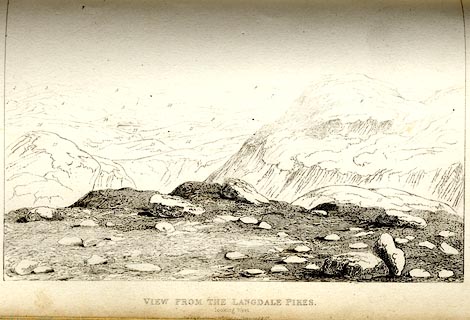 click to enlarge click to enlargeTAT116.jpg Tipped in opposite p.50 of The Lakes of England, by George Tattersall. printed at bottom:- "VIEW FROM THE LANGDALE PIKES. / looking West." printed at p.50:- "... FOUR VIEWS FROM THE SUMMIT OF HARRISON STICKLE, LANGDALE PIKES. IV. LOOKING WEST. / 1. Windermere. / 2. Witherslack Fell, Westmoreland. / 3. Cartnell Fell, Lancashire. / 4. Burgrunt Fell, Lancashire. / 5. Sizergh Fell, Westmoreland. / 6. Arnside Fell, Westmoreland. / 7. Morecambe Bay. / 8. Wetherlam End, Lancashire. / 9. Grizedale, Lancashire. / 10. Foulsha, Westmoreland. / 11. Graythort, Lancashire. / 12. Hawkshead Moor, Lancashire. / 13. Esthwaite Water. / 14. Sawrey Heights, Lancashire. / 15. Wernfell, Lancashire. / 16. Arnside, Lancashire. / 17. Lingmire, Westmoreland. / 18. Blakerigg, Westmoreland." item:- Armitt Library : A1204.17 Image © see bottom of page |
|||||||||||||||||||||||||
|
|
||||||||||||||||||||||||||
| evidence:- | outline view:- Tattersall 1836 placename:- Langdale Pikes |
|||||||||||||||||||||||||
| source data:- | Print, engraving, Little Langdale, Westmorland, drawn by George Tattersall, engraved
by W F Topham, published by Sherwood and Co, Paternoster Row, London, about 1836.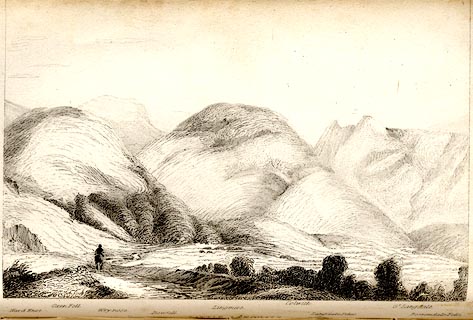 click to enlarge click to enlargeTAT107.jpg The print is captioned with mountain names and acts as an outline view. Tipped in opposite p.39 of The Lakes of England, by George Tattersall. printed at bottom:- "LITTLE LANGDALE." printed at bottom left to right:- "Hard Knot. / Oxen Fell. / Wrynose. / Bowfell. / Lingmire. / Colwith. / Langdale Pikes. / Gt. Langdale. / Borrowdale Fells." item:- Armitt Library : A1204.8 Image © see bottom of page |
|||||||||||||||||||||||||
|
|
||||||||||||||||||||||||||
| evidence:- | outline view:- Tattersall 1836 placename:- Langdale Pikes |
|||||||||||||||||||||||||
| source data:- | Print, engraving, Windermere from Rayrigg Bank, Westmorland, drawn by George Tattersall,
engraved by W F Topham, published by Sherwood and Co, Paternoster Row, London, about
1836.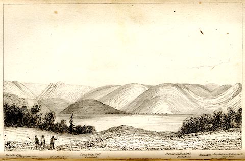 click to enlarge click to enlargeTAT104.jpg The print is captioned with mountain names and acts as an outline view. Tipped in opposite p.31 of The Lakes of England, by George Tattersall. printed at bottom:- "WINDERMERE from RAYRIGG BANK." printed at bottom left to right:- "Furness Fells. / Coniston Old Man. / Wetherlam Foot. / Wrynose. / Langdale Pikes. / Hardknot. / Loughrigg Fell. / Fairfield. / Troutbeck Hundred. / Kirkstone. / Wansfell. / Applethwaite Common. / High Street. / Hill Bell." item:- Armitt Library : A1204.5 Image © see bottom of page |
|||||||||||||||||||||||||
|
|
||||||||||||||||||||||||||
| evidence:- | outline view:- Tattersall 1836 placename:- Langdale Pikes item:- boat; rowing boat |
|||||||||||||||||||||||||
| source data:- | Print, engraving, Upper Reach, Windermere, Westmorland, drawn by George Tattersall,
engraved by W F Topham, published by Sherwood and Co, Paternoster Row, London, about
1836.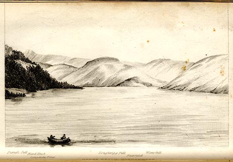 click to enlarge click to enlargeTAT102.jpg The print is captioned with mountain names and acts as an outline view. Tipped in opposite p.25 of The Lakes of England, by George Tattersall. printed at bottom:- "UPPER REACH, WINDERMERE." printed at bottom left to right:- "Furness Fell. / Hard Knot. / Langdale Pikes. / Loughrigg Fell. / Fairfield. / Wansfell." item:- Armitt Library : A1204.3 Image © see bottom of page |
|||||||||||||||||||||||||
|
|
||||||||||||||||||||||||||
| evidence:- | old print:- Rose 1832-35 |
|||||||||||||||||||||||||
| source data:- | Print, engraving, View from Langdale Pikes, looking towards Bowfell, Westmorland,
by Thomas Allom, engraved by W Kelsall, 1835.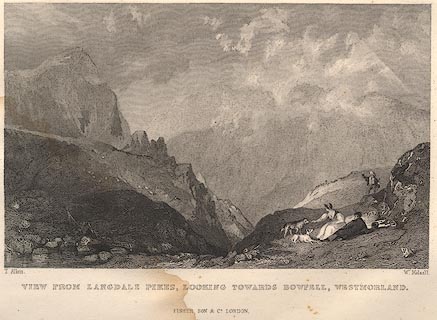 click to enlarge click to enlargeR365.jpg item:- JandMN : 66.60 Image © see bottom of page |
|||||||||||||||||||||||||
|
|
||||||||||||||||||||||||||
| evidence:- | old print:- Rose 1832-35 |
|||||||||||||||||||||||||
| source data:- | Print, engraving, View from Langdale Pikes, looking South East, Westmorland, by Thomas
Allom, engraved by W Kelsall, 1835.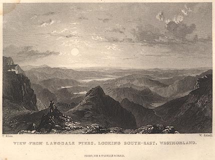 click to enlarge click to enlargeR364.jpg item:- JandMN : 66.8 Image © see bottom of page |
|||||||||||||||||||||||||
|
|
||||||||||||||||||||||||||
| evidence:- | old print:- Britton and Brayley 1802 placename:- Langdale Pikes |
|||||||||||||||||||||||||
| source data:- | Print, uncoloured engraving, View in the Valley of Langdale, with Langdale Pikes,
Westmorland, painted by G Arnald, engraved by W Angus, published by Vernor, Hood and
Sharpe, Poultry, London, 1807.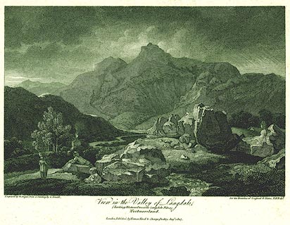 click to enlarge click to enlargePR0143.jpg Included in the Beauties of England and Wales, by John Britton and Edward W Brayley. printed at bottom left, right, centre:- "Engrav'd by W. Angus from a painting by G. Arnald, / for the Beauties of England & Wales. E.W.B dxt. / View in the Valley of Langdale, / (Looking Westward towards Langdale Pikes) / Westmoreland. / London, Published by Vernor, Hood &Sharpe, Poultry, Augt. 1. 1807." item:- Dove Cottage : 2008.107.143 Image © see bottom of page |
|||||||||||||||||||||||||
|
|
||||||||||||||||||||||||||
| evidence:- | old print:- Goodwin 1887 (edn 1890) |
|||||||||||||||||||||||||
| source data:- | Print, etching? Blea Tarn, with the Langdale Pikes, Westmorland, by Harry Goodwin,
published by Swan Sonnenschein and Co, Paternoster Square, London, 1890.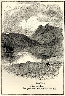 click to enlarge click to enlargePR1604.jpg Tipped in opposite p.178 of Through the Wordsworth Country, by William Knight. printed at lower centre:- "Blea Tarn / two huge Peaks / That from some other vale peered into this." item:- JandMN : 382.34 Image © see bottom of page |
|||||||||||||||||||||||||
|
|
||||||||||||||||||||||||||
| evidence:- | old drawing:- placename:- Langdale Pikes |
|||||||||||||||||||||||||
| source data:- | Drawing, Windermere and Langdale Pikes, Rayrigg, Windermere, Westmorland, by John
Harper, 1840.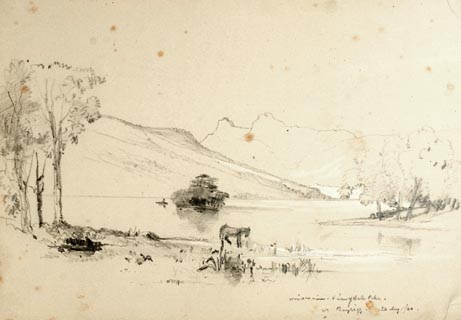 click to enlarge click to enlargePR1386.jpg View of Winderemere from the shore with Langdale Pikes in the background. Sheep in foreground at waters edge. Executed in pencil with touches of white gouache on buff coloured paper. Preparatory sketch drawn on the spot by the artist. at bottom right:- "Windermere &Langdale Pikes, Rayrigg. 26 Aug./40" item:- Tullie House Museum : 2009.89.29 Image © Tullie House Museum |
|||||||||||||||||||||||||
|
|
||||||||||||||||||||||||||
| evidence:- | old print:- Green 1809 placename:- Langdale Pikes |
|||||||||||||||||||||||||
| source data:- | Print, soft ground etching, Gimmer Crag in Langdale, Langdale Pikes, Westmorland,
by William Green, published by William Green, Ambleside, Westmorland, and Longman,
Hurst, Rees and Orme, Paternoster Row, London, 1809.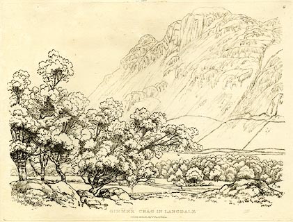 click to enlarge click to enlargeGN0361.jpg Plate 61 in Seventy Eight Studies from Nature. printed in introductory pages to set of prints:- "Number 61. It is the opinion of several people of acknowledged taste, that the mountains of Langdale afford to the eye, from many parts of the vale, a greater variety of fine forms than the mountains surrounding any other valley here. One of the conical-topped pikes, and a grand surface of rock called Gimmer Crag, are the principal features of the scene before us. The drawing was made at a little distance from Wall End, which is about nine miles from Ambleside." printed at bottom:- "GIMMER CRAG IN LANGDALE. / Published Ambleside, Augst. 1st. 1809, by W. Green." item:- Armitt Library : A6637.61 Image © see bottom of page |
|||||||||||||||||||||||||
|
|
||||||||||||||||||||||||||
| evidence:- | old print:- Green 1809 placename:- Langdale Pikes |
|||||||||||||||||||||||||
| source data:- | Print, soft ground etching, Elter Water, Westmorland, by William Green, published
by William Green, Ambleside, Westmorland, and Longman, Hurst, Rees and Orme, Paternoster
Row, London, 1809.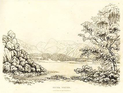 click to enlarge click to enlargeGN0350.jpg Plate 50 in Seventy Eight Studies from Nature. printed in introductory pages to set of prints:- "Number 50. Elter Water, ... Langdale Pikes are the last mountains in this scene." printed at bottom:- "ELTER WATER. / Published Ambleside, Augst. 1st. 1809, by W. Green." item:- Armitt Library : A6637.50 Image © see bottom of page |
|||||||||||||||||||||||||
|
|
||||||||||||||||||||||||||
| evidence:- | old drawing:- |
|||||||||||||||||||||||||
| source data:- | Drawing, Windermere from Low Wood, Westmorland, by William Havell, 1800s-10s.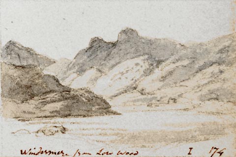 click to enlarge click to enlargePR1403.jpg View of Windermere from Low Wood from lake side with large hills in background. One of a set of twenty views of the lake district executed by the artist on one sheet of paper. at bottom:- "Windermere from Low Wood I 174" item:- Tullie House Museum : 2009.89.47 Image © Tullie House Museum |
|||||||||||||||||||||||||
|
|
||||||||||||||||||||||||||
 BTU39.jpg (taken 10.11.2010)  BPE83.jpg From the east shore of Windermere; Loft Crag on the left, Pike of Stickle just peeking over, Harrison Stickle on the right, Dungeon Ghyll between. (taken 12.5.2008)  BQL43.jpg (taken 20.4.2009) 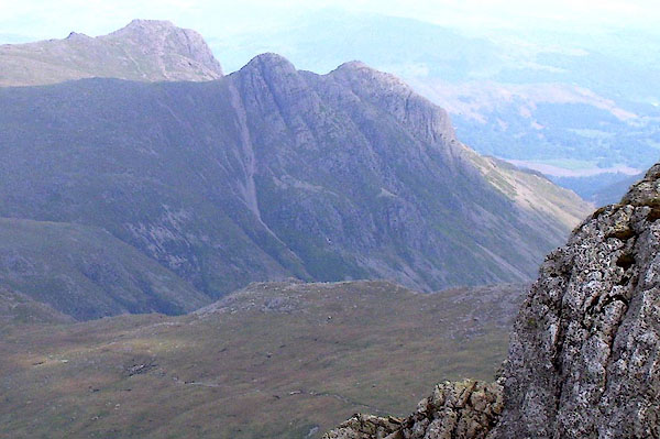 BPF53.jpg (taken 20.5.2008) 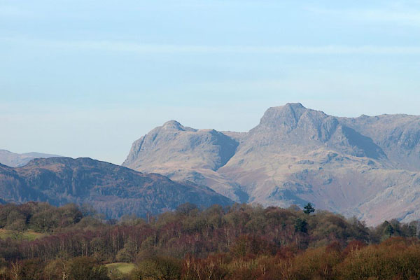 BOR21.jpg From Low Wray; Loft Crag on the left, Harrison Stickle on the right, Dungeon Ghyll between. (taken 15.2.2008) 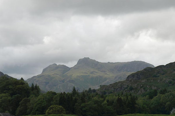 BTJ51.jpg Loft Crag on the left, Dungeon Ghyll, and Harrison Stickle and the ridge to Pavey Ark. (taken 12.5.2008) 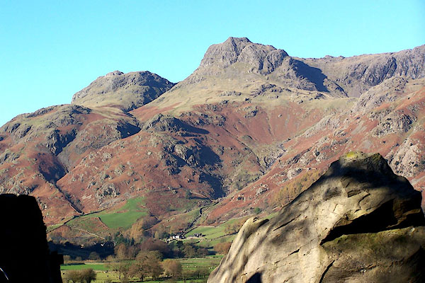 BJZ96.jpg Loft Crag on the left, Harrison Stickle on the right. (taken 17.11.2005) 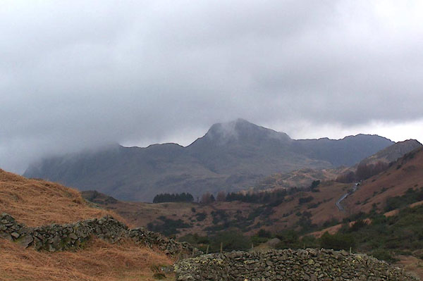 BNI96.jpg (taken 14.3.2007) 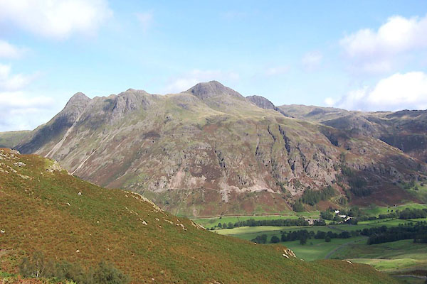 BXG90.jpg (taken 3.9.2012) 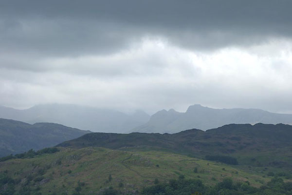 CDK03.jpg From Skelghyll area. (taken 18.6.2015) 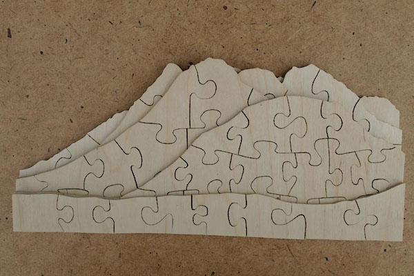 BWG39.jpg Multilayer jigsaw puzzle, Outline View, Langdale Pikes. (taken 25.4.2012) |
||||||||||||||||||||||||||
|
|
||||||||||||||||||||||||||
| hearsay:- |
William Constable painted the Langdale Pikes with a non-existent lake in front - in
the interests of picturesque beauty? |
|||||||||||||||||||||||||
|
|
||||||||||||||||||||||||||
Lakes Guides menu.