 Old Cumbria Gazetteer
 |
 |
|
| Lady Holme, Windermere lake | ||
| Lady Holme | ||
| site name:- | Windermere lake | |
| civil parish:- | Windermere (formerly Westmorland) | |
| county:- | Cumbria | |
| locality type:- | island | |
| coordinates:- | SD39829748 | |
| 1Km square:- | SD3997 | |
| 10Km square:- | SD39 | |
|
|
||
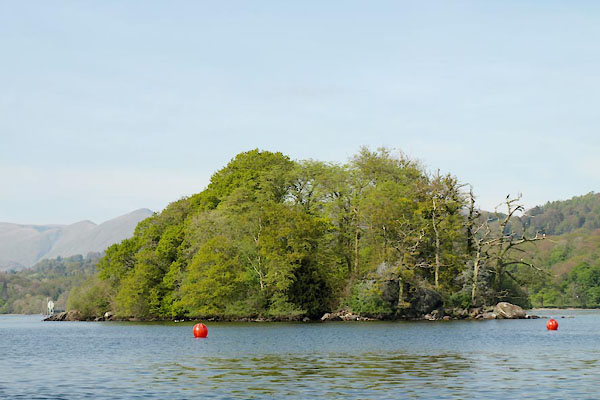
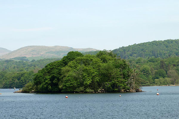 BPE52.jpg Lady Holme. (taken 12.5.2008) 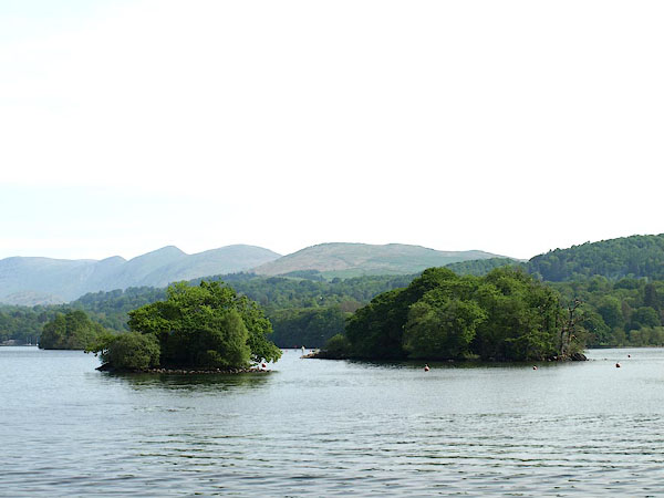 BPD42.jpg Hen Holme and Lady Holme. (taken 12.5.2008) |
||
|
|
||
| evidence:- | old map:- OS County Series (Wmd 32 11) placename:- Lady Holme |
|
| source data:- | Maps, County Series maps of Great Britain, scales 6 and 25
inches to 1 mile, published by the Ordnance Survey, Southampton,
Hampshire, from about 1863 to 1948. |
|
|
|
||
| evidence:- | descriptive text:- West 1778 (11th edn 1821) |
|
| source data:- | Guide book, A Guide to the Lakes, by Thomas West, published by
William Pennington, Kendal, Cumbria once Westmorland, and in
London, 1778 to 1821. goto source goto sourcePage 58:- "[Windermere] ... Lady-holme, where in ancient times stood an oratory, is an isle of an oval form, vested with coppice-wood. ..." |
|
|
|
||
| evidence:- | old map:- Crosthwaite 1783-94 (Win/Ble) placename:- Lady Holm |
|
| source data:- | Map, uncoloured engraving, An Accurate Map of the Grand Lake of
Windermere, scale about 2 inches to 1 mile, by Peter
Crosthwaite, Keswick, Cumberland, 1783, version published 1819.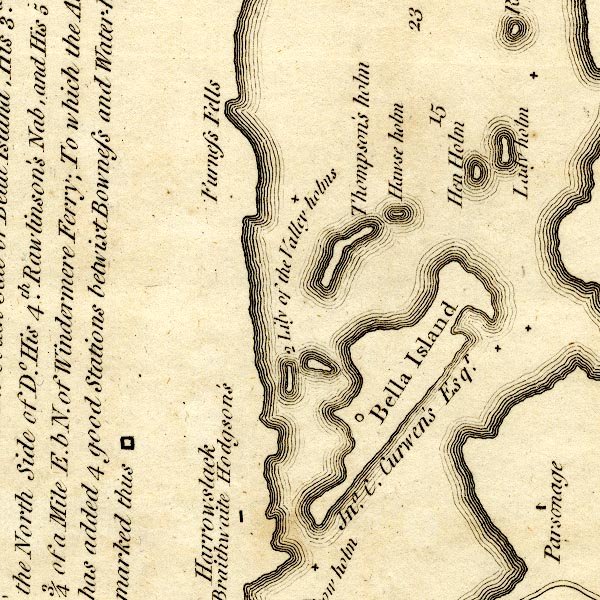 CT9SD39Y.jpg "Lady holm" island item:- Armitt Library : 2008.14.102 Image © see bottom of page |
|
|
|
||
| evidence:- | old map:- West 1784 map |
|
| source data:- | Map, hand coloured engraving, A Map of the Lakes in Cumberland,
Westmorland and Lancashire, scale about 3.5 miles to 1 inch,
engraved by Paas, 53 Holborn, London, about 1784.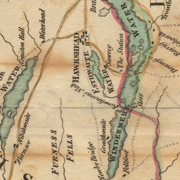 Ws02SD39.jpg In Windermere Water. item:- Armitt Library : A1221.1 Image © see bottom of page |
|
|
|
||
| evidence:- | old text:- Clarke 1787 placename:- Lady Holm item:- chapel; Chapel of St Mary Holm |
|
| source data:- | Guide book, A Survey of the Lakes of Cumberland, Westmorland,
and Lancashire, written and published by James Clarke, Penrith,
Cumberland, and in London etc, 1787; published 1787-93. goto source Page 140:- "... The rest of the islands are small, and belong to several persons too tedious to mention. One, viz. Lady Holm, had a chapel on it in the time of Henry the VIII. then called The Chapel of St Mary Holm, within Wynandermere, and belonged to the Abbey of Furness in Lancashire, ... (see plate X.)" |
|
|
|
||
| evidence:- | old map:- Clarke 1787 map (Windermere N) placename:- Lady Holm |
|
| source data:- | Map, A Map of the Northern Part of the Lake Winandermere and its
Environs, scale about 6.5 ins to 1 mile, by James Clarke,
engraved by Samuel John Neele, 352 Strand, published by James
Clarke, Penrith, Cumberland and in London etc, 1787.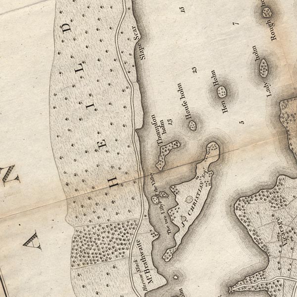 CLASD39Y.jpg "Lady holm" item:- private collection : 10.10 Image © see bottom of page |
|
|
|
||
| evidence:- | old text:- Camden 1789 (Gough Additions) placename:- St Mary Holme placename:- Lady Holme item:- chapel |
|
| source data:- | Book, Britannia, or A Chorographical Description of the Flourishing Kingdoms of England,
Scotland, and Ireland, by William Camden, 1586, translated from the 1607 Latin edition
by Richard Gough, published London, 1789. goto source Page 154:- "..." "St. Mary Holme, otherwise called Lady Holme, is another island in this lake, so denominated from a chapel built antiently therein, and dedicated to the Blessed Virgin." "By an inquisition after the death of Joan de Coupland the jurors found, that she died seised of the advowson of the chapel of St. Mary Holme within Wynandermere, which was valued at nothing, because the land that had belonged to the same had in old time been seized into the lord's hand, and laid within the park of Calvgarth." "Amongst the returns made by the commissioners to inquire of colleges, chapels, free chantries, and the like, in the reigns of Henry VIII. and Edward VI. there is the "free chapel of Holme and Winandermere."" "This island belonged to the Philipsons of Calgarth, and still goes along with the Calgarth estate. There are no ruins of the chapel remaining. It is a very small island. The chapel would cover near half of it. It is a rock with some few shrubs growing upon it in the middle of the lake, wonderfully adapted to contemplation and retirement." |
|
|
|
||
| evidence:- | old text:- Wordsworth 1810 placename:- Chapel Holm |
|
| source data:- | Guide book, A Description of the Scenery of the Lakes, later A
Guide through the District of The Lakes, by William Wordsworth,
1810-35. goto source page 21 "... Every one must regret that scarcely a vestige is left of the Oratory, consecrated to the Virgin, which stood upon Chapel-Holm in Windermere, ..." |
|
|
|
||
| evidence:- | old text:- Gents Mag placename:- Saint Mary's Holme placename:- Ladyes Holme |
|
| source data:- | Magazine, The Gentleman's Magazine or Monthly Intelligencer or
Historical Chronicle, published by Edward Cave under the
pseudonym Sylvanus Urban, and by other publishers, London,
monthly from 1731 to 1922. goto source Gentleman's Magazine 1849 part 2 p.251 "..." "Besides their other large estates, the Philipson owned the rocky islet in Windermere, called Saint Mary's or the Ladyes Holme, hitherto reputed to have formed part of the conventual domains of the abbey at Furness, and to have had its name from a chantry or small chapel dedicated to the Virgin Mary, which was existing so late as the reign of King Henry VIII. When at the Reformation all such minor institutions were swept away as superstituious, and the attendant priests driven forth, the building fell into so utter a state of ruin that no trace even of its foundations is left to procalim to the stranger who meditates upon the fleeting change of times and creeds that here in former ages stood a hallowed fane, from whence at eventide and prime unceasingly, for more than three centuries, "the hymn of intercession rose, and prayers were wafted through the dewy air," where now are only heard the festal sounds of life's more jocund hours. Lately renewed antiquarian investigation has however disclosed the erroneousness of the generally received statement respecting early ownership of this tiny spot. In vol.xxxii fo. 23, of that celebrated collection of ancient evidences gathered by the untiring perseverance of the profound antiquary Roger Dodsworth, now in the Bodleian library, there is contained an inquisition, or the copy of one, found at Kendal, so far back as the Monday after the Feast of the Annunciation, in the 28th year of King Edward III.; which explanatory document shews that this retreat amid the waters of our English Como appertained not to Furness Abbey, but to the house of Segden, in Scotland, which was bound always to provide two resident chaplains for the service of Our Ladyes Chapel in this island solitude. For the maintenance and support of these priests certain lands and tenements were given by the founder, who most probably was that Ingelram de Guisnes, Lord of Coucy, in France, who, in the thriteenth century, married Christain, the heiress of William de Lyndsey, and in her right became the feudal lord of that portion of the barony of Kendal called the Richmond Fee, within which lies Saint Mary's Holme." |
|
|
|
||
| evidence:- | old map:- Prior 1874 map 1 placename:- Lady Holme |
|
| source data:- | Map, uncoloured engraving or lithograph? Winander Mere, scale
about 2.5 miles to 1 inch, published by John Garnett,
Windermere, Westmorland, 1874. click to enlarge click to enlargePI03M1.jpg "Lady Holme" island item:- private collection : 133.1 Image © see bottom of page |
|
|
|
||
| evidence:- | outline view:- Black 1856 (23rd edn 1900) placename:- Lady Holm Isle |
|
| source data:- | Print, lithograph, Outline Views, Windermere - Mountains as seen from the North End
of Belle Isle, Windermere, and Mountains as seen from Biscay How, Bowness, by J Flintoft,
Keswick, Cumberland, engraved by R Mason, Edinburgh, Lothian, about 1900.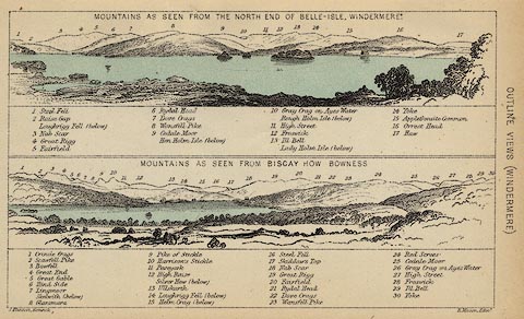 click to enlarge click to enlargeBC08E1.jpg "... Lady Holm Isle ..." item:- JandMN : 37.4 Image © see bottom of page |
|
|
|
||
| evidence:- | outline view:- Black 1841 (3rd edn 1846) placename:- Lady Holm Isle |
|
| source data:- | Print, engraving, outline view, Mountains as seen from the North End of Belle Isle,
Windermere, and Mountains as seen from Bisket How, Bowness, by J Flintoft, Keswick,
Cumberland, engraved by R Mason, Edinburgh, about 1844.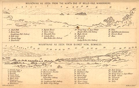 click to enlarge click to enlargeBC02E1.jpg "... Lady Holm Isle ..." item:- JandMN : 32.3 Image © see bottom of page |
|
|
|
||
 BWH90.jpg (taken 3.5.2012) |
||
|
|
||
Lakes Guides menu.