 Old Cumbria Gazetteer
 |
 |
|
| King's Forest of Geltsdale, Geltsdale | ||
| King's Forest of Geltsdale | ||
| locality:- | Geltsdale | |
| civil parish:- | Geltsdale (formerly Cumberland) | |
| county:- | Cumbria | |
| locality type:- | forest | |
| coordinates:- | NY59595312 (etc etc) | |
| 1Km square:- | NY5953 | |
| 10Km square:- | NY55 | |
| 10Km square:- | NY65 | |
|
|
||
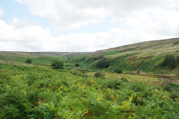 CBH62.jpg (taken 28.7.2014) |
||
|
|
||
| evidence:- | old map:- OS County Series (Cmd 25 11) placename:- King's Forest of Geltsdale |
|
| source data:- | Maps, County Series maps of Great Britain, scales 6 and 25
inches to 1 mile, published by the Ordnance Survey, Southampton,
Hampshire, from about 1863 to 1948. OS County Series (Cmd 25 12) |
|
|
|
||
| evidence:- | old map:- Donald 1774 (Cmd) placename:- Kings Forest of Geltsdale placename:- Forest of Geltsdale, Kings |
|
| source data:- | Map, hand coloured engraving, 3x2 sheets, The County of Cumberland, scale about 1
inch to 1 mile, by Thomas Donald, engraved and published by Joseph Hodskinson, 29
Arundel Street, Strand, London, 1774.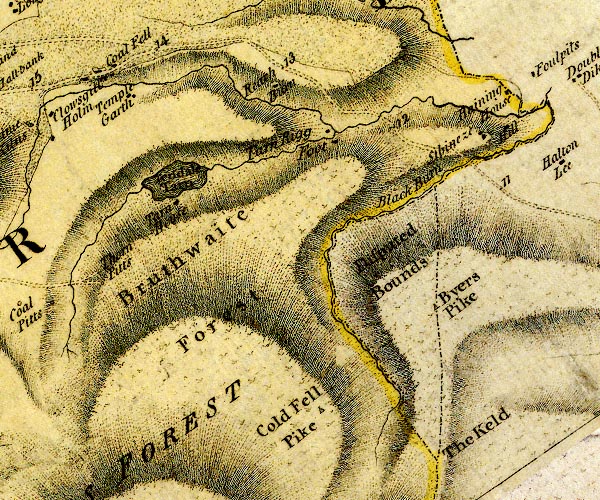 D4NY65NW.jpg 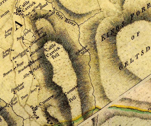 D4NY55SE.jpg 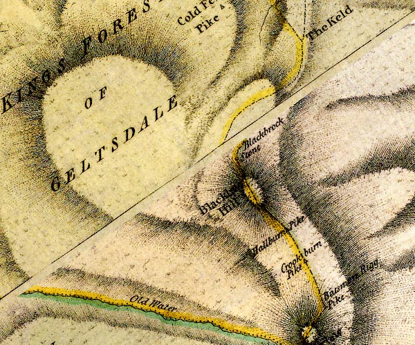 D4NY65SW.jpg "KINGS FOREST OF GELTSDALE" area item:- Carlisle Library : Map 2 Images © Carlisle Library |
|
|
|
||
| evidence:- | old map:- Cooke 1802 placename:- Kings Forest of Geltsdale |
|
| source data:- | Map, Cumberland, scale about 15.5 miles to 1 inch, by George
Cooke, 1802, bound in Gray's New Book of Roads, 1824, published
by Sherwood, Jones and Co, Paternoster Road, London, 1824. click to enlarge click to enlargeGRA1Cd.jpg "Kings Forest of Geltsdale" area item:- Hampshire Museums : FA2000.62.2 Image © see bottom of page |
|
|
|
||
 Lakes Guides menu.