 Old Cumbria Gazetteer
 |
 |
|
| Kings Arms, Kendal | ||
| Kings Arms | ||
| locality:- | Kendal | |
| civil parish:- | Kendal (formerly Westmorland) | |
| county:- | Cumbria | |
| locality type:- | inn | |
| coordinates:- | SD51489276 (approx) | |
| 1Km square:- | SD5192 | |
| 10Km square:- | SD59 | |
| references:- | Fiennes 1698 |
|
|
|
||
| evidence:- | old map:- OS County Series (Wmd 38 8) placename:- Kings Arms Hotel |
|
| source data:- | Maps, County Series maps of Great Britain, scales 6 and 25
inches to 1 mile, published by the Ordnance Survey, Southampton,
Hampshire, from about 1863 to 1948. |
|
|
|
||
| evidence:- | descriptive text:- Fiennes 1698 placename:- item:- char; potted char |
|
| source data:- | Travel book, manuscript record of Journeys through England
including parts of the Lake District, by Celia Fiennes, 1698. "At the Kings Arms one Mrs. Rowlandson she does pott up the charr fish the best of any in the country, I was curious to have some so bespoke some of her ..." |
|
|
|
||
| evidence:- | road book:- Cary 1798 (2nd edn 1802) placename:- King's Arms |
|
| source data:- | Road book, itineraries, Cary's New Itinerary, by John Cary, 181
Strand, London, 2nd edn 1802. goto source goto source click to enlarge click to enlargeC38267.jpg page 267-268 "Kendal - King's Arms" goto source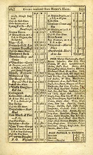 click to enlarge click to enlargeC38269.jpg page 269-270 "INNS. ... Kendal, Crown, King's Arms. ..." goto source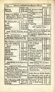 click to enlarge click to enlargeC38315.jpg page 315-316 "INNS. Kendal, Crown, King's Arms, W. Hart." goto source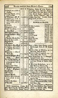 click to enlarge click to enlargeC38333.jpg page 333-334 "INNS. ... Kendal, Crown, King's Arms, W. Hart." item:- JandMN : 228.1 Image © see bottom of page |
|
|
|
||
| evidence:- | road book:- Cary 1798 (2nd edn 1802) placename:- King's Arms |
|
| source data:- | Road book, itineraries, Cary's New Itinerary, by John Cary, 181
Strand, London, 2nd edn 1802. goto source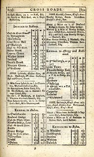 click to enlarge click to enlargeC38653.jpg page 653-654 "INNS, Kendal, Crown, King's Arms. ..." item:- JandMN : 228.2 Image © see bottom of page |
|
|
|
||
| evidence:- | descriptive text:- Wallis 1810 placename:- King's Arms |
|
| source data:- | Map, Westmoreland, scale about 19 miles to 1 inch, and
Cumberland, scale about 16 miles to 1 inch, by James Wallis, 77
Berwick Street, Soho, London, 1810; published 1810-36. "PRINCIPAL INNS, RECOMMENDED TO TRAVELLERS AND FAMILIES." "Kendal: Crown, King's Arms, White Hart, besides several others, where travellers will be well accommodated, at low charges." |
|
|
|
||
| evidence:- | descriptive text:- Otley 1823 (5th edn 1834) placename:- King's Arms |
|
| source data:- | Guide book, A Concise Description of the English Lakes, the
mountains in their vicinity, and the roads by which they may be
visited, with remarks on the mineralogy and geology of the
district, by Jonathan Otley, published by the author, Keswick,
Cumberland now Cumbria, by J Richardson, London, and by Arthur
Foster, Kirkby Lonsdale, Cumbria, 1823; published 1823-49,
latterly as the Descriptive Guide to the English Lakes. goto source Page 98:- "KENDAL" "... The King's Arms and Commercial are the principal Inns." |
|
|
|
||
| evidence:- | old advertisement:- Jenkinson 1875 B placename:- King's Arms Hotel |
|
| source data:- | Advertisements for James Bell, King's Arms Hotel, Kendal, Westmorland, ... published
by Edward Stanford, 55 Charing Cross, London, 1875 edn 1884?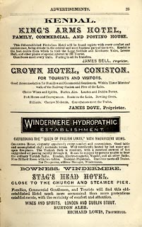 click to enlarge click to enlargeJK1215.jpg Adverts p.23 at the back of Jenkinson's Smaller Practical Guide to Carlisle, Gilsland, Roman Wall and Neighbourhood. item:- Armitt Library : A1717.16 Image © see bottom of page |
|
|
|
||
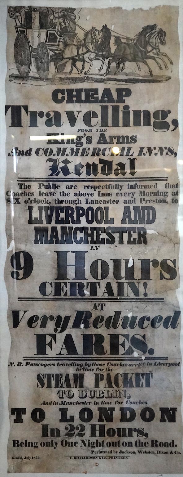 Click to enlarge CFX97.jpg Advertisement, in Kendal Museum (taken 20.3.2017) |
||
|
|
||
| Currington, David: 2009: Pictorial Record of Public Houses in Kendal: Westmorland
CAMRA |
||
|
|
||
Lakes Guides menu.