 Old Cumbria Gazetteer
 |
 |
|
| Kent Valley | ||
| site name:- | Kent, River | |
| county:- | Cumbria | |
| locality type:- | valley | |
| 10Km square:- | SD59 (etc) | |
| 1Km square:- | SD5090 | |
| 10Km square:- | NY40 | |
| 10Km square:- | SD49 | |
| 10Km square:- | SD59 | |
| 10Km square:- | SD58 | |
| 10Km square:- | SD48 | |
|
|
||
| evidence:- | old map:- Gough 1350s-60s placename:- Kendale |
|
| source data:- | Map, colour photozincograph copy, reduced size facsimile, Gough
Map of Britain, scale about 28.5 miles to 1 inch, published by
the Ordnance Survey, Southampton, Hampshire, 1875. click to enlarge click to enlargeGgh1Cm.jpg "Kendale" Written in a cartouche north of Beetham. item:- JandMN : 33 Image © see bottom of page |
|
|
|
||
| evidence:- | old map:- Gough 1350s-60s placename:- Kendale |
|
| source data:- | Map, lithograph facsimile, Gough Map of Britain, 20 miles to 1
inch? published by the Ordnance Survey, Southampton, Hampshire,
1935. click to enlarge click to enlargeGgh2Cm.jpg "Kendale" Written in a cartouche north of Beetham. item:- JandMN : 34 Image © see bottom of page |
|
|
|
||
| evidence:- | presumably old map:- Ptolemy 1540 placename:- Kendale |
|
| source data:- | Map, copy, uncoloured lithograph? Anglia II Nova Tabula, New Map
of England, scale about 50 miles to 1 inch, data in the
Geographia by Claudius Ptolemy, engraved by Sebastian Munster,
Basle, Switzerland, 1540.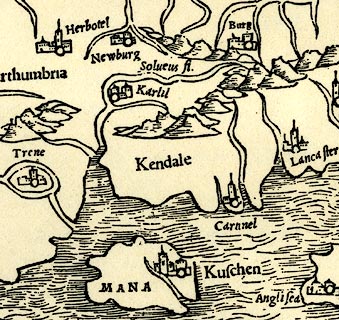 click to enlarge click to enlargePTY4Cm.jpg "Kendale" area item:- private collection : 131 Image © see bottom of page |
|
|
|
||
| evidence:- | old map:- Drayton 1612/1622 placename:- Kandale |
|
| source data:- | Map, hand coloured engraving, Cumberlande and Westmorlande, by
Michael Drayton, probably engraved by William Hole, scale about
4 or 5 miles to 1 inch, published by John Mariott, John
Grismand, and Thomas Dewe, London, 1622.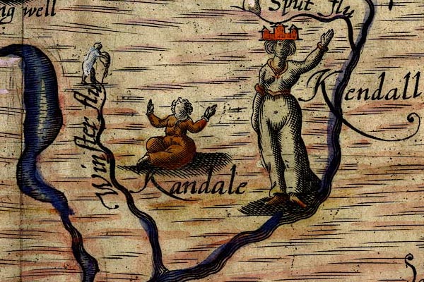 DRY523.jpg "Kandale" Lady sitting. item:- JandMN : 168 Image © see bottom of page |
|
|
|
||
| evidence:- | old text:- Camden 1789 placename:- Kendale placename:- Candale |
|
| source data:- | Book, Britannia, or A Chorographical Description of the Flourishing Kingdoms of England,
Scotland, and Ireland, by William Camden, 1586, translated from the 1607 Latin edition
by Richard Gough, published London, 1789. goto source goto sourcePage 147:- "..." "The southern part of this county [Westmorland], which is contracted in a narrow space between the river Lone and Winander mere is reckoned very fruitful in the vales, though it has its rough and slippery craggs, and is comprehended under the general name of The Barony of Kendale, or Candale, q.d. the Valley on the Can, a river which runs over rocks through this valley, and gives name to it, ..." |
|
|
|
||
| evidence:- | text:- Mason 1907 (edn 1930) placename:- Vale of Kendal |
|
| source data:- | Text book, The Ambleside Geography Books bk.III, The Counties of
England, by Charlotte M Mason, published by Kegan Paul, Trench,
Trubner and Co, Broadway House, 68-74 Carter Lane, and the
Parents' Educational Union Office, 26 Victoria Street, London,
edn 1930. MSN1P024.txt Page 24:- "..." "There are two fertile valleys in Westmoreland - the Vale of Eden, ... and the Vale of Kendal, which is a very old town upon the Kent, where the wool of the mountain" goto sourcePage 25:- "sheep is manufactured." |
|
|
|
||
Lakes Guides menu.