 |
 |
   |
|
|
|
Islekirk Hall |
| civil parish:- |
Westward (formerly Cumberland) |
| county:- |
Cumbria |
| locality type:- |
buildings |
| coordinates:- |
NY25984455 |
| 1Km square:- |
NY2544 |
| 10Km square:- |
NY24 |
|
|
| evidence:- |
possibly descriptive text:- Simpson 1746
placename:- Iselkirk
|
| source data:- |
Atlas, three volumes of maps and descriptive text published as
'The Agreeable Historian, or the Compleat English Traveller
...', by Samuel Simpson, 1746.
 goto source goto source
"... Islekirk, Mr. Fetherstone's. ..."
|
|
|
| evidence:- |
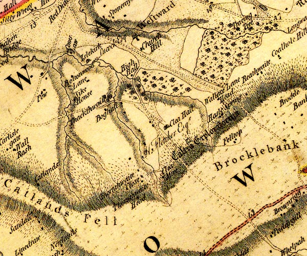
old map:- Donald 1774 (Cmd)
placename:- Islekirk
|
| source data:- |
Map, hand coloured engraving, 3x2 sheets, The County of Cumberland, scale about 1
inch to 1 mile, by Thomas Donald, engraved and published by Joseph Hodskinson, 29
Arundel Street, Strand, London, 1774.

D4NY24SE.jpg
"Islekirk / Lucock Esq"
house
item:- Carlisle Library : Map 2
Image © Carlisle Library |
|
|
| evidence:- |
old painting:-
|
| source data:- |
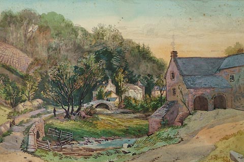
Painting, watercolour, Islekirk Hall, Westward, Cumberland, by Samuel Bough, 1849.
 click to enlarge click to enlarge
PR1165.jpg
Sunset scene; to right of foreground a stone farmhouse stands from which a winding
pathway leads across a stream towards the village beyond. A single figure stands beneath
the shade of a tree beside it, in middle distance. To left of composition rises a
steep hill, partially ploughed, adjoined by woodland. Lengthy shadows are cast throughout.
signed &dated at bottom right:- "S Bough 1849"
item:- Tullie House Museum : 1976.53.4
Image © Tullie House Museum |
|
|
| evidence:- |
database:- Listed Buildings 2010
placename:- Islekirk Hall
|
| source data:- |
courtesy of English Heritage
"ISLEKIRK HALL / / / WESTWARD / ALLERDALE / CUMBRIA / II[star] / 416212 / NY2594344526"
|
|
|
notes:-
|
Supposed pele tower and 16th century hall.
|
|
Perriam, D R &Robinson, J: 1998: Medieval Fortified Buildings of Cumbria: CWAAS::
ISBN 1 873124 23 6
|
|
|


 goto source
 click to enlarge